
Images


November 20, 2021 - Garabogazköl Basin
 Tweet
Tweet
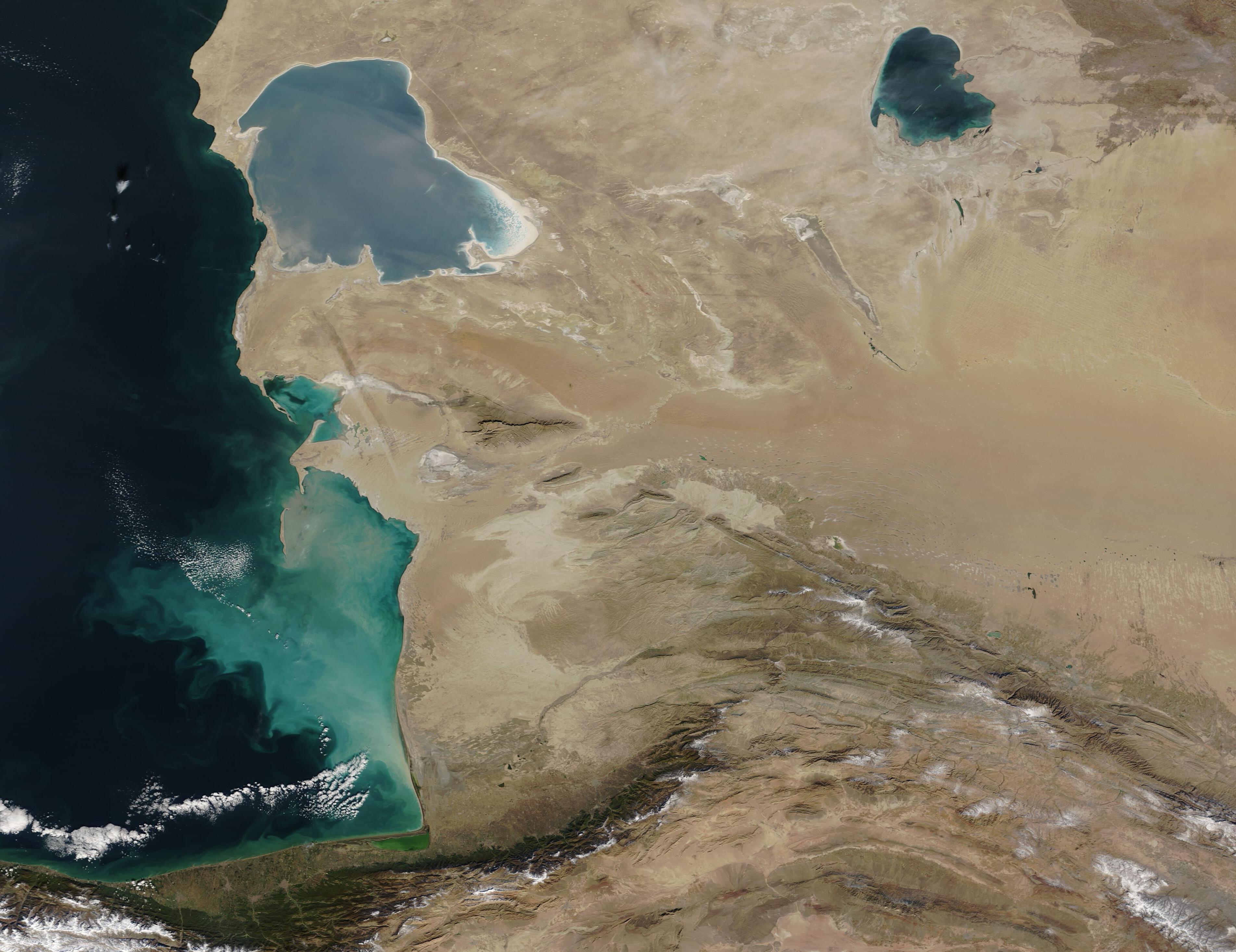
Pale shades of teal, turquoise, tan, and salty white filled the waters of the Garabogazköl Depression in this stunning true-color image, which was acquired by the Moderate Resolution Imaging Spectroradiometer (MODIS) on board NASA’s Terra satellite on November 19, 2021.
Also known as the Zaliv Kara-Bogaz-Gol, Garabogazköl Gulf, and Garabogazköl Bay, the extremely salty and shallow basin sits in an arid location in Turkmenistan. The Garabogazköl Basin was once relatively well-connected to the dark waters of the Caspian Sea, allowing water fresh water to flow freely into the basin. Drought and diversion of water from the major rivers that feed the Caspian Sea (the Volga and Kur Rivers) caused the level of the Sea waters to lower, slowing the freshwater intrusion into the Garabogazköl. In 1980, a dam was completed which completely blocked the connection between the Caspian and the basin, creating rapid evaporation which reduced that Garabogazköl to about 1/3 of its former size and dropped the average depth to less than 50 cm (19.5 inches). The dam was destroyed in 1992 and today the Caspian Sea and the Garabogazköl share a narrow connection that allows survival of the water in the shallow basin.
Image Facts
Satellite:
Terra
Date Acquired: 11/19/2021
Resolutions:
1km (554.2 KB), 500m (1.5 MB), 250m (995.6 KB)
Bands Used: 1,4,3
Image Credit:
MODIS Land Rapid Response Team, NASA GSFC
