
Images


December 21, 2021 - Snow across the Great Basin
 Tweet
Tweet
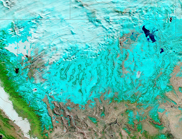
Winter weather swept across California and the Great Basin, bringing substantial snow to the Sierra Nevada and the Coast Range in the closing month of 2021. On December 13, a frontal system merged with a weak atmospheric river over Northern California, increasing the duration of precipitation and snow depth. In higher elevations, snowfall was measured in feet, not inches during the impressive event.
The Moderate Resolution Imaging Spectroradiometer (MODIS) on board NASA’s Aqua satellite acquired a false-color image showing widespread snow in eastern California, Nevada, and Utah on December 19. Using MODIS bands 7-2-1, this image shows snow as bright blue, vegetation as green, and open land as tan or brown. Water appears deep blue and cloud usually appears white, although high, cold cloud that contains ice crystals may also have a bright blue tint.
The National Weather Service forecasts additional snowfall on December 21-26, thanks to a series of storms that will bring multiple rounds of mountain snow and gusty winds to the region. A foot of snow is expected on December 21 in the high elevations of the Coastal Range and Sierras, and that is just for starters. Some locations may see up to 8 feet of heavy, wet snow before the storms ease after December 26.
Image Facts
Satellite:
Aqua
Date Acquired: 1/20/2021
Resolutions:
1km (1.2 MB), 500m (3.2 MB), 250m (8.9 MB)
Bands Used: 1,4,3
Image Credit:
MODIS Land Rapid Response Team, NASA GSFC
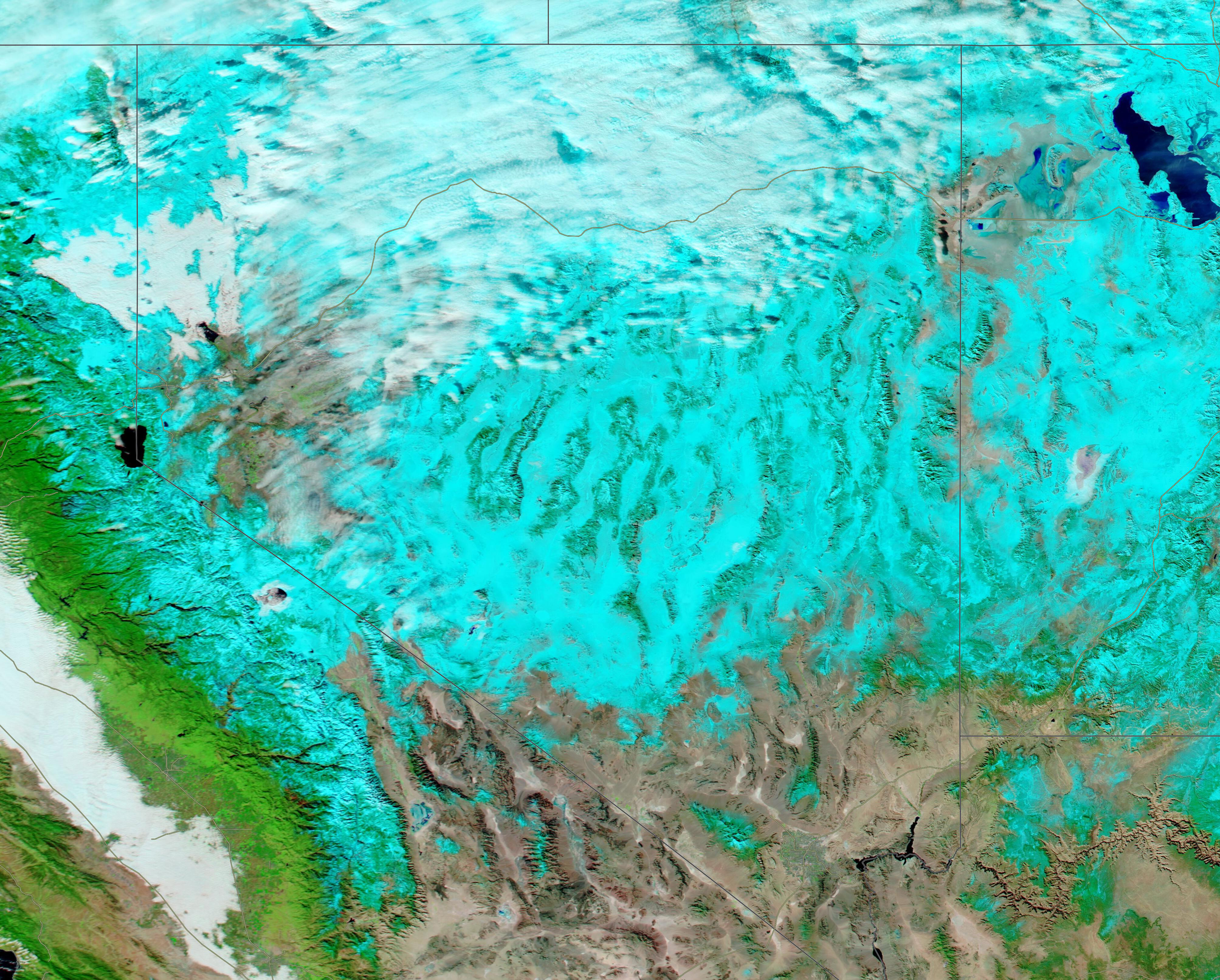
