
Images


January 23, 2022 - Clear Skies over Patagonia
 Tweet
Tweet
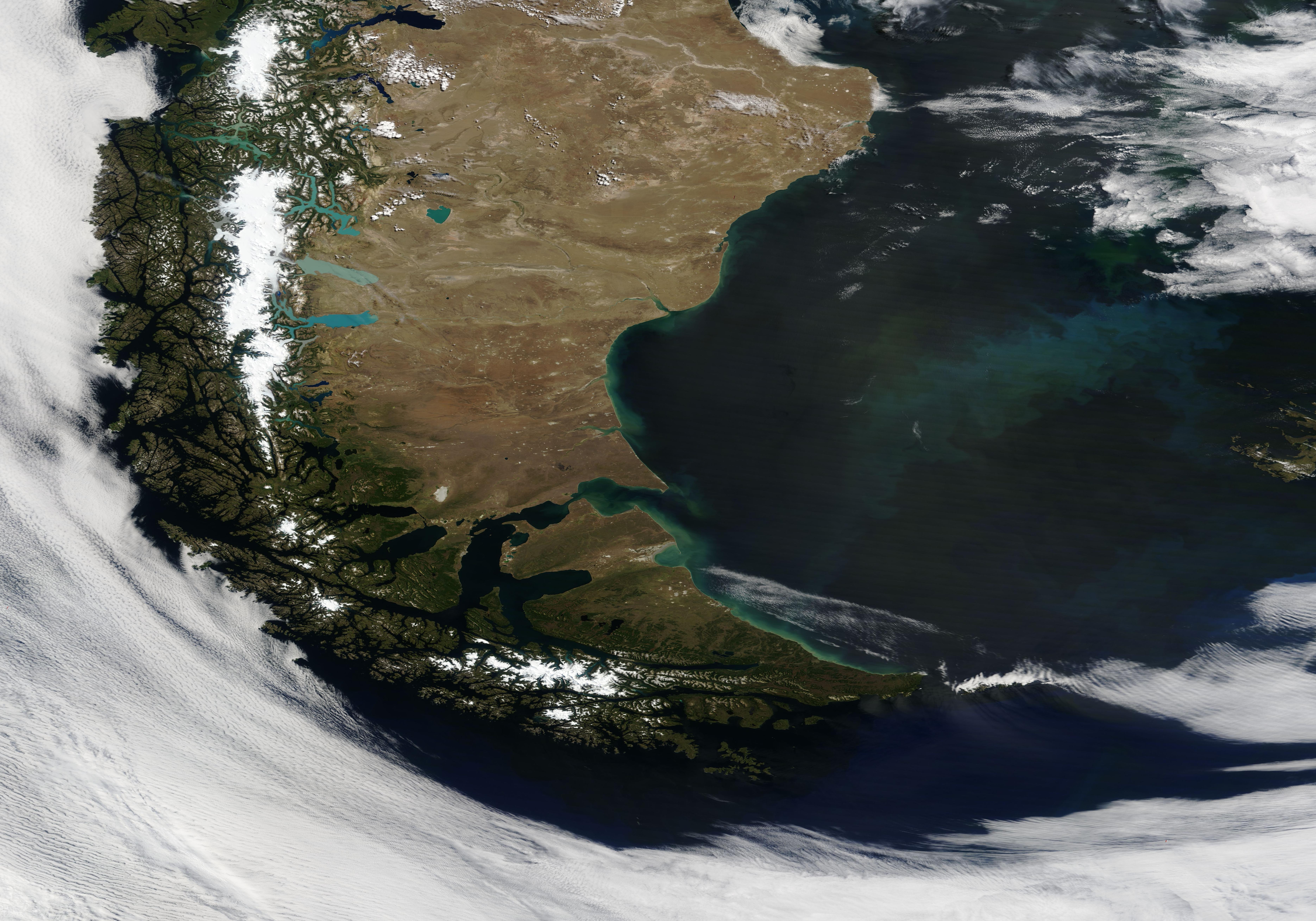
On January 20, 2022, the Moderate Resolution Imaging Spectroradiometer (MODIS) on board NASA’s Terra satellite acquired a dramatic true-color image of Patagonia surrounded by a swirl of cloud. On this clear summer day, almost all of Patagonia can be seen, from Chile’s verdant Pacific coast, to the snow-and-glacier-topped Andes Mountains, then to the dry scrublands and coastal lowlands of Argentina. Only a small part of the western-most coastlines are hidden under fingers of low cloud (fog).
Spanning more than 1 million square kilometers, Patagonia is surrounded by the Pacific Ocean in the west and the Atlantic Ocean in the east. The southern tip, Tierra del Fuego, is crossed by the Strait of Magellan, the Beagle Channel, and the Drake Passage to the south. Several glacial lakes sit on the eastern edge of the Andes, shining brightly in various shades of blue.
Such a widespread clear view of southern South America is rather rare, thanks to the year-round and frequent passage of storms. Tierra del Fuego sits in a belt of prevailing westerly winds where blustery and cloud-filled days are the norm as high- and low-pressure systems drift eastward. The Andes Mountains, sitting along the border between Chile (west) and Argentina (east) adds to inland cloudiness. When eastward-blowing wind passing over the Pacific Ocean encounter the tall Andes, it is forced upward. As moist air rises and cools, it condenses into cloud.
Image Facts
Satellite:
Terra
Date Acquired: 1/20/2022
Resolutions:
1km (1.8 MB), 500m (5 MB), 250m (3.4 MB)
Bands Used: 1,4,3
Image Credit:
MODIS Land Rapid Response Team, NASA GSFC
