
Images


January 25, 2022 - Smoke over California
 Tweet
Tweet
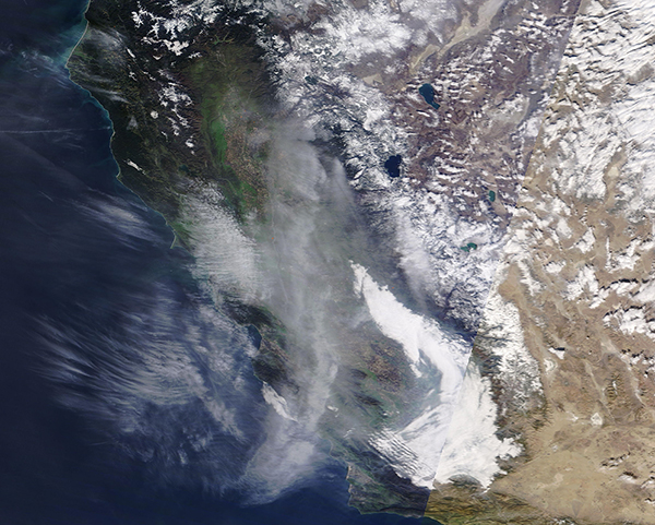
A wind-driven wildfire leapt to life in Big Sur, Monterey County, California on January 21, 2022, quickly prompting evacuations and causing the closure of a portion of the Pacific Coast Highway. The blaze was named the Colorado Fire after the Palo Colorado Canyon, where it was first spotted on Friday evening. As many as 500 residents were under evacuation orders in the mountainous coastal region as the fire exploded, driven by wind gusts of up to 50 miles per hour. As of January 24, the fire has scorched 700 acres and is 40 percent contained, according to CAL FIRE. The cause of this wildfire is under investigation.
The Moderate Resolution Imaging Spectroradiometer (MODIS) on board NASA’s Terra satellite acquired a true-color image of southern California on January 21. At that time, thick haze and smoke covered most of the state, including the area around the Colorado Fire. Although the Colorado Fire was the only active wildfire listed by CAL FIRE on that day, several other hot spots were seen across the state from other MODIS images. Several prescribed burns have been planned in various locations around the state and neighboring states for January, and these likely contribute to the heavy haze. Prescribed burns are fires that are deliberately set to manage land, usually wildlands or forest. They can be used to promote healthy undergrowth, remove deadfall that would fuel a wildfire, and reduce the danger of out-of-control wildfires in a given location.
Image Facts
Satellite:
Terra
Date Acquired: 1/21/2022
Resolutions:
1km (681.7 KB), 500m (1.6 MB), 250m (1 MB)
Bands Used: 1,4,3
Image Credit:
MODIS Land Rapid Response Team, NASA GSFC
