
Images


February 17, 2022 - Fires across the Southeastern United States
 Tweet
Tweet
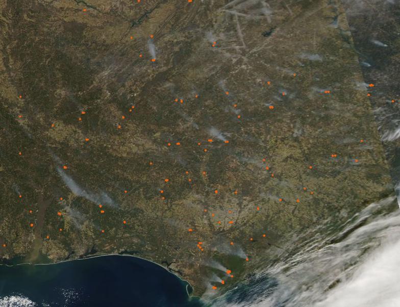
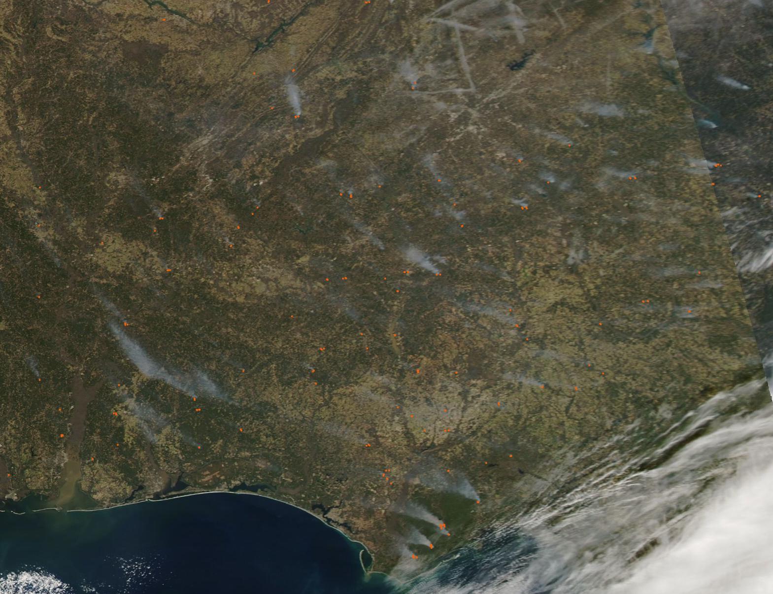
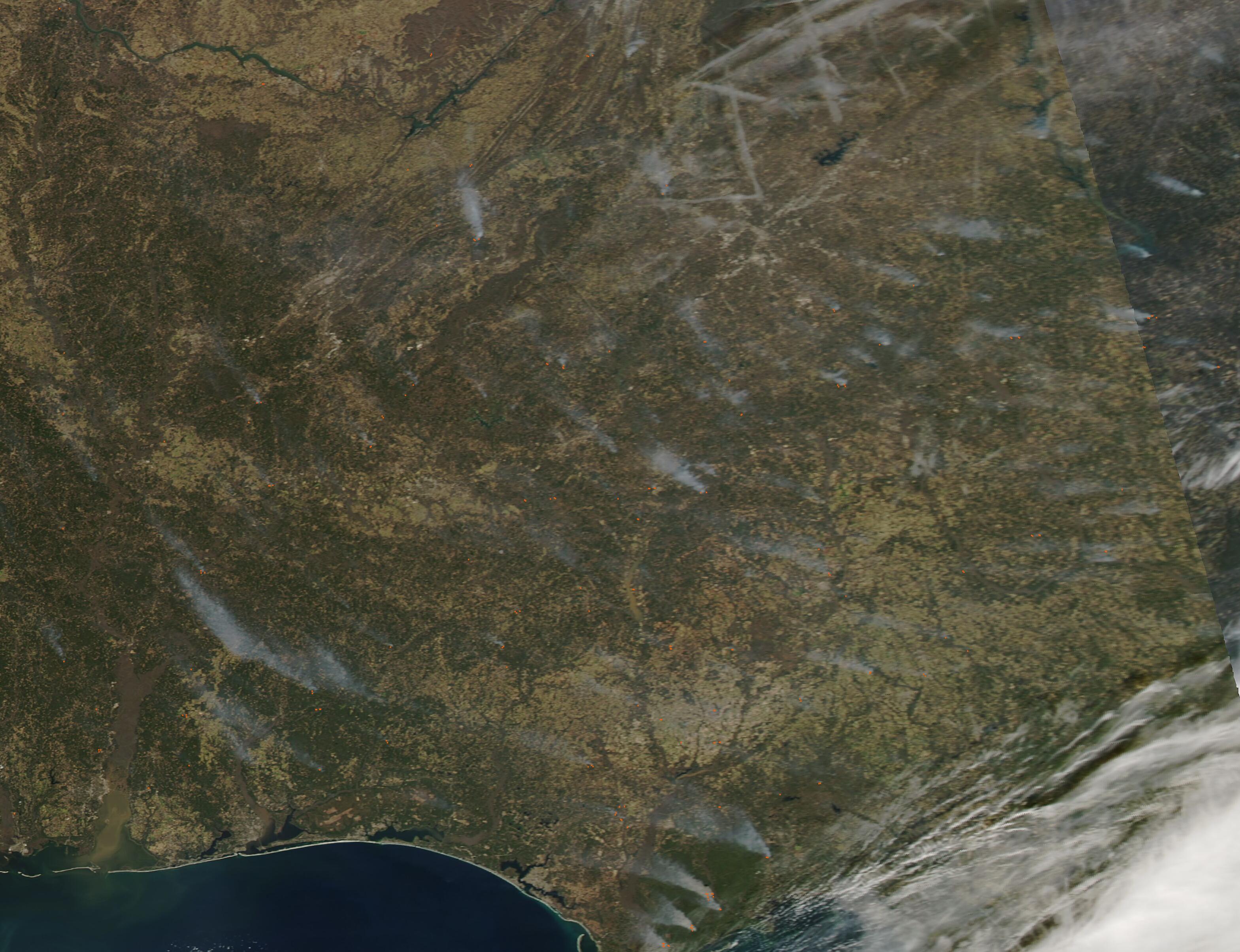
Dozens of fires were scattered over the Southeastern United States on February 15, 2022, when the Moderate Resolution Imaging Spectroradiometer (MODIS) on board NASA’s Aqua satellite acquired a true-color image of the region. Each red “hot spot” marks an area where the thermal sensors on the MODIS instrument detected high temperatures. When combined with typical smoke, as in this image, such hot spots mark actively burning fire. The blazes are scattered across Alabama (west), Georgia (east), and Florida.
The widespread nature, location, and time of year suggests that most of these fires are likely prescribed burns—fires that are deliberately set to manage public lands, such as forests or grassland. Such controlled burns are carefully planned to benefit the environment and wildlife, and also helps reduce the impact of wildfires by reducing fuel ahead of wildfire season. Winter’s weather, with cooler temperatures, is prime time for prescribed burns in this region. In late January, the U.S. Forest Service announced that, in Alabama, approximately 120,000 acres in four national forests in that state were slated for prescribed fires before the end of winter. Similar land management is occurring in Georgia and Florida as well. It is also possible that some of these fires are agricultural in nature. Agricultural fires are similar to prescribed burns in that they are deliberately set to manage land, but they are typically set by farmers to freshen pasture or work cropland.
According to reports from the National Interagency Fire Center from February 11, only one wildfire was burning in this region on that date. That fire was near Elgin Air Force Base, had been contained, and affected about 460 acres. Elgin sits close to the coast on the Florida Panhandle.
Image Facts
Satellite:
Aqua
Date Acquired: 2/15/2022
Resolutions:
1km (75.1 KB), 500m (262.9 KB), 250m (794.2 KB)
Bands Used: 1,4,3
Image Credit:
MODIS Land Rapid Response Team, NASA GSFC
