
Images


February 23, 2022 - Iceberg B-22A
 Tweet
Tweet
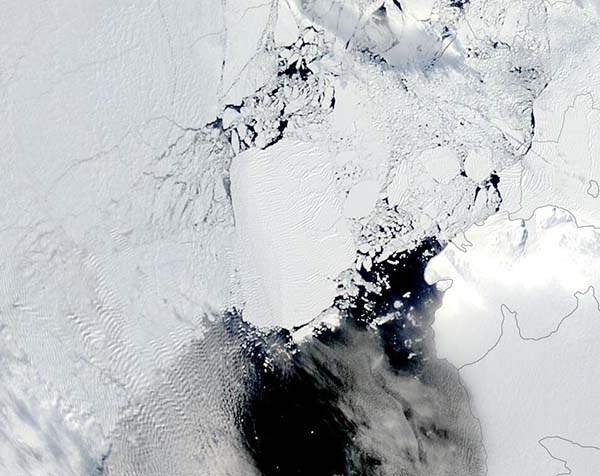
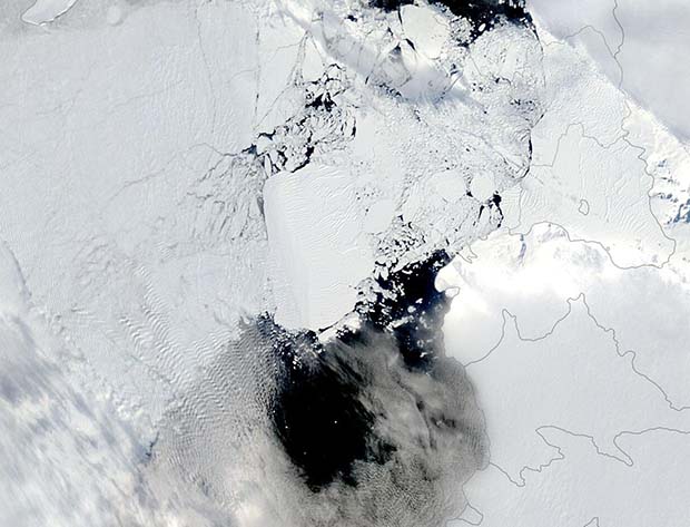
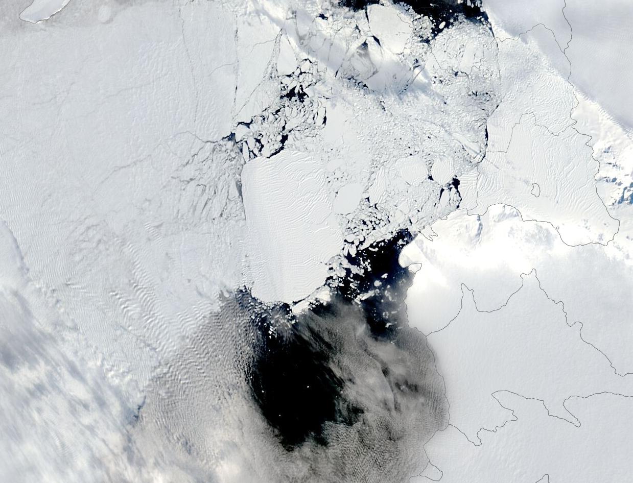
Almost twenty years ago, in mid-March 2002, a massive Antarctic iceberg broke off the ice tongue of the Thwaites Glacier and slowly inched its way into Pine Island Bay, part of the Amundsen Sea. Shortly after calving, four fragments broke off the almost-Delaware-sized iceberg. Caught by currents, the smaller fragments drifted away but the large iceberg, dubbed B-22A, grounded not far from the mother tongue.
As of February 18, 2022, iceberg B-22A has drifted only 32 miles (53 km)—a remarkably slow crawl of about 1.6 miles (2.6 km) per year. The berg initially measured 52.8 miles (85km) long and 40.4 miles (65 km) wide. The U.S. National Ice Center reported that, as of February 18, the ‘berg measured 43.7 miles (70.3 km) long by 27.6 miles (44.4 km) wide. That same day, B-22A was spied sitting in the Amundsen Sea by the Terra satellite’s Moderate Resolution Imaging Spectroradiometer (MODIS), which captured this true-color image.
This MODIS image gives a beautiful view of the iceberg at one point in time. Thanks to the NASA Worldview App, the iceberg’s travels can be tracked with a simple click. To view the track of this iceberg on part of its double-decade trek, from August 2011-February 18, 2022, click here.
Image Facts
Satellite:
Terra
Date Acquired: 2/18/2022
Resolutions:
1km (30.4 KB), 500m (65.6 KB), 250m (161.8 KB)
Bands Used: 1,4,3
Image Credit:
MODIS Land Rapid Response Team, NASA GSFC
