
Images


March 6, 2022 - Ice on Green Bay
 Tweet
Tweet
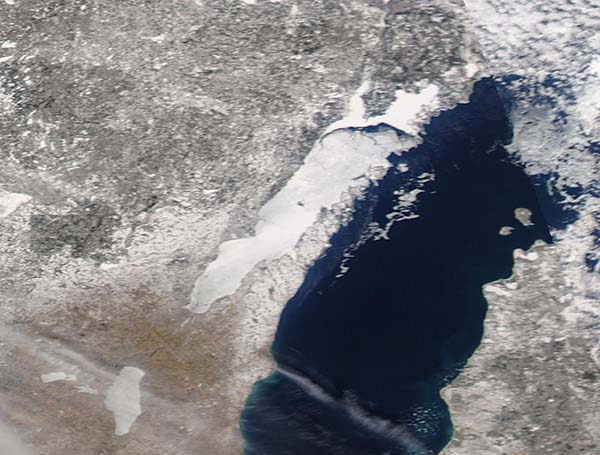
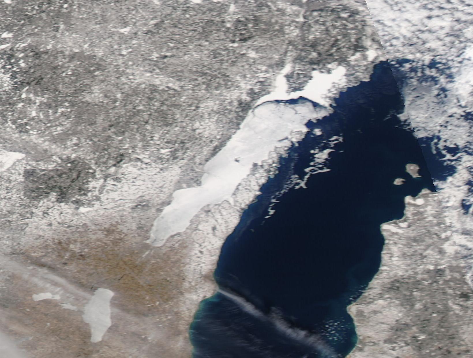
Ice cover on the Great Lakes reached maximum extent on February 26, 2022, with an overall coverage on the five large lakes as 56.1 percent. This is just over the long-term average annual maximum ice extent of 53.3 percent. Ice extent on individual lakes on February 26 were reported as: Superior 63.1%, Michigan 33.1%, Huron 67.2%, Erie 80.5%, Ontario 22.6%, and Lake St. Clair 91.2%. Strong winds and increasing sun angle resulted in a drop in ice cover over the last days of February, but a March cold spell has current ice coverage still close to 50 percent, according to the National Weather Service.
On March 3, the Moderate Resolution Imaging Spectroradiometer (MODIS) on board NASA’s Aqua satellite acquired a true-color image of western Lake Michigan. While most of the lake shows open water, both Green Bay and Lake Winnebago, south of Green Bay, are covered with a sheet of frozen ice. The ice in the far north of Green Bay, where it meets with the open Lake Michigan, is cracked and melting, but most of the rest of the Bay, especially in the south, appears quite solid.
Green Bay is a popular destination for winter ice fishing, with tourists and locals willing to sit on the ice for hours at a time as they lure in whitefish, walleye, or trout. But as the ice thins, ice-fishing season both on the Bay and across Wisconsin comes to a close. Legal deadlines for removal of ice shanties are as follows: March 6—inland waters south of Highway 64; March 13—Lake Michigan, Green Bay, Lake Superior, and inland waters north of Highway 64; and March 15—all state waters and Wisconsin-Michigan boundary waters.
Image Facts
Satellite:
Aqua
Date Acquired: 3/3/2022
Resolutions:
1km (52.3 KB), 500m (101.9 KB), 250m (230.3 KB)
Bands Used: 1,4,3
Image Credit:
MODIS Land Rapid Response Team, NASA GSFC
