
Images


March 9, 2022 - Tropical Cyclone Gombe
 Tweet
Tweet
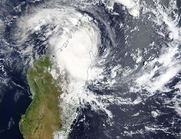
Tropical Storm Gombe formed over the Indian Ocean on March 7, 2022, spinning up over open water northeast of Madagascar. Late that evening, the storm made landfall along the northeastern coast, becoming the fifth cyclone to make a direct hit on Madagascar in the last six weeks. According to the Global Disaster Alert and Coordination Center (GDACS), Tropical Storm Gombe carried maximum sustained winds of 65 km/h (40.4 mph) when it came ashore over southern Antsiranana Province.
Once onshore, Gombe quickly weakened to tropical depression strength as it continued moving westward over the island. Although Tropical Storm Gombe is not a particularly strong system, it brings heavy wind and potentially torrential rains to an area already soaked from earlier cyclones.
The Joint Typhoon Warning Center (JTWC) expects Tropical Cyclone Gombe to move offshore and over the Mozambique Channel on March 8 and strengthen as it drifts west-southwestward to make landfall over Mozambique later this week. The warm sea surface temperatures in the Mozambique Channel will help fuel steady intensification. Gombe is expected to reach peak sustained wind speeds of 86 mph (138 km/h) or more by March 10, equivalent to a Category 1 storm on the Saffir-Simpson Hurricane Wind Scale.
The Moderate Resolution Imaging Spectroradiometer (MODIS) on board NASA’s Terra satellite acquired a true-color image of Tropical Cyclone Gombe on March 8. The storm has moved westward after making landfall and the large cloud-filled center sits near the center of Madagascar. Nearly one-third of the northern portion of Madagascar sits under Gombe’s convective bands, where heavy rains are located.
Image Facts
Satellite:
Terra
Date Acquired: 3/8/2022
Resolutions:
1km (505.5 KB), 500m (1.6 MB), 250m (4.8 MB)
Bands Used: 1,4,3
Image Credit:
MODIS Land Rapid Response Team, NASA GSFC
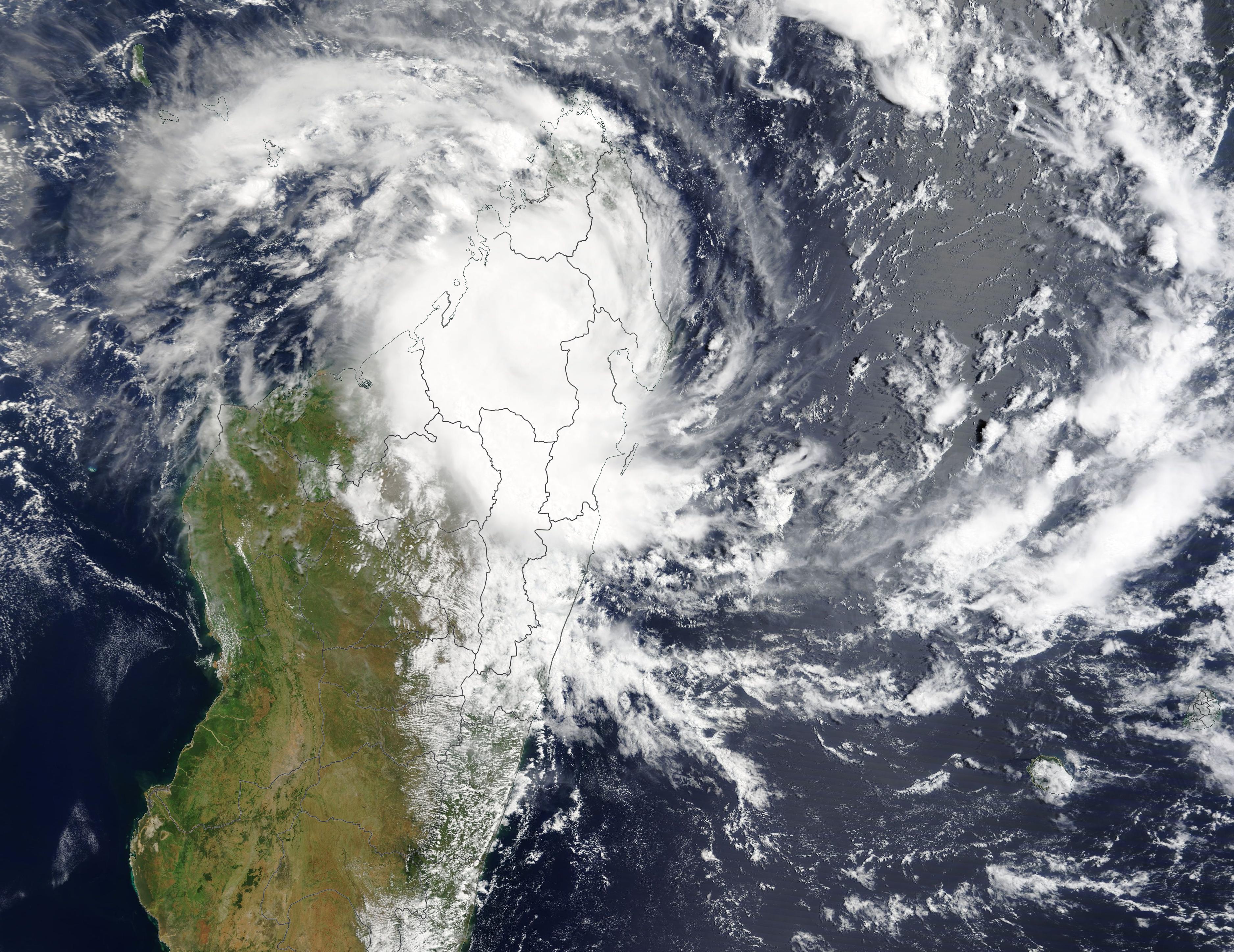
