
Images


March 19, 2022 - Japan
 Tweet
Tweet
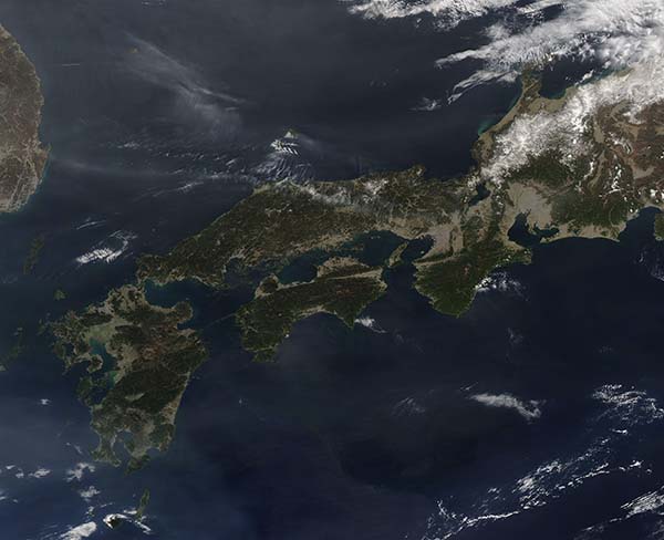
The island nation of Japan stretches over roughly 1,900 miles (3,000 km) between the western North Pacific Ocean and Sea of Japan (East Sea). The entire landmass is slightly smaller than the state of California, USA, with the southwest limits separated from the Korean Peninsula separated by less than 125 miles (200 km). The highly volcanic archipelago contains four main islands and about 6,848 smaller islands and islets.
On March 16, 2022, the Moderate Resolution Imaging Spectroradiometer (MODIS) on board NASA’s Aqua satellite acquired a true-color image of Japan. The main islands, which are captured in this image, are Hokkaido in the north; Honshu—the largest and most populous island; Kyushu in the south; and Shikoku tucked along the southeast flank of Honshu.
Bright white snow caps the mountains on the western coasts of the main islands. With roughly 67 percent of Japan’s land covered in rugged mountains, the combination of winter snow and steep slopes creates the perfect conditions for world-class skiing. Snow sits atop some of the highest elevations year-round.
Image Facts
Satellite:
Aqua
Date Acquired: 3/16/2022
Resolutions:
1km (135.4 KB), 500m (315.2 KB), 250m (1.1 MB)
Bands Used: 1,4,3
Image Credit:
MODIS Land Rapid Response Team, NASA GSFC
