
Images


March 21, 2022 - A Slice of Mexico
 Tweet
Tweet
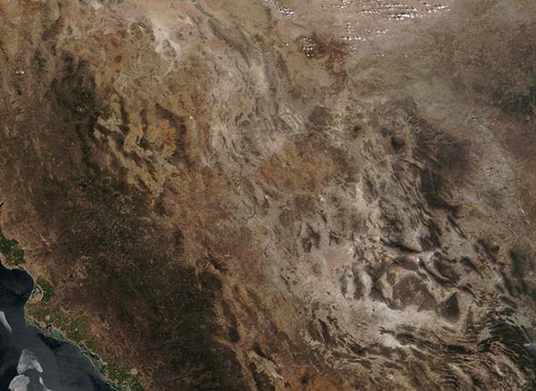
The Moderate Resolution Imaging Spectroradiometer (MODIS) on board NASA’s Terra satellite acquired a true-color image of a slice of northwestern Mexico on March 17, 2022. This image captures a section of Mexico east of the southern portion of the Baja Peninsula, including parts of the coastal states of Sonora (north) and Sinaloa (south) and the inland states o Chihuahua and a small portion of northern Durango. The Gulf of California (Golfo de California) laps along the coastline.
Narrow coastal plains provide rich agricultural land, while forests cover much of the foothills of the Sierra Madre Occidental Mountains. The wide central plateau fills the center of the country. Rugged red outcroppings of rock and pale dirt and sand illustrate extremely dry conditions of the Chihuahuan Desert. The desert is considered to be a rain-shadow desert, created due to the blocking of moisture from the Pacific Ocean in the west by the Sierra Madre Occidental Mountains and, in the east, from the Gulf of Mexico by the Sierra Madre Oriental. The eastern mountains are not visible in this image.
Image Facts
Satellite:
Terra
Date Acquired: 3/17/2022
Resolutions:
1km (181.9 KB), 500m (401.4 KB), 250m (1.6 MB)
Bands Used: 1,4,3
Image Credit:
MODIS Land Rapid Response Team, NASA GSFC
