
Images


April 16, 2022 - The Sheared End of Typhoon Malakas
 Tweet
Tweet
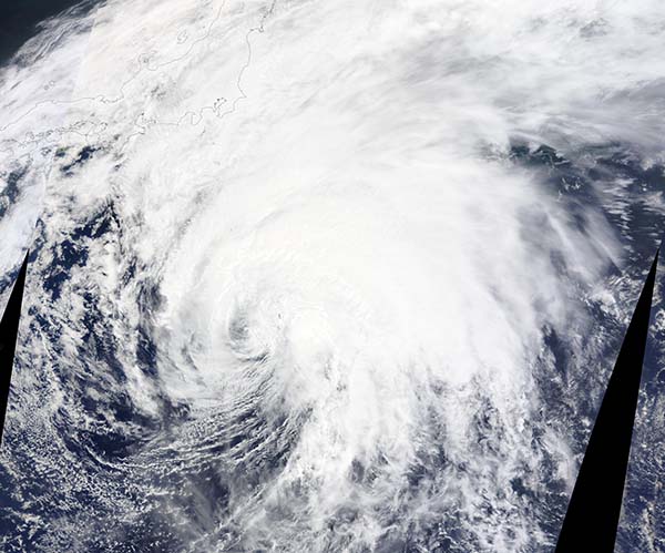
On April 15, 2022, Typhoon Malakas was completing extra-tropical transition and losing strength as it spun over the Philippine Sea. The Moderate Resolution Imaging Spectroradiometer (MODIS) on board NASA’s Terra satellite acquired a true-color image of the storm that same day which showed that Malakas had become asymmetric. The storm retained a cloud-filled eye, with a broad area of convective bands spiraling into it from the north and east. Little convection remained on the west and south sides of the storm.
Malakas, also known as Basyang, first formed on April 8 over the North Pacific Ocean. By April 12, the system had reached typhoon strength, which means winds were 74 mph (119 km/h) or greater. Typhoon Malakas reached peak strength on April 13 when it sported maximum sustained winds of 130 mph (209 km/h), placing it as a Category 3 storm on the Saffir-Simpson Hurricane Wind Scale. Category 4 starts when maximum sustained winds reach 131 mph (211 km/h).
On April 15, the much-weakened storm was located near 29.4 N and 143.0 E, according to the Joint Typhoon Warning Center (JWTC) and was carrying maximum sustained winds of about 63 mph (101 km/h). The JWTC noted the sheared convection as well as cold air stratocumulus lines wrapping into the broad and ragged low-level circulation. Their analysis indicated that the storm had begun extra-tropical transition and was expected to transform into a strong gale-force cold core low by April 16.
Image Facts
Satellite:
Terra
Date Acquired: 4/15/2022
Resolutions:
1km (2.3 MB), 500m (2.3 MB),
Bands Used: 1,4,3
Image Credit:
MODIS Land Rapid Response Team, NASA GSFC
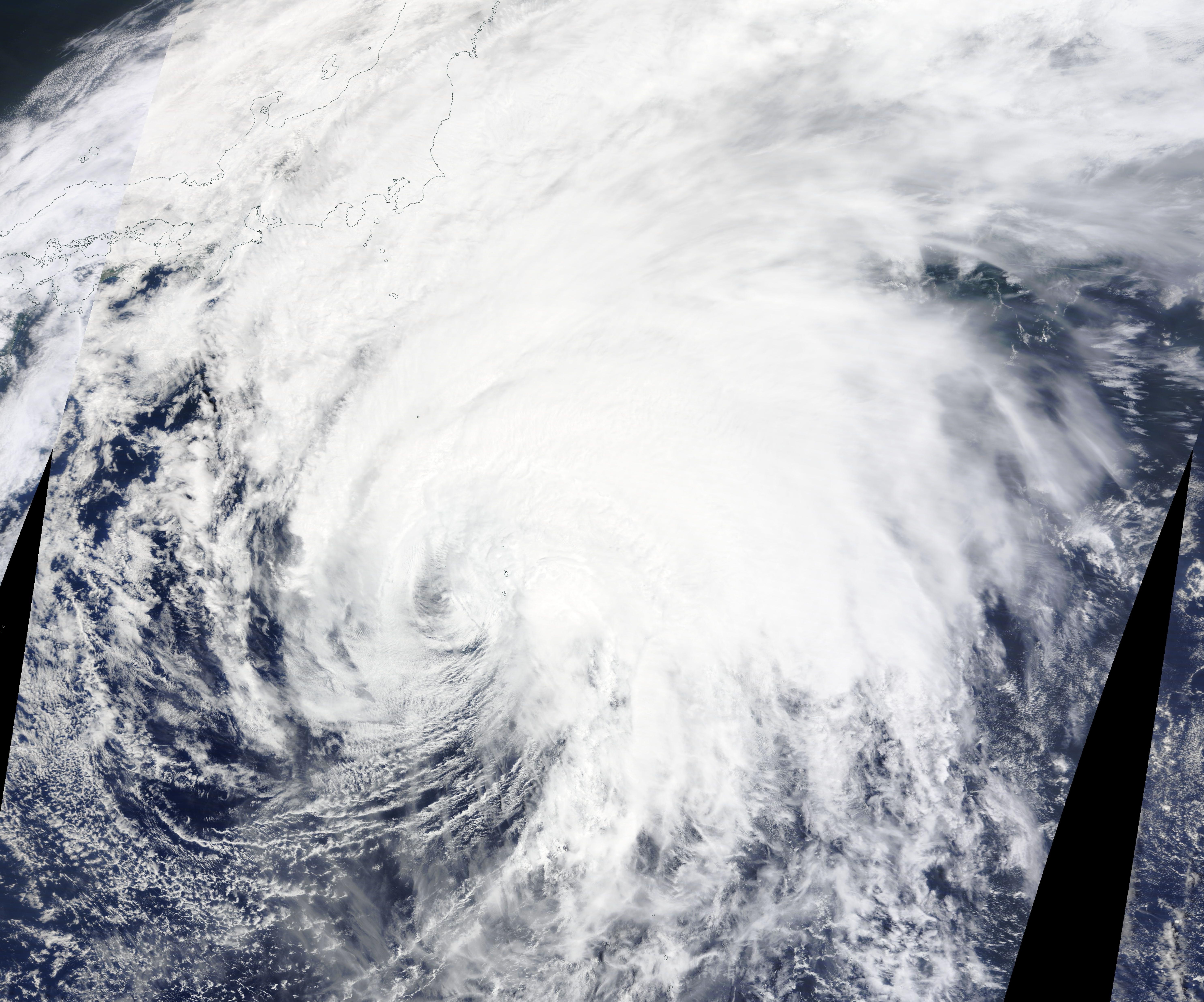
