
Images


April 19, 2022 - Fires in Guinea and Sierra Leone
 Tweet
Tweet
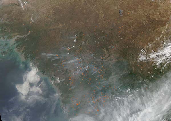
Many dozens of fires speckled the Sahel of Guinea (north) and Sierra Leone in mid-April 2022, creating a veil of smoke that wafted over both the land and North Atlantic Ocean. The Moderate Resolution Imaging Spectroradiometer (MODIS) on board NASA’s Aqua satellite acquired a true-color image of the region on April 17.
Each red “hot spot” marks an area where the thermal bands on the MODIS instrument detected high temperatures. When combined with typical smoke—as seen in this image—such hot spots are diagnostic for actively burning fire. While it is not possible to know the cause of a fire simply from looking at a satellite image, the widespread nature of the fires and the time of year are strongly suggestive of agricultural fires. Farmers often use fire to return nutrients to the soil and to clear the ground of unwanted plants. While fire helps enhance cropland and renews grasses for pasture, the fires also produce smoke that degrades air quality.
Image Facts
Satellite:
Aqua
Date Acquired: 4/17/2022
Resolutions:
1km (81.2 KB), 500m (259.9 KB), 250m (806.5 KB)
Bands Used: 1,4,3
Image Credit:
MODIS Land Rapid Response Team, NASA GSFC
