
Images


April 24, 2022 - Contrails over the Maritimes
 Tweet
Tweet
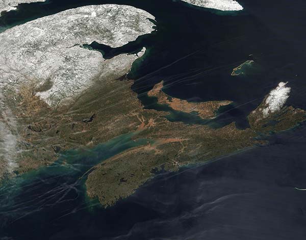
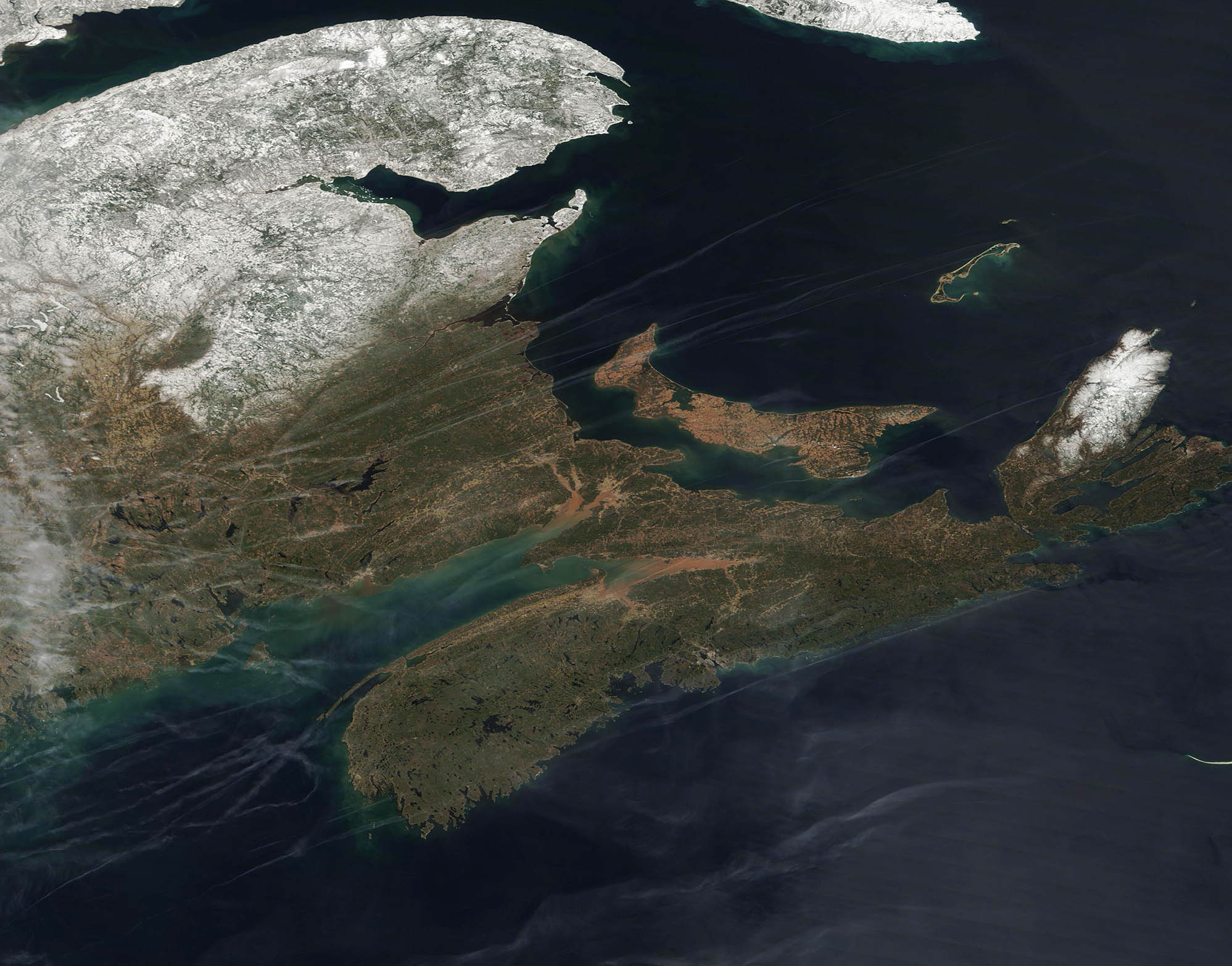
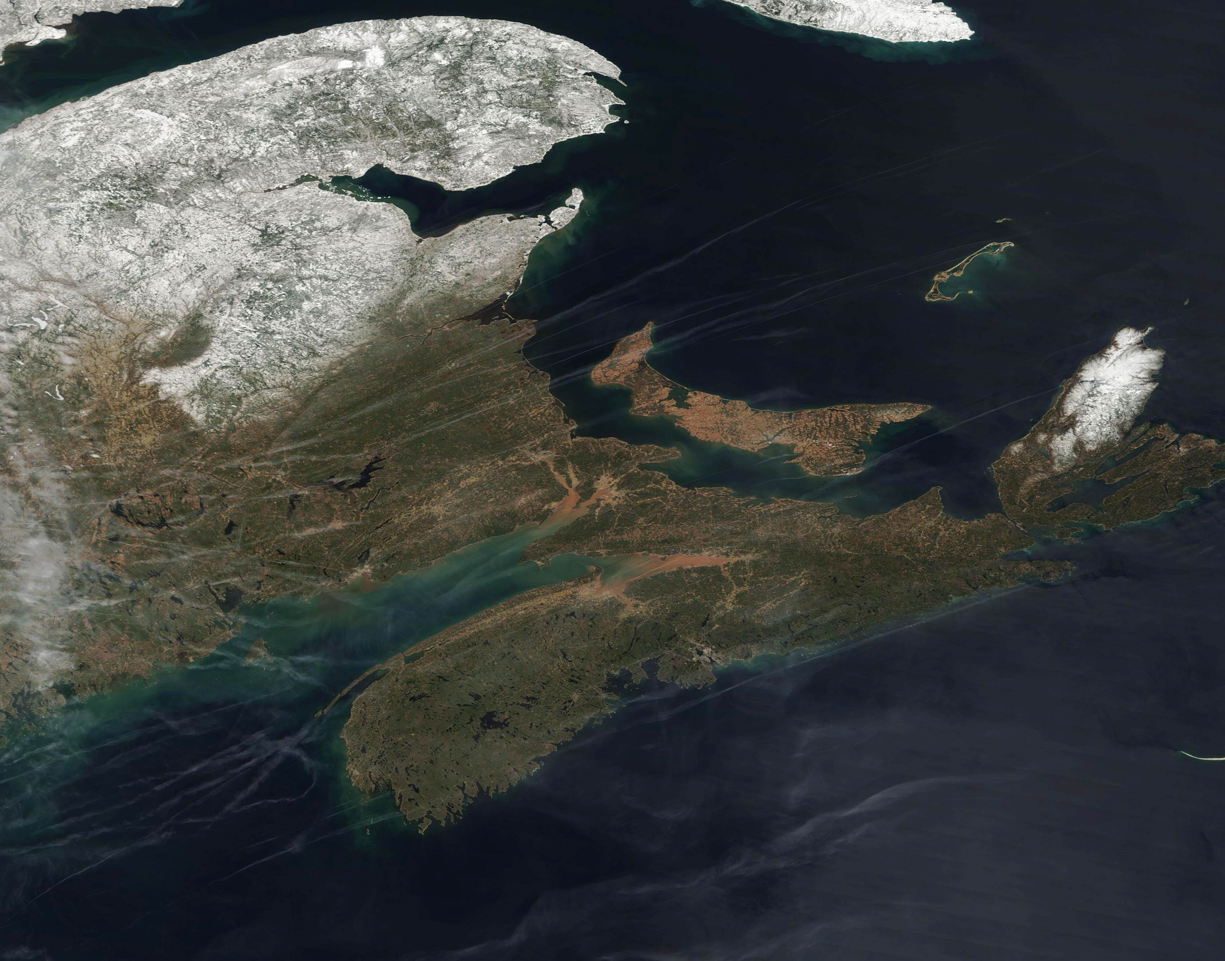
On April 21,2022, the Moderate Resolution Imaging Spectroradiometer (MODIS) on board NASA’s Terra satellite acquired a gorgeous true-color image of New Brunswick, Nova Scotia, and Prince Edward Island, Canada. Snow still clings to the landscape of New Brunswick and the very northern-most tip of the peninsula of Nova Scotia, while the Isthmus of Chignecto and Prince Edward Island are snow-free. The Isthmus of Chignecto connects the main Nova Scotia peninsula to New Brunswick and the Canadian mainland. Prince Edward Island lies northeast of the Isthmus.
In addition to snow, dozens of white streaks cross New Brunswick, the Isthmus of Chignecto, Prince Edward Island and the Bay of Fundy. Several long streaks also surround Nova Scotia, although the atmosphere over the peninsula appears clear. These streaks are known as condensation trails, or contrails and are the result of aircraft flight.
Contrails are actually a type of cloud, and form in a similar way as naturally occurring cirrus clouds. At high altitudes, where it’s cold enough—at least -39°C (-38°F)—water vapor can easily freeze onto small particles in the atmosphere and form clouds. When the phenomenon involves particles from the exhaust of aircraft, the resulting long, narrow cloud is categorized as a contrail.
Image Facts
Satellite:
Terra
Date Acquired: 4/21/2022
Resolutions:
1km (147.9 KB), 500m (388.3 KB), 250m (1.1 MB)
Bands Used: 1,4,3
Image Credit:
MODIS Land Rapid Response Team, NASA GSFC
