
Images


June 11, 2022 - Sao Francisco River and Sobradinho Reservoir
 Tweet
Tweet
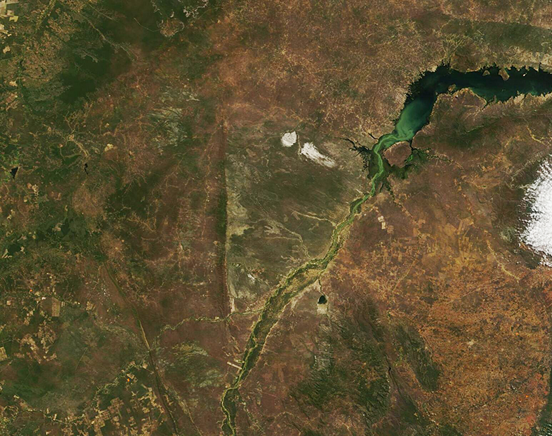
The São Francisco River is the fourth-largest river system in South America as well as the longest river that stays within the country of Brazil. The roughly 1,800-mile (2,900-km) long river starts in the Canastra mountains of the Brazilian highlands, then flows north and east through the Brazilian sertão before expanding behind a major dam to form the Sobradinho Reservoir. Ultimately, water from the São Francisco River pours into the Atlantic Ocean. The massive Sobradinho Reservoir ranks as the fifteenth-largest reservoir in the world and the dam, which was completed in 1982, generates more than 60 percent of Brazil’s energy needs.
On June 7, 2022, the Moderate Resolution Imaging Spectroradiometer (MODIS) on board NASA’s Terra satellite acquire a true-color image capturing much of the São Francisco River and the Sobradinho Reservoir. The green color seen in the river and spilling into the southern waters of the reservoir is most likely sediment washed into the river as it traverses the semi-arid sertão region that makes up much of the São Francisco River basin.
The sertão is an inland, semi-desert land of filled with rock and cactus, and also of broken highlands. It is sparsely populated, thanks primarily to unpredictable and scarce rain, which can be absent for years in some places. Where the São Francisco River snakes through the sertão, villages and towns have sprung up. Some of the hills of the São Francisco River basin hold a wealth of gold and emeralds and have supported mining for nearly 300 years.
Image Facts
Satellite:
Terra
Date Acquired: 6/7/2022
Resolutions:
1km (174.2 KB), 500m (474.3 KB), 250m (1 MB)
Bands Used: 1,4,3
Image Credit:
MODIS Land Rapid Response Team, NASA GSFC
