
Images


July 4, 2022 - Chesapeake Bay
 Tweet
Tweet
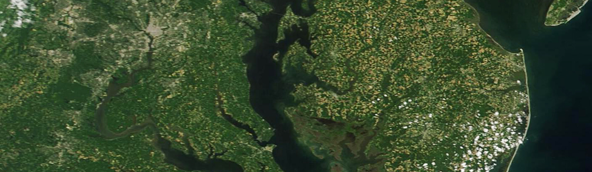
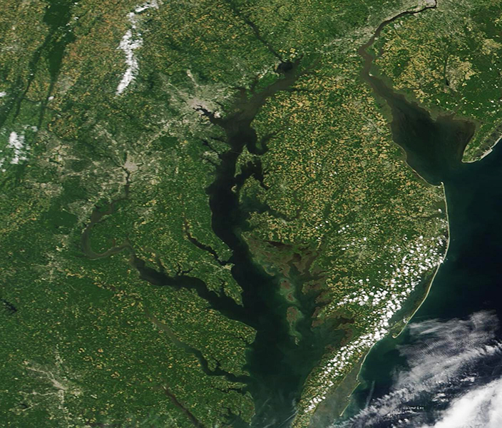
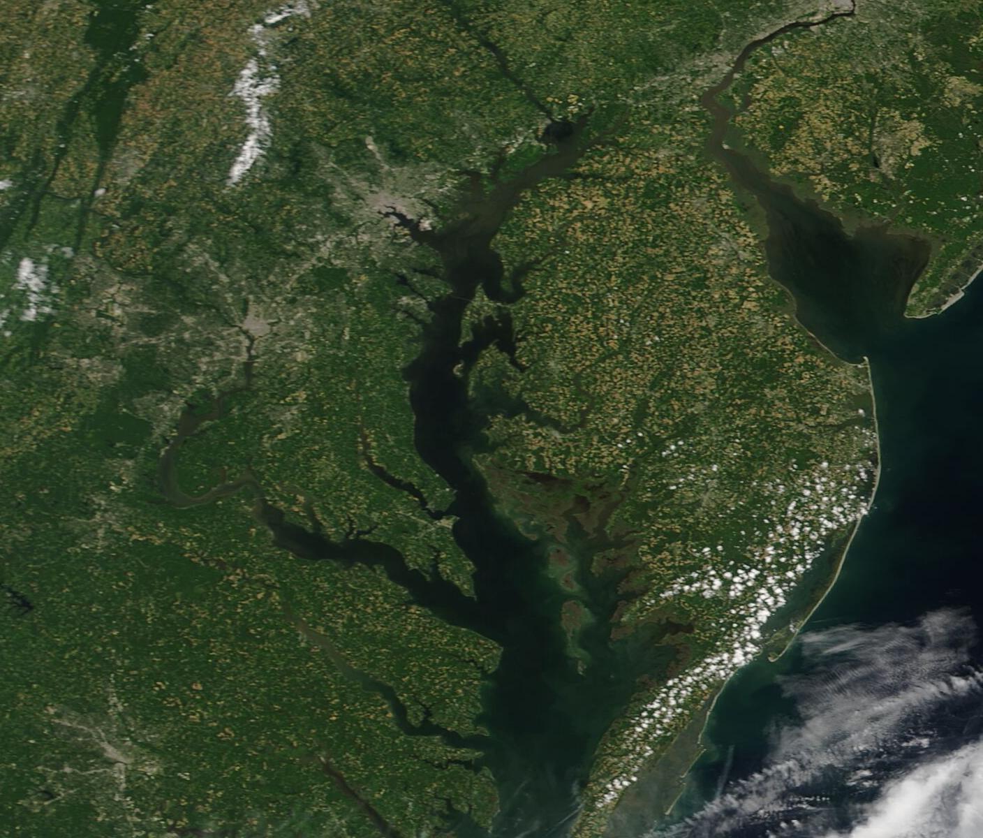
The Chesapeake Bay, stretching about 200 miles (322 km) along the East Coast of the United States, is the largest estuary in the U.S. as well as the third largest estuary on Earth. The narrowest point of the Bay is only 4 miles (6.4 km) near to Aberdeen, Maryland and close to the inflow of the Susquehanna River at the northern end of the estuary. The Chesapeake Bay widens towards the Despite its large size, the Chesapeake Bay is quite shallow, averaging only 21 feet (6.4) meters. However, deep channels thread the Bay, allowing deep water passage for more than 2,000 cruise ships and cargo vessels that utilize the Port of Baltimore each year. The ports of Baltimore, Annapolis, and Hampton Roads are three of the major ports along the shores of the Chesapeake, but hundreds of smaller ports are utilized by industry, agriculture, recreational fishing, recreational boating, and working watermen.
On June 29, 2022, the Moderate Resolution Imaging Spectroradiometer (MODIS) on board NASA’s Terra satellite acquired a true-color image that showed a slice of the central Chesapeake Bay.
The large group of gray pixels near the top of the image west of the blue waters of the Chesapeake Bay marks the Washington, D.C. metro area, which includes not only the District of Columbia but also part of Maryland (north) and, south of the Potomac River, includes Fairfax, Alexandria, and Chantilly, Virginia. A smaller swatch of gray near the top of the image along the western shoreline of the Bay marks Annapolis, Maryland, the capital city of Maryland. Annapolis also served as the capital of the United States from 1783-1784.
Directly across the Bay from Annapolis is Kent Island, which serves as the gateway to the Eastern Shore for many Marylanders as they cross the Chesapeake Bay Bridge on weekend beach getaways. The cantilever bridge was built in 1952, consists of two spans with five lanes, and stretches 4.35 miles from the Western Shore northeast of Annapolis to Kent Island. At high resolution, the Bay Bridge (formally named the Gov. William Preston Lane Jr. Memorial Bridge), can be visualized as a faint line.
The portion of the Eastern Shore captured in this image is divided almost equally between Maryland and Delaware. The region is heavily agricultural with less population density than the Western Shore. A wide variety of crops, including watermelon, corn, potatoes, and soybean, are grown in the rolling, fertile fields and poultry farms are also abundant. In the northeastern corner, along the northern Delaware Coast, the dark waters belong to the Delaware Bay, a smaller estuary. In the far east, the white sands mark the Atlantic Ocean beaches of southern Delaware.
Image Facts
Satellite:
Terra
Date Acquired: 6/29/2022
Resolutions:
1km (163.4 KB), 500m (411 KB), 250m (241.1 KB)
Bands Used: 1,4,3
Image Credit:
MODIS Land Rapid Response Team, NASA GSFC
