
Images


July 17, 2022 - Fires in Saskatchawan and Manitoba
 Tweet
Tweet
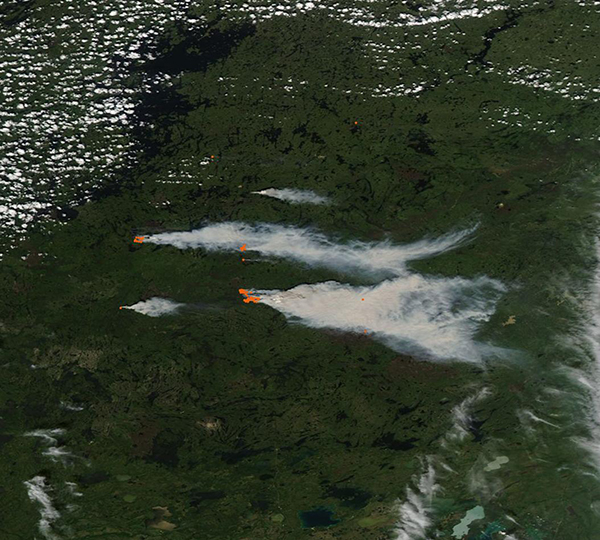
On July 14, 2022, the Moderate Resolution Imaging Spectroradiometer (MODIS) on board NASA’s Aqua satellite acquired a true-color image of heavy smoke pouring from dozens of fires burning near the border of Saskatchewan and Manitoba. Each red “hot spot” marks a location where the thermal bands on the instrument detected high temperatures. When combined with typical smoke, as in this image, such hot spots are diagnostic for actively burning fire. Strong wind is blowing copious smoke eastward, across Manitoba. The border between the two Canadian provinces lies between the western- and eastern-most clusters of fire.
According to a media bulletin published on July 15 by the government of Manitoba, 39 fires were burning in Manitoba with three new starts in the previous 24 hours. Increased lightning and minimal precipitation have led to high wildfire danger levels throughout Manitoba and high to extreme wildfire danger level in northwest Manitoba. Air quality statements have been issued for parts of northwest Manitoba due to smoke from wildfires.
The largest wildfire in Manitoba is estimated to cover about 10,000 hectares and is burning approximately two miles east of Mathian Colomb Cree Nation (MCCN). The Nation has activated its emergency plan and called for the evacuation of all community members. Manitoba fire crews are assisting with firefighting and protection of homes and critical structures.
The Saskatchewan Daily Fire Map shows that on July 16 there were 62 active wildfires, almost all in the northern half of the province. Some of the fires remained unsuppressed.
Image Facts
Satellite:
Aqua
Date Acquired: 7/14/2022
Resolutions:
1km (44.8 KB), 500m (154.5 KB), 250m (489.2 KB)
Bands Used: 1,4,3
Image Credit:
MODIS Land Rapid Response Team, NASA GSFC
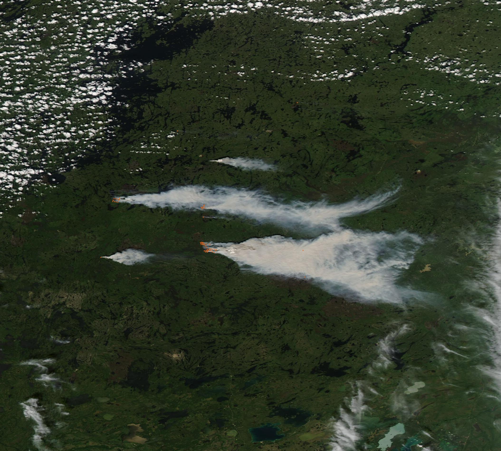
