
Images


July 20, 2022 - Hurricane Estelle
 Tweet
Tweet
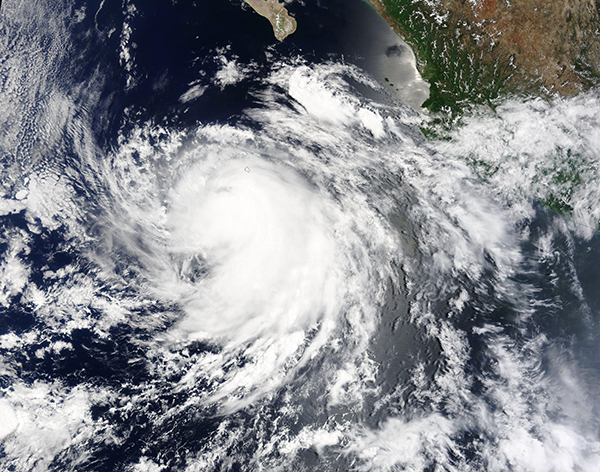
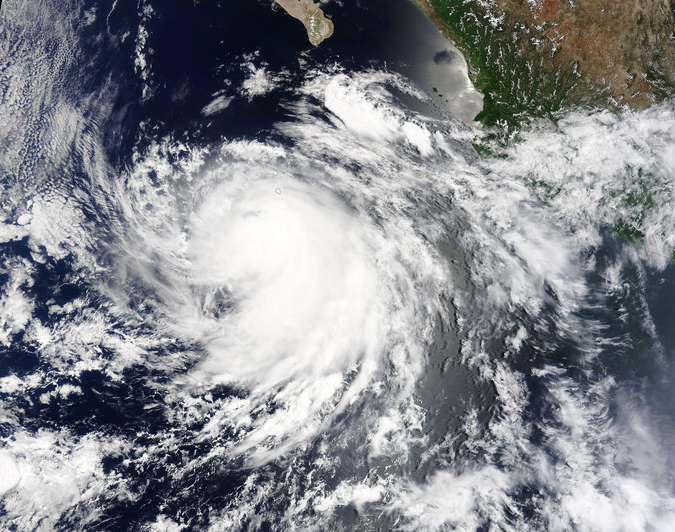
On July 18, 2022, the sixth named storm and the fifth hurricane of the Pacific Hurricane Season was spinning off the coast of Mexico. The Moderate Resolution Imaging Spectroradiometer (MODIS) on board NASA’s Terra satellite acquired a true-color image of Hurricane Estelle on that afternoon. At that time, the slightly asymmetric storm sported a cloud-filled eye and convective bands northeast of the center were bringing rain to Mexico’s Socorro Island. Near the same time, Hurricane Estelle was carrying maximum sustained winds of about 80 mph (129 km/h), placing it as a Category 1 storm on the Saffir-Simpson Hurricane Wind Scale. That was just 5 mph (8 km/h) down from storm’s peak of 85 mph (137 km/h) reached on the afternoon of July 17.
On July 15, the National Hurricane Center (NHC) issued the first advisory on the system, which was then a tropical depression sitting about 345 miles (555 km) south of Acapulco, Mexico. Later that same day the storm strengthened and was named Tropical Storm Estelle when maximum sustained winds reached 40 mph (65 km/h). On the evening of July 16, maximum sustained winds picked up to measure 80 mph (129 km/h), earning hurricane status for Estelle. Although expected to intensify rapidly, Estelle began to encounter wind shear. It was able to reach peak strength on July 17 but struggled to maintain strength through the next day. By the morning of July 19, Estelle had once again become a tropical storm.
At 11:00 p.m. EDT July 19 (0300 UTC on July 20), the NHC advised that Tropical Storm Estelle was located at 20.2 N and 118.0 W, or about 550 miles (890 km) west-southwest of the southern tip of Baja California, Mexico and was moving west northwest at 14 mph (22 km/h). Estelle was maintaining maximum sustained winds of 65 mph (100 km/h).
Tropical Storm Estelle is expected to gradually weaken until it becomes a post-tropical remnant low, likely on July 21. It is posing no threat to land.
Image Facts
Satellite:
Terra
Date Acquired: 7/18/2022
Resolutions:
1km (2.5 MB), 500m (2 MB),
Bands Used: 1,4,3
Image Credit:
MODIS Land Rapid Response Team, NASA GSFC
