
Images


July 24, 2022 - Western Montana
 Tweet
Tweet
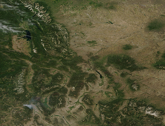
On July 21, 2022, the Moderate Resolution Imaging Spectroradiometer (MODIS) on board NASA’s Terra satellite acquired a true-color image of mountain-rich western Montana.
Montana, aptly named from the Spanish word for mountains (montaña) is the fourth-largest state in the United States by area, yet one of the least-densely populated states. In the western portion of the state, the topography changes, in some places abruptly, from wide-open prairies to the high peaks of the Rocky Mountains.
The vast high country is made up of about 77 named ranges, with at least 300 peaks rising more than 9,600 feet. The Continental Divide—the line that separates the watersheds that drain into the Pacific Ocean from those that drain into the Atlantic or Arctic Oceans—runs along the peaks of Montana’s Rocky Mountains.
Glaciers nestle into the highest elevations of the northern mountains, close to the border with Canada. This area is home to Glacier National Park, and also is part of the region called the Crown of the Continent, a name given by conservationist George Bird Grinnell, who was amazed by the glaciers, the alpine terrain, and the plants and animals that called the high-country home. Grinnell advocated the preservation of the Glacier National Park and helped negotiate the purchase of the land from the Blackfeet Native Americans. The white glaciers can easily be seen atop the ridges in the northwestern section of the image.
Image Facts
Satellite:
Terra
Date Acquired: 7/21/2022
Resolutions:
1km (400.4 KB), 500m (1 MB), 250m (750.3 KB)
Bands Used: 1,4,3
Image Credit:
MODIS Land Rapid Response Team, NASA GSFC
