
Images


September 6, 2022 - Nile River
 Tweet
Tweet
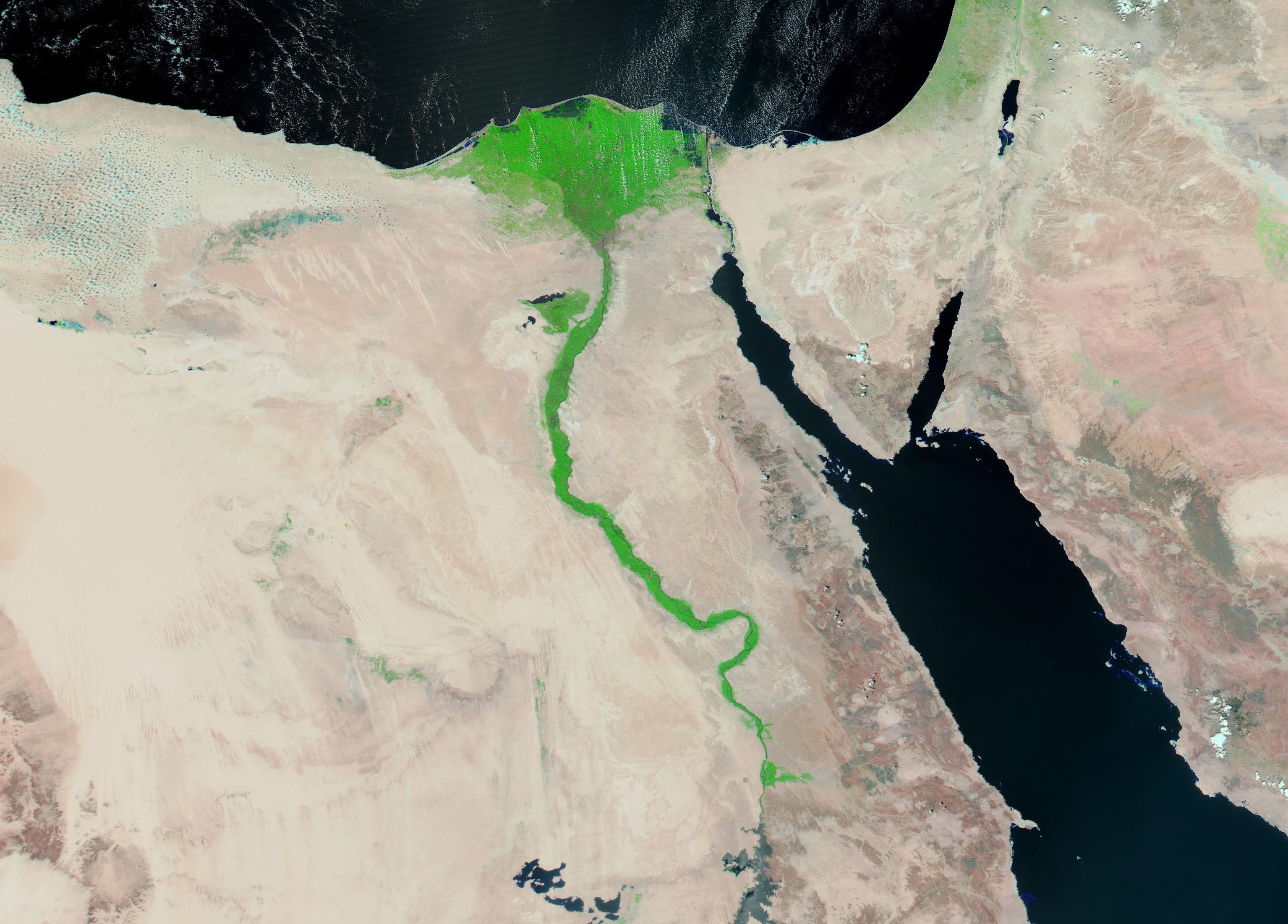
The Nile River courses through some of the driest regions on Earth, with the life-giving water creating fertile valley through the shifting sand. Rising in Burundi, the Nile flows approximately 4,160 miles (6,670 km) to reach the Mediterranean Sea at the expansive Nile River Delta. Nearly one-fourth (22 percent) of the Nile runs through Egypt.
On August 31, 2022, the Moderate Resolution Imaging Spectroradiometer (MODIS) on board NASA’s Aqua satellite acquired a gorgeous false-color image of the rich fertility of the Nile River and its Delta. This type of image combines shortwave infrared, near infrared, and red light (MODIS bands 7,2,1) to create an image that highlights water from land. Water appears blue, with deep water appearing darker, vegetated areas look bright green, and bare ground are tinted in a variety of tans and browns.
At the lower (southern) edge of the image is Lake Nassar, the large impoundment created by the Aswan High Dam, which opened in 1970. To the west of Lake Nassar are the Toshka Lakes which sit in the sands of the Sahara Desert. The Red Sea sits in the east and the Mediterranean Sea stretches across the north (top) of the image. A thin blue line, marking the Nile River, is almost hidden in the bright green vegetative growth spanning the river. As it approaches the Mediterranean, the Nile River expands to form the lush, green “V” of the Nile River Delta. Light patches of green tint the desert in various locations, especially near the Mediterranean Coast—evidence of life-giving moistness in those areas.
Image Facts
Satellite:
Aqua
Date Acquired: 8/31/2022
Resolutions:
1km (188.2 KB), 500m (654.5 KB), 250m (2.1 MB)
Bands Used: 7,2,1
Image Credit:
MODIS Land Rapid Response Team, NASA GSFC
