
Images


October 20, 2022 - Tropical Storm Nesat Heads to Vietnam
 Tweet
Tweet
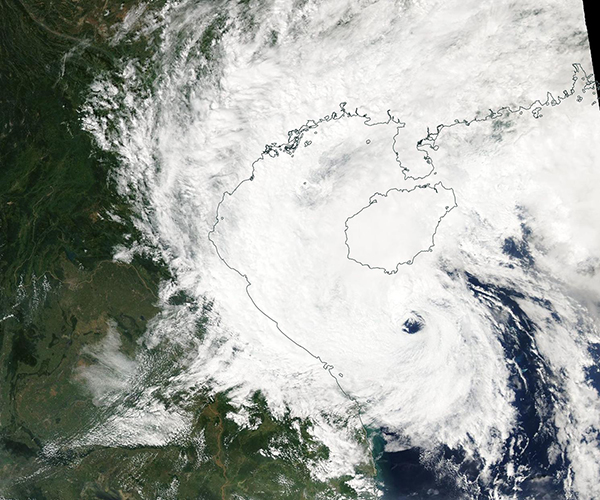
Tropical Storm Nesat sported a large, dramatic eye on October 19, 2022, when the Moderate Resolution Imaging Spectroradiometer (MODIS) on board NASA’s Aqua satellite acquired this true-color image. At the time, Nesat was losing strength as it battled an intervening cold front as the storm moved westward over the South China Sea towards Vietnam.
Although the system started the day with maximum sustained winds of about 60 mph (96.5 km/h), as of 5:00 p.m. EDT (2100 UTC) on October 19, Nesat was very close to a Tropical Depression, carrying maximum sustained winds of 40 mph (64.4 km/h). By definition, a tropical storm carries maximum sustained winds of 39-73 mph (53-117.5 km/h) while a tropical depression’s winds are 38 mph (61 mph) or less. According to the Joint Typhoon Warning Center (JTWC), Tropical Storm Nesat was located 110 miles (178 km) north of Da Nang, Vietnam and was tracking northwestward.
Tropical Storm Nesat is forecast to weaken through the next 24 hours and forward motion should slow, bringing landfall over eastern Vietnam on October 20-21. It is expected to stall shortly after landfall, then dissipate quickly. Parts of central Vietnam are still dealing with damage from Tropical Storm Sonca. That storm made landfall on October 14-15 and brought flooding and landslides. About 3,700 people were displaced during Sonca and at least on person died.
Image Facts
Satellite:
Aqua
Date Acquired: 10/19/2022
Resolutions:
1km (296.8 KB), 500m (986.8 KB), 250m (3 MB)
Bands Used: 1,4,3
Image Credit:
MODIS Land Rapid Response Team, NASA GSFC
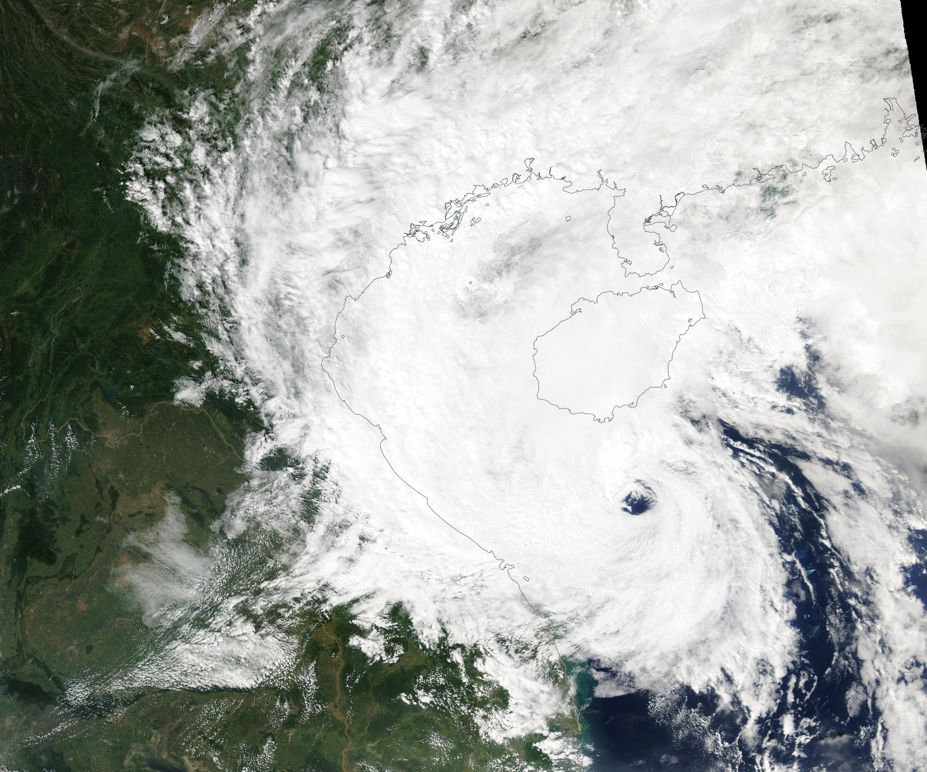
