
Images


October 23, 2022 - Tropical Storm Roslyn Strengthening off the Coast of Mexico
 Tweet
Tweet
Late in the evening of October 19, 2022, the National Hurricane Center (NHC) issued an advisory for formation of a depression offshore of southwestern Mexico. Only twelve hours later, on the morning of October 20, the depression became Tropical Storm Roslyn. The storm travelled west-northwestward, roughly paralleling the coast of Mexico as it continued to strengthen, becoming a hurricane on the evening of October 21. Roslyn then rapidly intensified to become a major hurricane. Hurricane Roslyn is expected to continue to batter the Mexican coastline through the night of October 22 at Category 4 strength, then make landfall north of Puerto Vallarta on October 23.
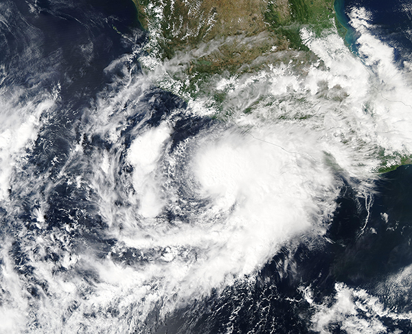
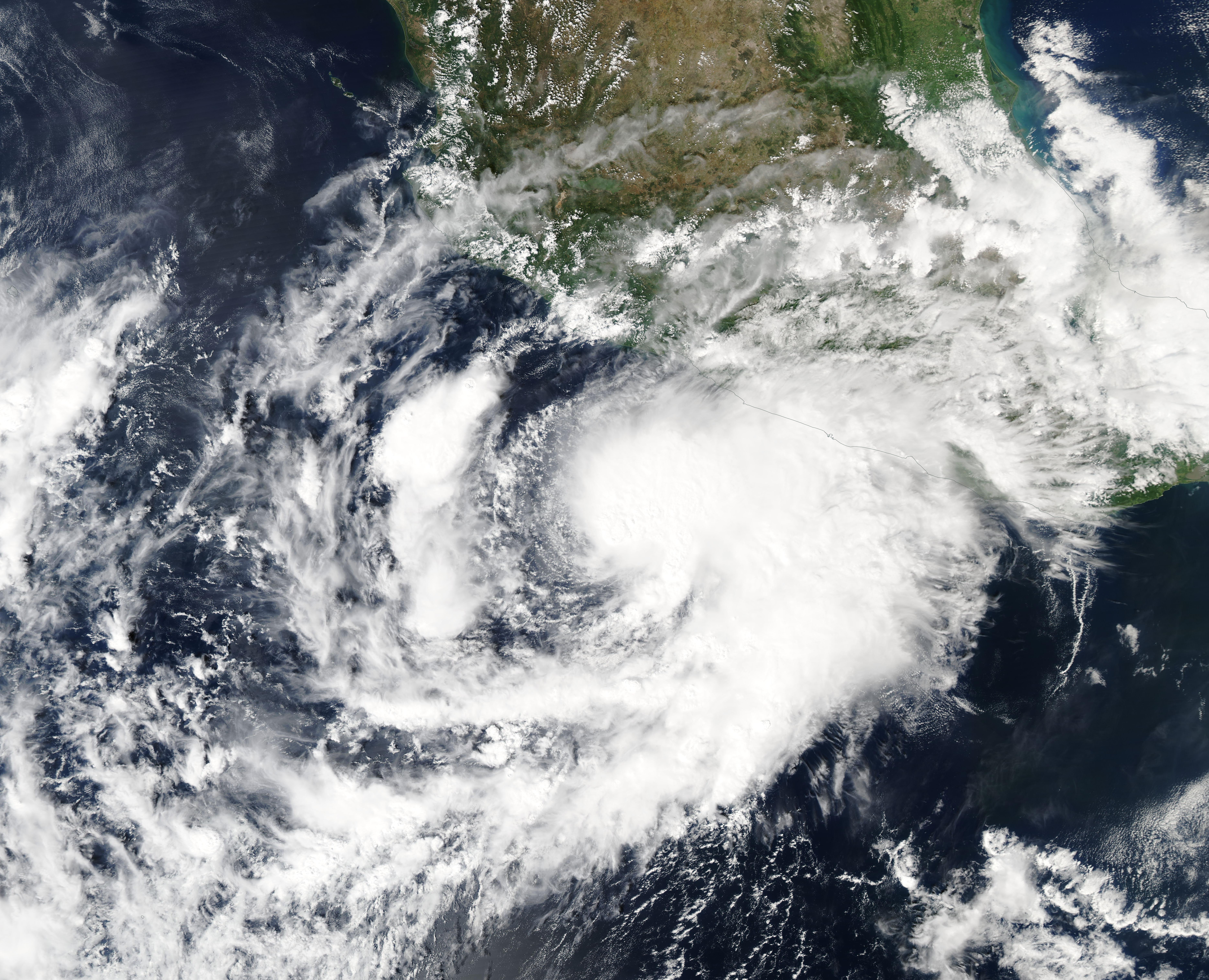
The Moderate Resolution Imaging Spectroradiometer (MODIS) on board NASA’s Aqua satellite acquired a true-color image of newly-formed Tropical Storm Roslyn on the morning of October 20. Near that time, Roslyn carried maximum sustained winds of about 45 mph (72 km/h) and was about 175 miles (280 km) south of Zihuantanejo, Mexico and about 305 miles (490 km) south-southeast of Manzanillo, Mexico. The center of the storm was cloud-filled and becoming defined, with ragged and asymmetric circulation that stretched both to the southwest and northeast. Storm bands in the northeast quadrant were already bringing rain to the city of Acapulco, which sits on the Pacific Coast.
At 11:00 p.m. EDT on October 22 (0300 UTC on October 23), the NHC advised that Hurricane Roslyn’s maximum sustained winds were near 132 mph (212 km/h), which places it as a Category 4 storm on the Saffir-Simpson Hurricane Wind Scale. Gusts were reaching 161 mph (259 km/h). The center of Hurricane Roslyn was located near latitude 20.0 north, longitude 106.6 west, which is southwest of Puerta Vallarta. Hurricane warnings were in effect for Playa Perula to Escuinapa and Las Islas Marias.
The NHC warned that Roslyn is expected to be at or near hurricane strength when it makes landfall along the west-central coast of Mexico by October 23. It will be accompanied by damaging wind and dangerous storm surge. The Global Disaster Alert and Coordination System (GDACS) states that Roslyn “can have a high humanitarian impact based on the maximum sustained wind speed, exposed population, and vulnerability”. They estimate that 350,000 people may be impacted by Category-1-force winds or higher. Category 1 winds range from 75 to 95 mph (119 to 153 km/h).
Image Facts
Satellite:
Aqua
Date Acquired: 10/20/2022
Resolutions:
1km (2.3 MB), 500m (6.4 MB), 250m (4.6 MB)
Bands Used: 1,4,3
Image Credit:
MODIS Land Rapid Response Team, NASA GSFC
Late in the evening of October 19, 2022, the National Hurricane Center (NHC) issued an advisory for formation of a depression offshore of southwestern Mexico. Only twelve hours later, on the morning of October 20, the depression became Tropical Storm Roslyn. The storm travelled west-northwestward, roughly paralleling the coast of Mexico as it continued to strengthen, becoming a hurricane on the evening of October 21. Roslyn then rapidly intensified to become a major hurricane. Hurricane Roslyn is expected to continue to batter the Mexican coastline through the night of October 22 at Category 4 strength, then make landfall north of Puerto Vallarta on October 23.
The Moderate Resolution Imaging Spectroradiometer (MODIS) on board NASA’s Aqua satellite acquired a true-color image of newly-formed Tropical Storm Roslyn on the morning of October 20. Near that time, Roslyn carried maximum sustained winds of about 45 mph (72 km/h) and was about 175 miles (280 km) south of Zihuantanejo, Mexico and about 305 miles (490 km) south-southeast of Manzanillo, Mexico. The center of the storm was cloud-filled and becoming defined, with ragged and asymmetric circulation that stretched both to the southwest and northeast. Storm bands in the northeast quadrant were already bringing rain to the city of Acapulco, which sits on the Pacific Coast.
At 11:00 p.m. EDT on October 22 (0300 UTC on October 23), the NHC advised that Hurricane Roslyn’s maximum sustained winds were near 132 mph (212 km/h), which places it as a Category 4 storm on the Saffir-Simpson Hurricane Wind Scale. Gusts were reaching 161 mph (259 km/h). The center of Hurricane Roslyn was located near latitude 20.0 north, longitude 106.6 west, which is southwest of Puerta Vallarta. Hurricane warnings were in effect for Playa Perula to Escuinapa and Las Islas Marias.
The NHC warned that Roslyn is expected to be at or near hurricane strength when it makes landfall along the west-central coast of Mexico by October 23. It will be accompanied by damaging wind and dangerous storm surge. The Global Disaster Alert and Coordination System (GDACS) states that Roslyn “can have a high humanitarian impact based on the maximum sustained wind speed, exposed population, and vulnerability”. They estimate that 350,000 people may be impacted by Category-1-force winds or higher. Category 1 winds range from 75 to 95 mph (119 to 153 km/h).
Image Facts
Satellite:
Aqua
Date Acquired: 10/20/2022
Resolutions:
1km (2.3 MB), 500m (6.4 MB), 250m (4.6 MB)
Bands Used: 1,4,3
Image Credit:
MODIS Land Rapid Response Team, NASA GSFC
