
Images


November 13, 2022 - Snow in the Western United States
 Tweet
Tweet
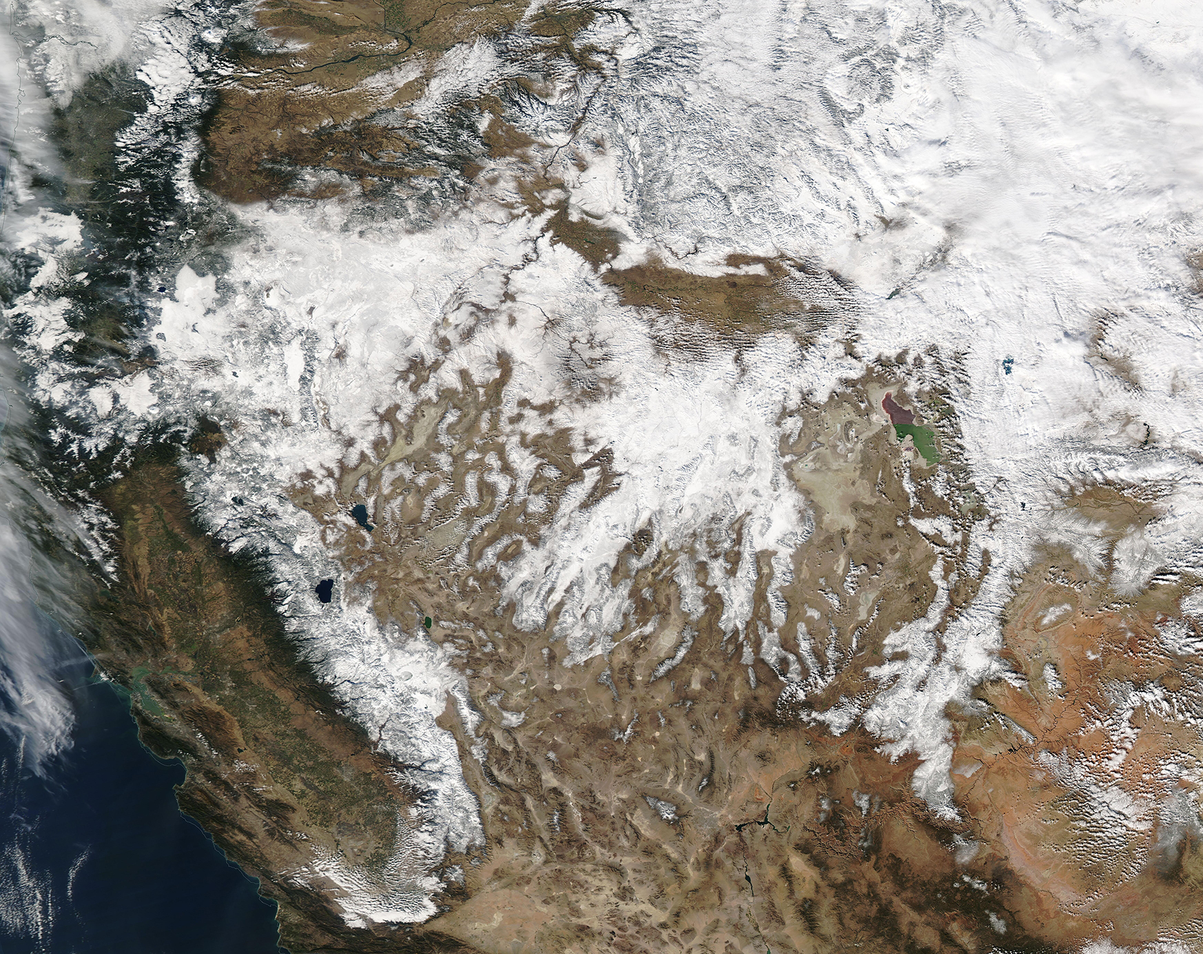
The first winter storm of the season rolled across the Western and Mid-Western United States from November 6 to 10, 2022, leaving behind a vast blanket of white. The Moderate Resolution Imaging Spectroradiometer (MODIS) on board NASA’s Aqua satellite acquired a true-color image of the aftermath of the storm on November 10. This image stretches from the Pacific Ocean to Montana, and shows deep, fresh snow covering the Sierra Nevada Mountains, the Cascades Range, and the Rocky Mountains as well as parts of the Great Basin and the Columbia Plateau. The storm also created blizzard conditions in the Great Plains states, which sit east of this image.
The storm began along the west coast on November 6, leaving parts of the high country in Washington state covered in 1-2 feet of fresh snow. According to the National Weather Service (NWS) Sacramento, 44 inches fell at Dodge Ridge in the Stanislaus National Forest in the Sierra Nevada, California while Bear Valley saw a 36-inch accumulation from the storm. Meanwhile, numerous accidents were reported in Montana, while the Dakotas suffered blizzard conditions and accumulating ice. Bismarck, North Dakota, also felt the blast of gusty winds measuring more than 30 mph. Visitors to Yosemite briefly experienced thundersnow—snow accompanied by thunder and lightning.
According to the Weather Channel, more than two- to three-times the normal amount of snow has already accumulated in some parts of the west, including the high country in the Sierras, Cascades, and Rockies. As a result, ski resorts in many locations, including Colorado, New Mexico, and Utah are eyeing an early opening for winter sports.
Image Facts
Satellite:
Aqua
Date Acquired: 11/10/2022
Resolutions:
1km (2.6 MB), 500m (7.2 MB), 250m (5.7 MB)
Bands Used: 1,4,3
Image Credit:
MODIS Land Rapid Response Team, NASA GSFC
