
Images


December 27, 2022 - Smoke and Fire near Santiago, Chile
 Tweet
Tweet
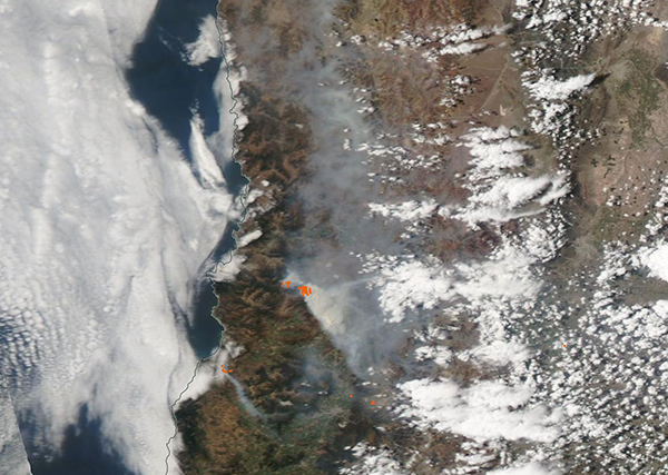
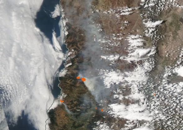
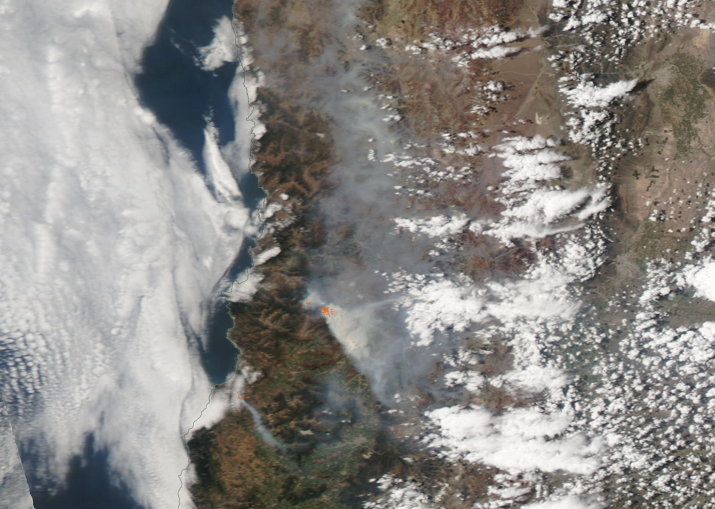
On December 16, 2022, the Moderate Resolution Imaging Spectroradiometer (MODIS) on board NASA’s Aqua satellite acquired a true-color image of multiple fires and heavy smoke in Chile.
Each red “hot spot” marks an area where the thermal bands on the MODIS instrument detected high temperatures. When combined with typical smoke, as in this image, such hot spots mark actively burning fire.
The thickest smoke sits over and near Santiago, the capital city which is located in the Central Valley formed between the Chilean Coastal Range (west) and the Andes Mountains (east). A blanket of smoke also fills the Central Valley north of Santiago, while a fire near the Pacific coastline sends a plume of smoke southeastward.
According to local media, a dense cloud of smoke covered the city on December 16, spurring officials to declare a Health Alert for the Metropolitan Region. On that date, according to the National Emergency Office of the Ministry of the Interior and Public Safety, a total of 97 forest fires burning nationwide, with 48 of those considered under control.
Chile has been sweltering under an intense heatwave, which helped prime vegetation to serve as tinder for any spark. The heat also hinders firefighters, especially when wearing heavy safety gear. On December 15, temperatures in the Quinta Normal station hit 36.7 °C (98˚F). That is the third-highest temperature recorded in Santiago in December in 111 years.
Image Facts
Satellite:
Aqua
Date Acquired: 12/16/2022
Resolutions:
1km (48.5 KB), 500m (141.8 KB), 250m (388.3 KB)
Bands Used: 1,4,3
Image Credit:
MODIS Land Rapid Response Team, NASA GSFC
