
Images


January 19, 2023 - Flooding in California's Sacramento Valley
 Tweet
Tweet
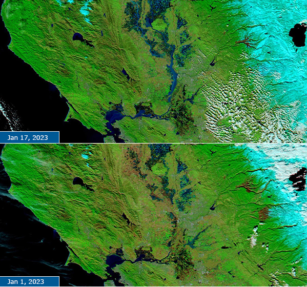
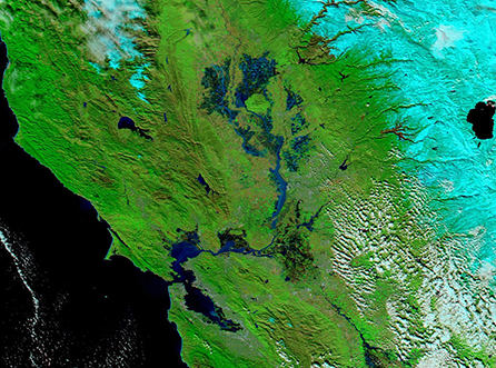
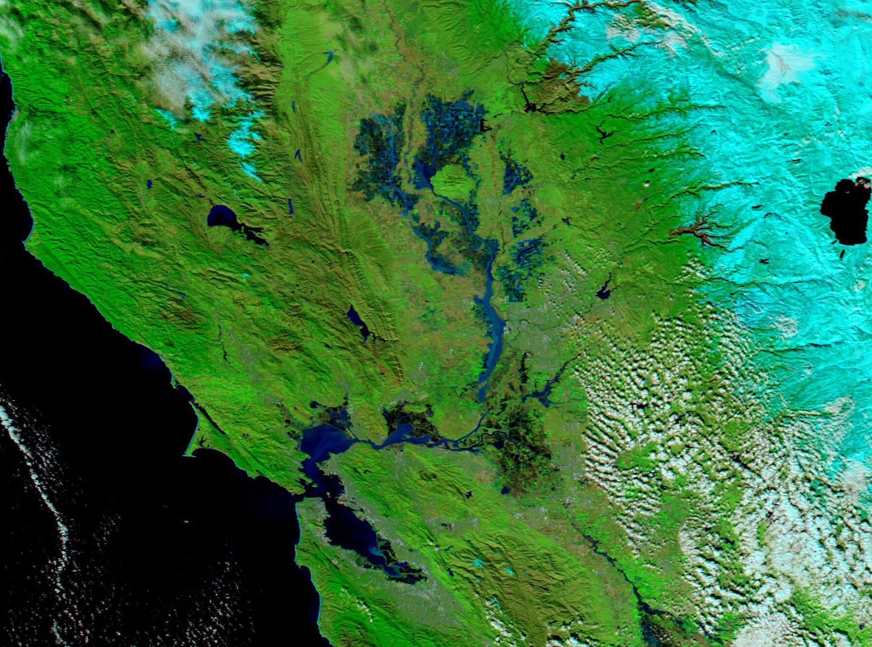
After weeks of a seemingly endless string of storms, skies cleared over California’s Sacramento Valley on January 17, 2023, allowing the Moderate Resolution Imaging Spectroradiometer (MODIS) on NASA’s Terra satellite to acquire a false-color image of flooding in the region. In this type of image, vegetation appears bright green, water looks dark blue, and open land appears tan. Burn scars, which have been left behind by previous fires, can range from deep tan to brick red. Snow appears electric blue while cloud may look either white or, if it contains ice crystals, be tinted electric blue.
On January 1, 2023—the last previous day the skies were clear—Terra MODIS acquired a similar image on the same region. By stacking the two images, with January 17 on top and January 1 below, it is easy to compare the progression of flooding near Sacramento.
On January 1, floodwaters had clearly laid claim to much of the Sacramento Valley, including many of the agricultural fields near the Sutter Buttes. The Sutter Buttes, which look nearly circular from space, rise almost 2,000 feet (610 meters) above the surrounding fields, which are used to produce sunflower, winter wheat, tomato, and almonds. Some fields appear brown, either due to stubble from harvested crops left to lie fallow for the season or due to recently-turned soil in preparation for planting. The Sacramento River, which tumbles through a series of bays before reaching the Pacific Ocean, is also in extreme flood. The city of Sacramento sits along the east side of this river, close to where it curves westward and southeast of the Sutter Buttes. Two large burn scars can be seen on the western slopes of the snow-covered mountains near Lake Tahoe.
By January 17, after the passage of several more deluge-filled atmospheric rivers, flooding has become even more intense. Fewer fields are visible due to the inundation, and the Sacramento River has become even wider. A streak of light color, most likely suspended sediment, tints the river near Sacramento. Sediment also colors Suisun Bay and San Pablo Bay. Snowpack has also increased in the mountains, with fresh snow covering the burn scars.
According to local weather forecasts, the sunny skies won’t last for long. A storm driven by the passage of a cold front is expected to bring more rain to the valley, snow to the mountains, and gusty wind over the entire region in the upcoming week. This isn’t the same type of storm as the repetitive rounds of atmospheric rivers that have battered the state, but additional rain may add to flooding. After mid-week, sunny skies are expected to return to the state.
Image Facts
Satellite:
Terra
Date Acquired: 1/17/2023
Resolutions:
1km (263.7 KB), 500m (709.4 KB), 250m (450.8 KB)
Bands Used: 7,2,1
Image Credit:
MODIS Land Rapid Response Team, NASA GSFC
