
Images


February 21, 2023 - Aerosols over India and Bangladesh
 Tweet
Tweet
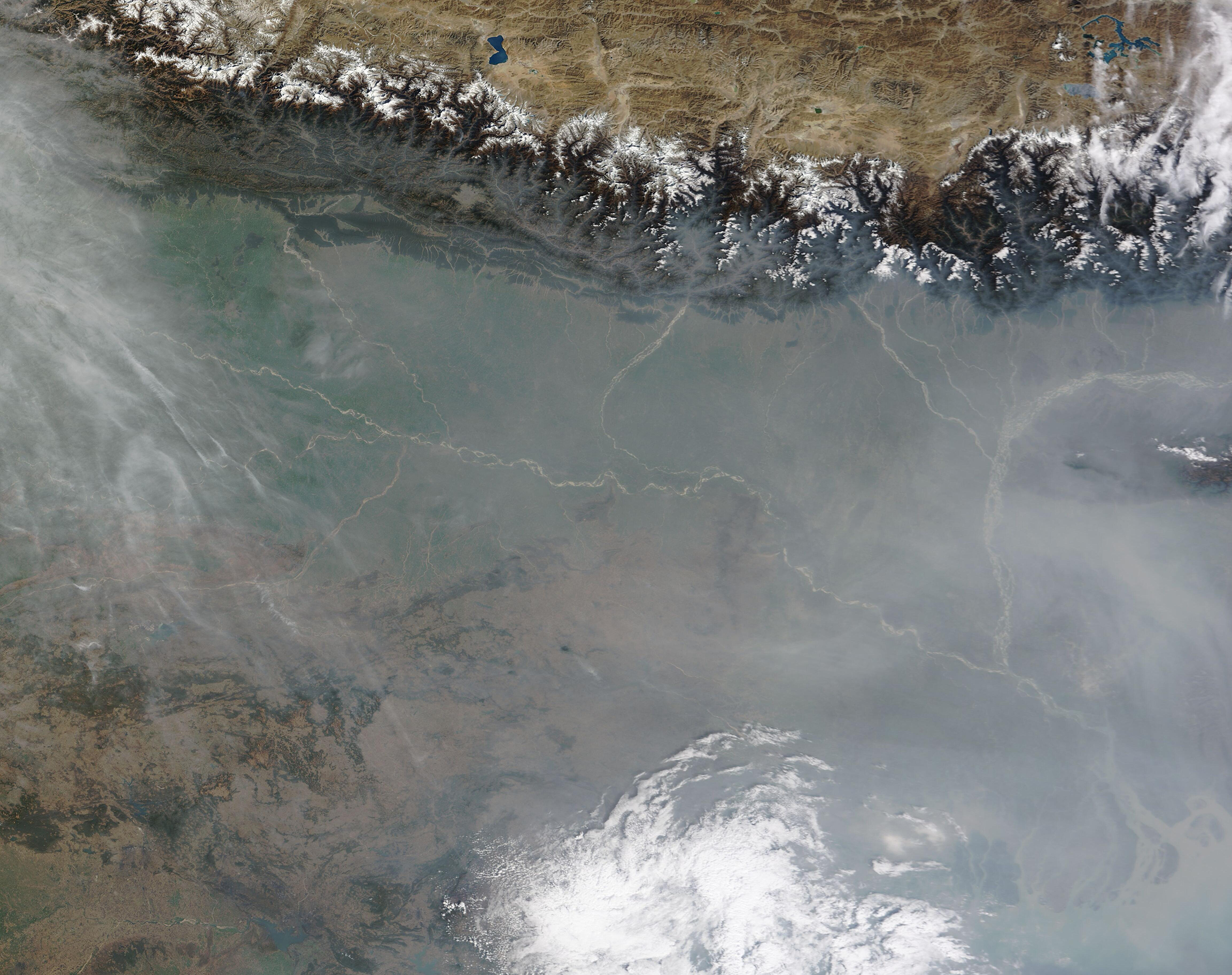
A thick gray haze hung over India and Bangladesh in late February 2023, obscuring much of the land from satellite view and raising levels of aerosol pollution near the ground. The Moderate Resolution Imaging Spectroradiometer (MODIS) on board NASA’s Terra satellite acquired a true-color image of the scene on February 17.
The haze is thickest in the southeast, over Bangladesh, but covers almost all the landscape south of the Himalaya Mountains, indicating that the haze is relatively low-level. North of the high mountains peaks, the air over the Tibetan Plateau appears crystal-clear. High cloud in the south and the northeast are white, suggesting they are floating over the lower-level haze. A wider view, which expands beyond the edges of the image, shows that the fingers of smokey-toned haze and cloud visible in the west of this image stretch across Afghanistan and Pakistan, where dust mingles with the cloud.
Winter haze is a regular visitor in northern India, and typically is caused by a complex mix of aerosols (tiny particles suspended in air) and weather conditions. Winter aerosols in this region include pollution from the densely-populated Indo-Gangetic plain, industry, smoke, and dust blowing from the Thar Desert, which sits between India and Pakistan. Cold seasonal temperatures contribute to the buildup of haze as they trap the cooler air near the Earth under a high layer of warmer air. The layer of high warm air acts like a lid, stopping the upward flow of low-level air and thus the dispersion of aerosols and haze.
Early in the morning of February 17, the air quality index (AQI) score in Dhaka, the capital of Bangladesh, reached 335, bringing it the dubious title of “city with the most polluted air” on that date, according to local media. On that same day, the AQI in Delhi, India was 302, Lahore, Pakistan registered 213, and Kabul, Afghanistan, was 188, capturing second, third, and fourth-most polluted spots, respectively. AQI is based on five pollutants: particular matter (PM10 and PM2.5), nitrogen dioxide (N02), carbon monoxide (CO), sulfur dioxide (SO2), and ozone (O3). An AQI between 151 and 200 listed as “unhealthy”; between 201 and 300 is “very unhealthy”, and 301 to 400 is “hazardous”.
Image Facts
Satellite:
Terra
Date Acquired: 2/17/2023
Resolutions:
1km (840.9 KB), 500m (2 MB), 250m (1.4 MB)
Bands Used: 1,4,3
Image Credit:
MODIS Land Rapid Response Team, NASA GSFC
