
Images


March 2, 2023 - Fire and Smoke in Southeast Asia
 Tweet
Tweet
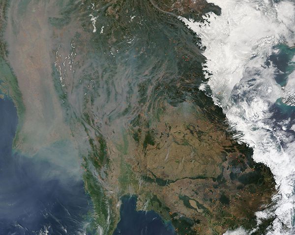
By early March, the late dry season wanes as temperatures rise in Southeast Asia, creating perfect conditions for the spread of fire. During this season, farmers set small fires to manage land, particularly to clear residue of old crops, prepare fields for planting, and renew pastures. Fire is also a tool use for clearing forest for new cropland. While most agricultural fires are useful and stay under control, they may also escape to create destructive wildfires.
On March 1, 2023, the Moderate Resolution Imaging Spectroradiometer (MODIS) on board NASA’s Terra satellite acquired a true-color image of heavy smoke across part of Southeast Asia. Most of the gray haze hangs over the lowest valleys especially along Burma’s (Myanmar’s) Irrawaddy River, which is completely obscured from view. Haze also settled in the valleys in Thailand, to the east, while a large bank of fog lies over parts of Vietnam and Laos.
Red hot spots, many with long plumes of gray smoke rising from them, mark actively burning fires. Many dozens of fires are scattered across the entire scene.
While smoke from fires currently burning across much of Southeast Asia undoubtedly contribute to the gray skies, some of the haze over Burma (Myanmar) has seeped eastward from a thick cloud of aerosols hanging over India and Bangladesh. Winter aerosol haze frequently occurs over those countries, driven by smoke, pollution, and dust that collects south of the Himalayan Mountains. When trapped near the ground by an air inversion, the thick haze can spread across not only India and Bangladesh, but also into the air over Southeast Asia.
Image Facts
Satellite:
Terra
Date Acquired: 3/1/2023
Resolutions:
1km (325.8 KB), 500m (1.1 MB), 250m (3.8 MB)
Bands Used: 1,4,3
Image Credit:
MODIS Land Rapid Response Team, NASA GSFC
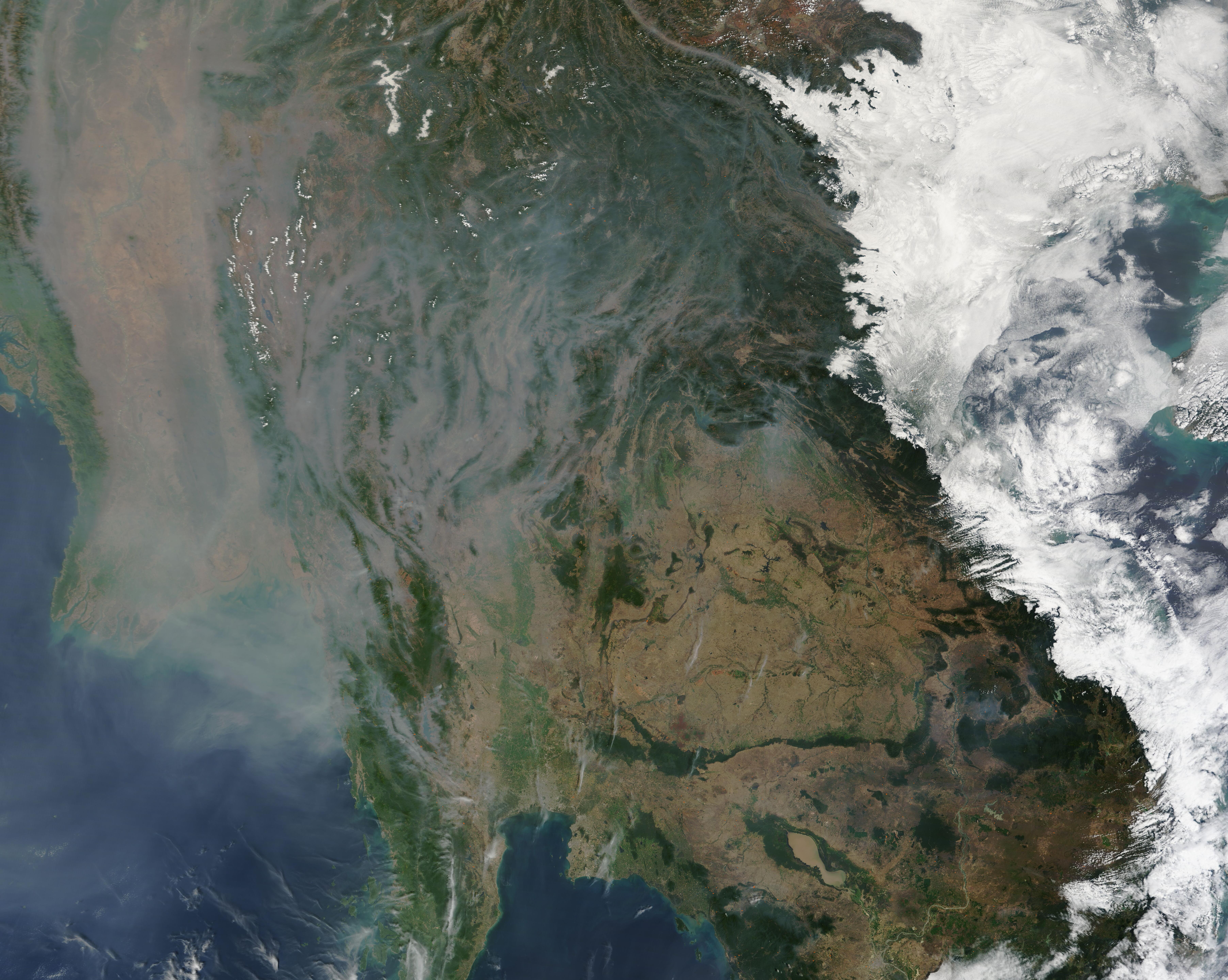
