
Images


January 23, 2024 - Snow Across the United States
 Tweet
Tweet
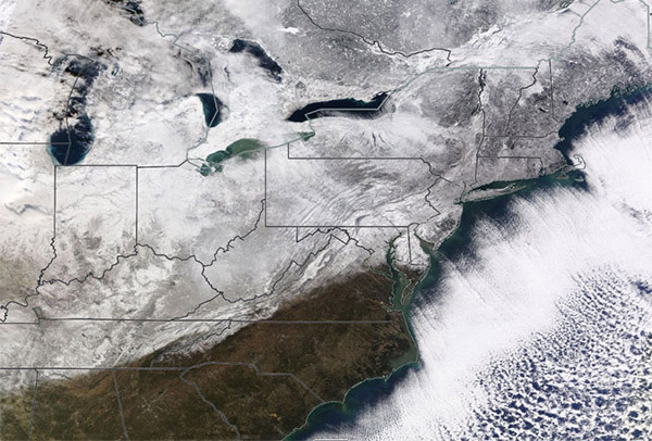
A series of back-to-back winter storms left much of the United States and Canada blanketed under widespread snow in January 2024.
On January 21, the Moderate Resolution Imaging Spectroradiometer (MODIS) on NASA’s Terra satellite acquired a true-color image of a portion of snow-draped southeastern Canada and the northeastern United States. All five Great Lakes are surrounded by snow, and most are at least partially covered by clouds—clouds that carry additional snow and ice. In the south, the transition line between snow and clear ground is distinct and crosses six states: Mississippi, Alabama, Tennessee, North Carolina, Virginia, and southern Maryland. Frigid air blowing off the coast of the Eastern United States has created clouds offshore that covers the Atlantic Ocean.
According to the National Weather Service’s National Operational Hydrological Remote Sensing Center, 53.7 percent of the contiguous United States was covered with snow on January 21. That’s up from 19.9 percent on December 31, 2023.
On January 22, temperatures were rising across much of the United States as another winter storm impacted parts of the Central United States. With the extra warmth, there was less snow and more freezing rain and ice. Ice was reported as far south as Texas, Oklahoma, and Arkansas, according to media reports. This storm is expected to push eastward to bring more foul weather and snow to much of New England over the next several days. At least 82 deaths have been attributed to the seemingly endless series of winter storms that have impacted the United States this January.
Image Facts
Satellite:
Terra
Date Acquired: 1/21/2024
Resolutions:
1km (1.7 MB), 500m (4.1 MB),
Bands Used: 1,4,3
Image Credit:
MODIS Land Rapid Response Team, NASA GSFC
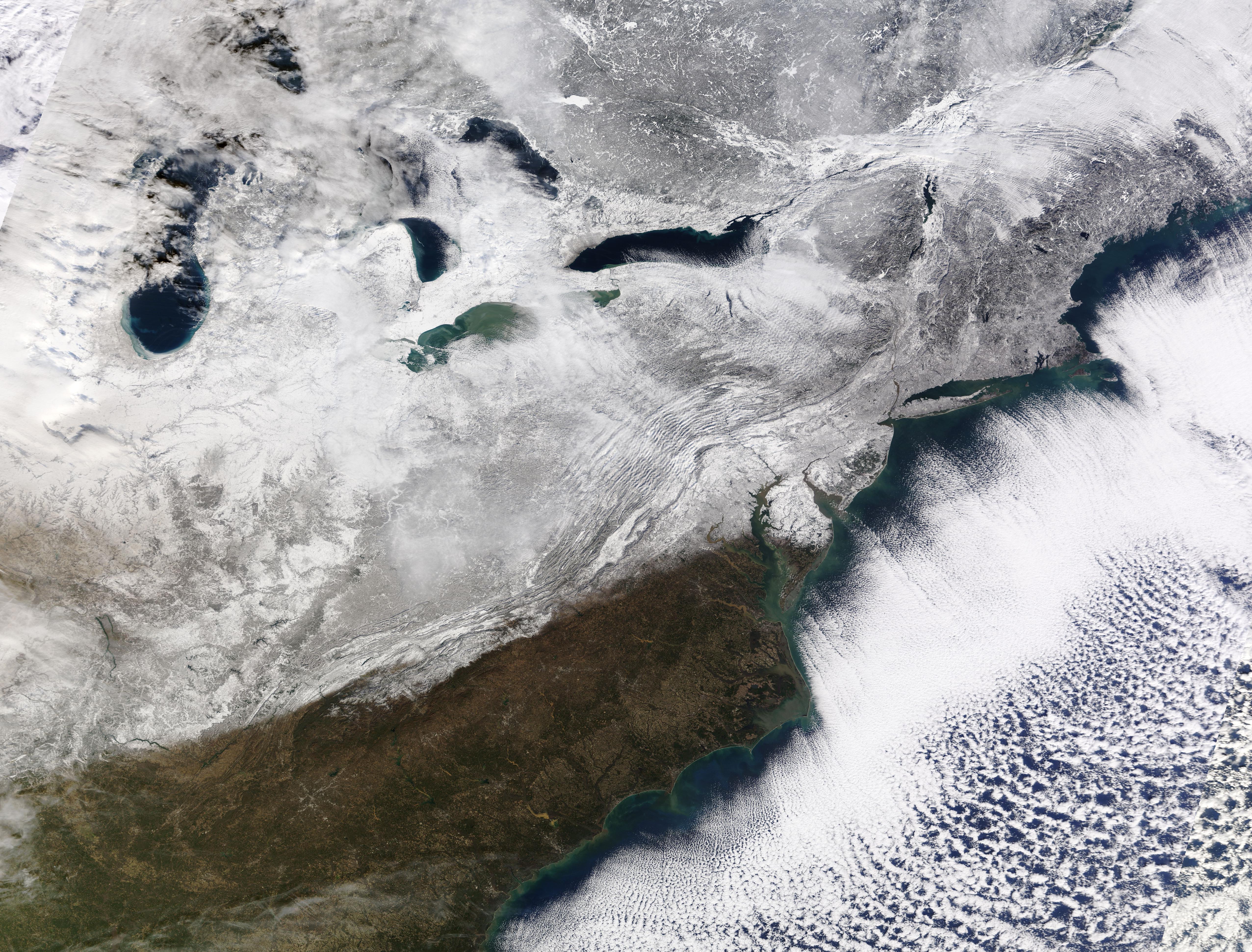
