
Images


March 3, 2024 - Lake Chad
 Tweet
Tweet
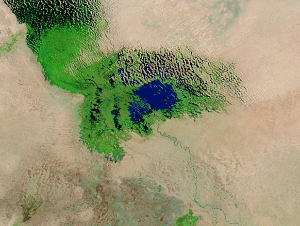
Lake Chad was once one of Africa’s largest freshwater lakes, spanning an area roughly the size of North America’s present-day Lake Erie. With a warming climate, decreasing rainfall, and increasing demands from an increasing population, Lake Chad has been shrinking over the last several decades. It is estimated that it has lost about 92 percent of its former size, while the greater Lake Chad Basin contributes to the food security for 50 million people.
Efforts are underway to try to restore water to the lake. In February 2024, it was announced that the Lake Chad Basin Commission and the African Development Bank Group signed a Memorandum of Understanding to join forces to help rehabilitate and restore the Lake Chad Basin. The mobilization of financial and technical resources is designed to improve the development and management of water resources, support livelihoods, and help restore peace in the region, according to a statement published by Friends of The Lake Chad on their Facebook Page. The Lake Chad Basin Commission includes six member countries: the Central African Republic, Libya, Chad, Cameroon, Nigeria, and Niger. Lake Chad straddles the last four countries.
On February 29, 2024, the Moderate Resolution Imaging Spectroradiometer (MODIS) on NASA’s Aqua satellite acquired a false-color image of Lake Chad. The blue areas are water, while vegetation found in wetlands and grasslands around the lake appear bright green. Open or very sparsely vegetated land looks tan.
In the south, the Chari River looks like a ribbon of both blue (water) and green (vegetation) as it winds from the Central African Republic to skirt the boundary between Cameroon and Chad and then pour into Lake Chad. The Chari River provides about 90 percent of the water inflow to Lake Chad.
Image Facts
Satellite:
Aqua
Date Acquired: 2/29/2024
Resolutions:
1km (108 KB), 500m (278.2 KB), 250m (167.8 KB)
Bands Used: 1,4,3
Image Credit:
MODIS Land Rapid Response Team, NASA GSFC
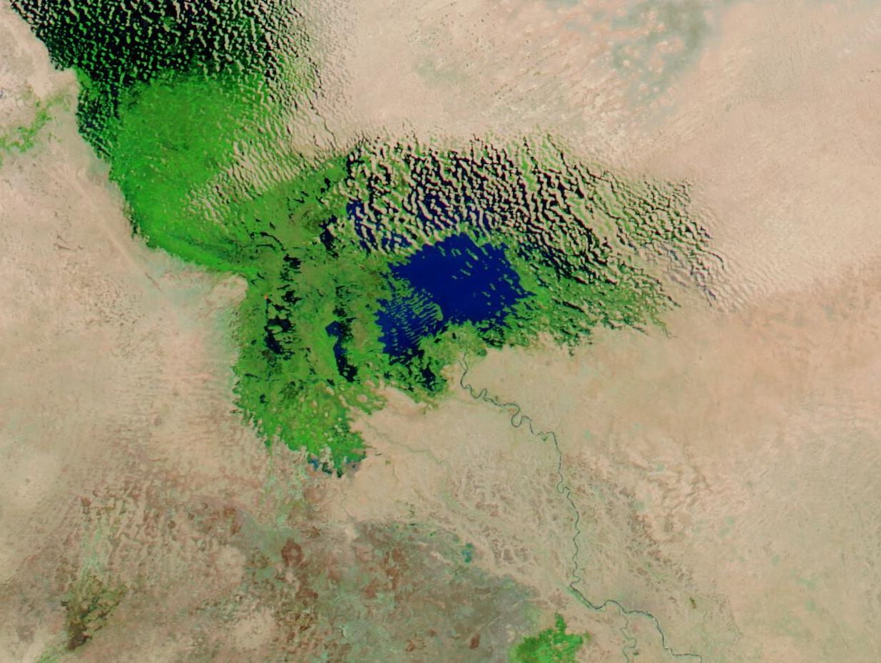
