
Images


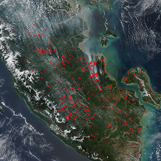
September 1, 2015 - Fires in southern Sumatra
 Tweet
Tweet
Sumatra's burning again and the El Nino event that is occurring this year is partially to blame for the proliferation of the blazes.
El Nino events bring drier weather to Indonesia and with it, a rise in the number of forest fires that break out. Many of the wildfires occur on land that has deep reserves of peat, which is rich in carbon. These fires produce huge plumes of dark smoke, insidious carbon dioxide, and other greenhouse emissions that contribute to the current climate change crisis.
Sumatra, Indonesia might seem a world away but the smoke from the fires there tends to travel along the jetstreams, carrying that smoke and its accompanying degraded air quality across the globe.
Many of the fires on the island are due to farmers clearing their land for agricultural reasons. Such fires can usually be contained, but they tend to outgrow their boundaries and become raging infernos more often during the drier seasons. These types of fires are illegal in Sumatra but are still used by the subsistance farmers as they have for thousands of years.
The Moderate Resolution Imaging Spectroradiometer (MODIS) aboard NASA’s Aqua satellite captured this true-color image on August 19, 2015.
Image Facts
Satellite:
Aqua
Date Acquired: 8/19/2015
Resolutions:
1km (290.1 KB), 500m (1.1 MB), 250m (2.5 MB)
Bands Used: 1,4,3
Image Credit:
Jeff Schmaltz, MODIS Land Rapid Response Team, NASA GSFC
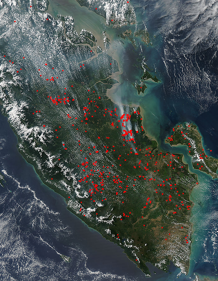
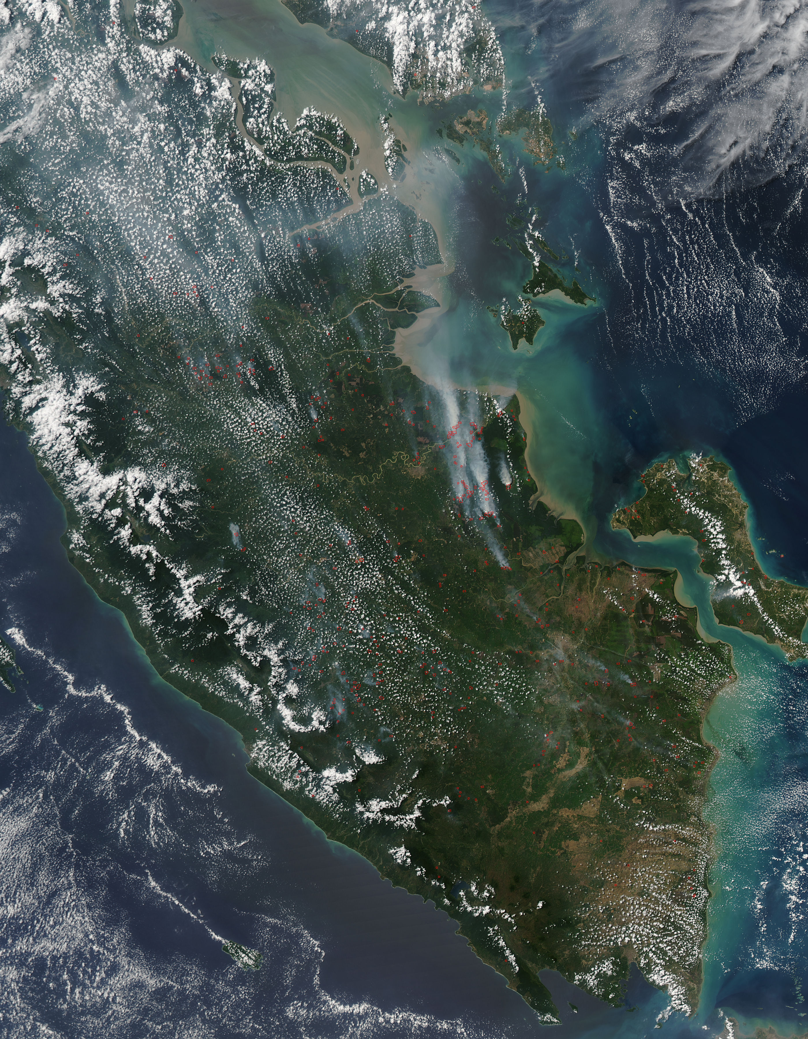
