
Images


June 20, 2020 - Fires in Southwest US
 Tweet
Tweet
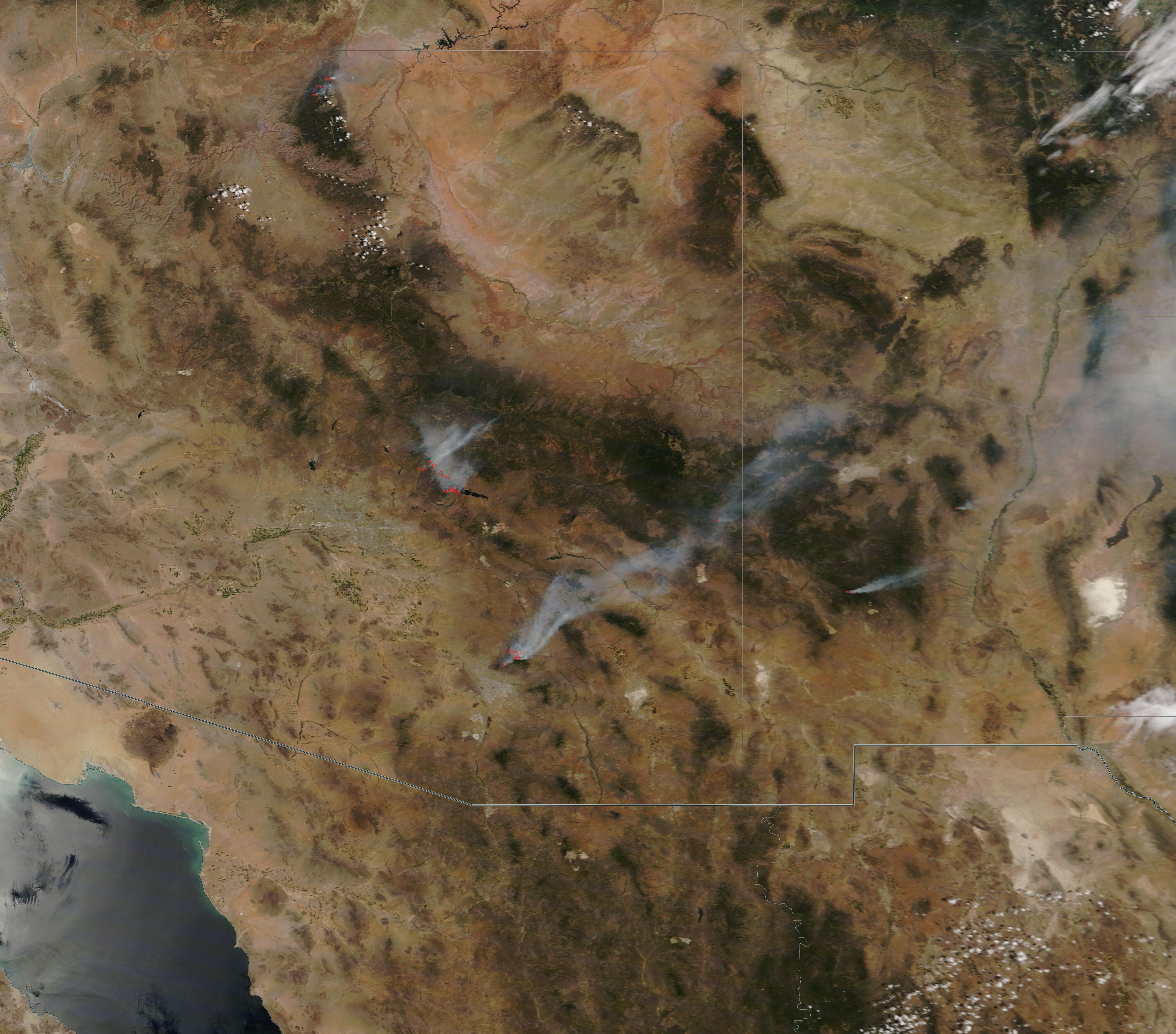
On June 18, 2020, the Moderate Resolution Imaging Spectroradiometer (MODIS) on board NASA’s Terra satellite acquired a true-color image highlighting fire and smoke in Arizona and New Mexico. Fourteen active fires were burning in Arizona and three in New Mexico when the satellite passed overhead.
On June 19, InciWeb Incident Management System identified ten named wildfires in Arizona, with prescribed burns occurring in the northern section of the state near Flagstaff and three named wildfires continued to burn in New Mexico. Three of the active fires detected in Arizona on June 18 appeared to have joined into nearby larger, named fires by the next day.
Arizona claimed the largest fires, which were the Bush Fire, the Sawtooth Fire, and the Bighorn Fire. The massive Bush Fire had consumed more than 151,000 acres, ranking it as the fifth-largest fire in the state’s history. This is an equivalent to 236 square miles, or roughly the size of the city of Chicago, Illinois. Started from a vehicle fire in the Tonto National Forest on June 14, the Bush Fire has experience rapid spread enhanced by hot, dry weather, low humidity, and erratic, strong gusty winds. As of June 19, it was reported as only 7 percent contained.
The Sawtooth Fire sits to the south and slightly east of the Bush Fire. It ignited in the Superstition Mountains on May 30 due to lightning strike. By June 19 it had burned 24,729 acres of forest, bush and grass and had been fully contained. Mop-up operations will continue until the fires is fully suppressed.
Further south, the Bighorn Fire continues to burn in the Catalina Mountains northwest of Tucson, Arizona. A lightning strike in the Pusch Ridge Wilderness, Catalina Mountains, started the blaze on June 5. The terrain is steep and rugged, and the canyons help created strong, gusty wind corridors, all that combine to make firefighting a challenge. By June 19 the Bighorn Fire was moving towards some communities, forcing evacuations as well as closure of the Coronado National Forest. The fire has been 21 percent contained.
Image Facts
Satellite:
Terra
Date Acquired: 6/18/2020
Resolutions:
1km (125.8 KB), 500m (419.3 KB), 250m (1.3 MB)
Bands Used: 1,4,3
Image Credit:
MODIS Land Rapid Response Team, NASA GSFC
