Images
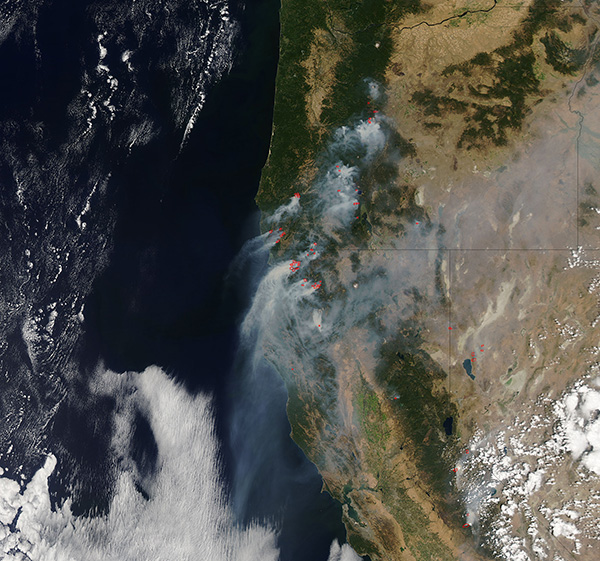
September 3, 2017 - Fires and smoke in the Pacific Northwest
Tweet
The Pacific Northwest enjoyed a rainy, cool spring in 2017, but summertime has proven so warm and dry that conditions have become ripe for wildfires. An outbreak of wildfires along with hot, dry conditions prompted the governor of Oregon declared a state of emergency regarding in early August. On September 2, Inciweb Incident Information System reported more than 20 active fires burning in Oregon, 10 in Washington, and 38 in California.
The Moderate Resolution Imaging Spectroradiometer (MODIS) aboard NASA’s Aqua satellite acquired a true-color image of fires and smoke in the Pacific Northwest on August 31. The image is centered on Oregon, where about a dozen red hotspots and billowing smoke can be viewed. Northern California has a similar amount of fires and smoke. Smoke plumes from these fires blows to the southwest over the Pacific Ocean and a finer veil of smoke blows inland, covering parts of Nevada, eastern Oregon and Idaho.
Image Facts
Satellite:
Aqua
Date Acquired: 8/31/2017
Resolutions:
1km (439.3 KB), 500m (1.5 MB), 250m (3.8 MB)
Bands Used: 1,4,3
Image Credit:
Jeff Schmaltz, MODIS Land Rapid Response Team, NASA GSFC


