
Images


January 30, 2018 - Snow across southeast Europe
 Tweet
Tweet
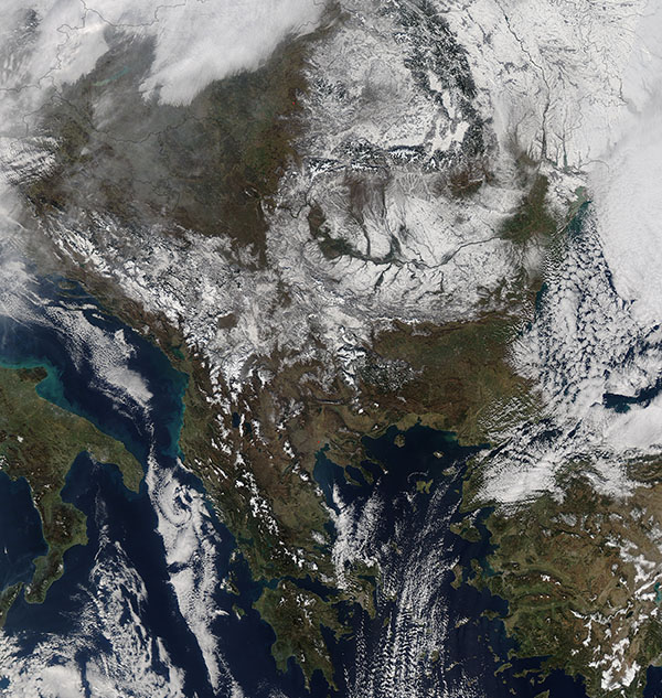
As much of northern Europe experienced a January “warm wave”, including record high temperatures in parts of Germany and flooding in France, southeastern Europe was digging out from a significant winter snowstorm. The Moderate Resolution Imaging Spectroradiometer (MODIS) aboard NASA’s Aqua satellite acquired a true-color image of the region on January 26, 2018. A thick blanket of snow stretched from the Adriatic Sea eastward as far as the Ukraine while, to the west, Italy remained snow free.
According to Weather Underground, Eurasia experienced record warmth on the west side and periods of brutal cold on the east side throughout January, 2018. The article, published on January 27, states: “The culprits for these dual patterns are strong, recurrent upper-level ridges over the far North Pacific and North Atlantic. These have been pushing warm air into western North America and Europe and guiding cold fronts into eastern North America and eastern Asia. They’re also feeding into a lively scientific debate on how warming across the Arctic is affecting midlatitude winters”.
Image Facts
Satellite:
Aqua
Date Acquired: 1/26/2018
Resolutions:
1km (734.7 KB), 500m (2.6 MB), 250m (6.7 MB)
Bands Used: 1,4,3
Image Credit:
Jeff Schmaltz, MODIS Land Rapid Response Team, NASA GSFC
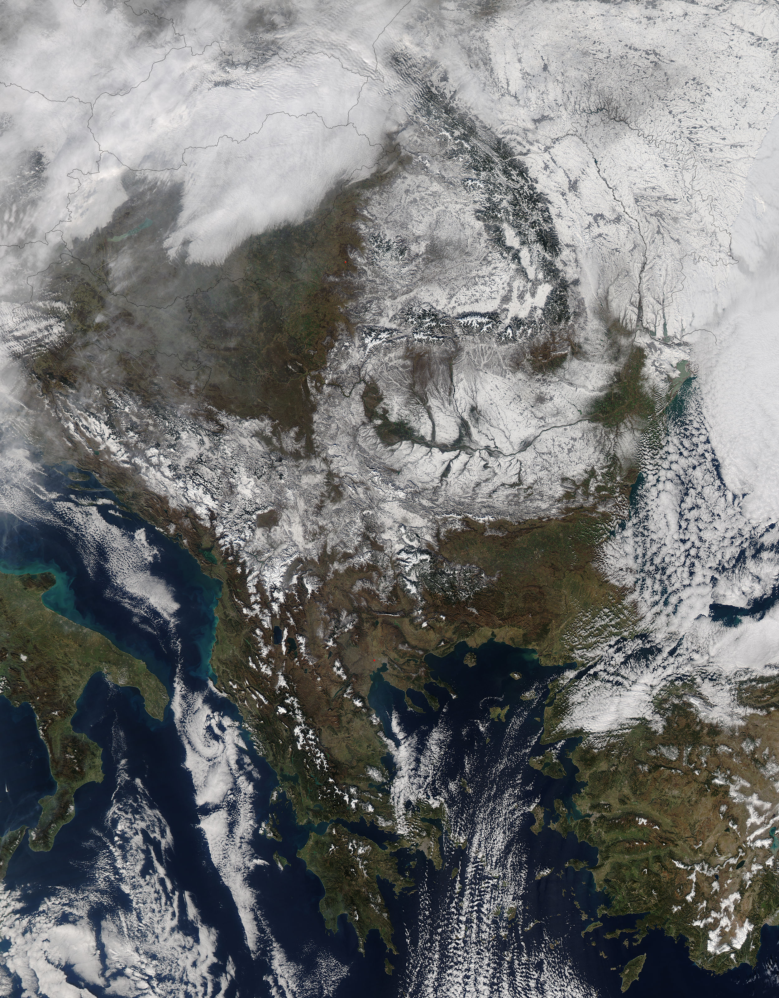
