Images
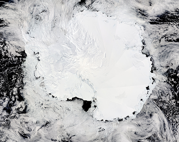
December 6, 2018 - Antarctica Mosaic
Tweet
The fifth-largest continent and the coldest place on Earth, Antarctica wears a cover of ice year-round. The lowest temperature ever recorded in Antarctica was minus 89.4°C (minus 129°F). The center of the continent tends to stay much colder than the coastal regions. The warmest temperature measured 17.5°C (63.5°F) at Esperanza Base on the Antarctic Peninsula in March 2015.
Unlike much of the Earth, Antarctica experiences only two seasons: summer and winter. The six-month winter is marked by darkness while summer’s days are sun-filled. The seasons are a result of the tilt of the Earth’s axis in relation to the sun. As the Earth orbits the sun, different parts of the planet are exposed to direct sunlight. During summer, Antarctica is on the side of Earth tilted toward the sun and is in constant sunlight. In the winter, Antarctica is on the side of Earth tilted away from the sun, causing the continent to be dark.
On December 2, 2018, the Moderate Resolution Imaging Spectroradiometer (MODIS) on board NASA’s Aqua satellite passed over Antarctica, allowing the creation of this stunning true-color image of the continent. This image is a “mosaic”, which means several individual MODIS images were blended together to create a single, larger, image. The ice-covered continent is sparsely covered by cloud, especially in the upper left section, over the Antarctic Peninsula. It is also surrounded by floating sea ice.
Image Facts
Satellite:
Aqua
Date Acquired: 12/2/2018
Resolutions:
1km ( B), 500m ( B), 250m (6 MB)
Bands Used: 1,4,3
Image Credit:
MODIS Land Rapid Response Team, NASA GSFC


