
Images


June 28, 2019 - Grand Erg Occidental and Grand Erg Oriental
 Tweet
Tweet
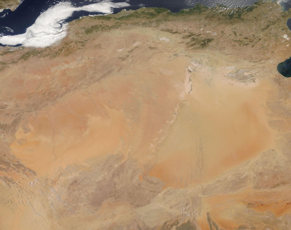
The Sahara Desert covers nearly a third of the African Continent, spanning 3.6 million square miles (9.4 million sq. km) of northern Africa. It is the largest hot desert in the world, and ranks as the third largest desert on Earth following two vast cold deserts—Antarctica and the Arctic. The Sahara contains a variety of geographical features, such as plateaus, plains, and salt flats, but the most iconic features have to be vast seas of sand and dunes which sweep across various sections of the desert.
On June 23, 2019, the Moderate Resolution Imaging Spectroradiometer (MODIS) on board NASA’s Terra satellite acquired a stunning true-color image of two large fields of sand dunes, the Grand Erg Oriental and Grand Erg Occidental. These are located in northwestern Africa, primarily in Algeria.
Large dune fields are known to geologists as “ergs,” the Arabic term for these extensive regions of sand; they are also sometimes called “sand seas”. The eastern erg is known as the Oriental. The western erg, the Occidental, is the smaller of the two. Each contain hundreds of sand dunes formed by prevailing winds. In some areas, large crescent-shaped dunes are mobile, moving as much as 65 to 100 feet in one year.
Image Facts
Satellite:
Terra
Date Acquired: 6/23/2019
Resolutions:
1km (215.1 KB), 500m (728.1 KB), 250m (2.3 MB)
Bands Used: 1,4,3
Image Credit:
MODIS Land Rapid Response Team, NASA GSFC
