
Images


December 9, 2019 - Arabian Peninsula
 Tweet
Tweet
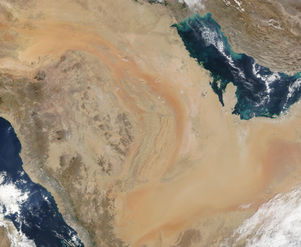
The Moderate Resolution Imaging Spectroradiometer (MODIS) on board NASA's Terra satellite captured a stunning true-color image of the Arabian Peninsula on December 5, 2019.
The Arabian Peninsula has coastlines on the Red Sea (west and southwest), the Gulf of Aden (south), the Arabian Sea (south and southeast), and the Gulf of Oman and the Persian Gulf on the east. While Saudi Arabia occupies the bulk of the Arabian Peninsula, six other countries share part of the land, primarily along the coasts. Starting in the northeast and moving clockwise around the Peninsula they are: Kuwait, Bahrain, Qatar, United Arab Emirates, Oman, and Yemen.
One of the most striking features of this region is the warm orange- and peach-colored sands that fill the sprawling Empty Quarter—or Rub’ al Khali. Roughly the size of France, the Empty Quarter covers an area roughly the size of France on the southern end of the Peninsula. It holds about half as much sand as the entire Sahara Desert, including long fields of linear sand dunes. Much of the land in this region actually lies at an elevation below sea level, but near the Yemen border, dunes can reach an altitude of 1,200 meters (3,900 feet) above sea level.
Image Facts
Satellite:
Terra
Date Acquired: 12/5/2019
Resolutions:
1km (2 MB), 500m (5.4 MB), 250m (10.2 MB)
Bands Used: 1,4,3
Image Credit:
MODIS Land Rapid Response Team, NASA GSFC
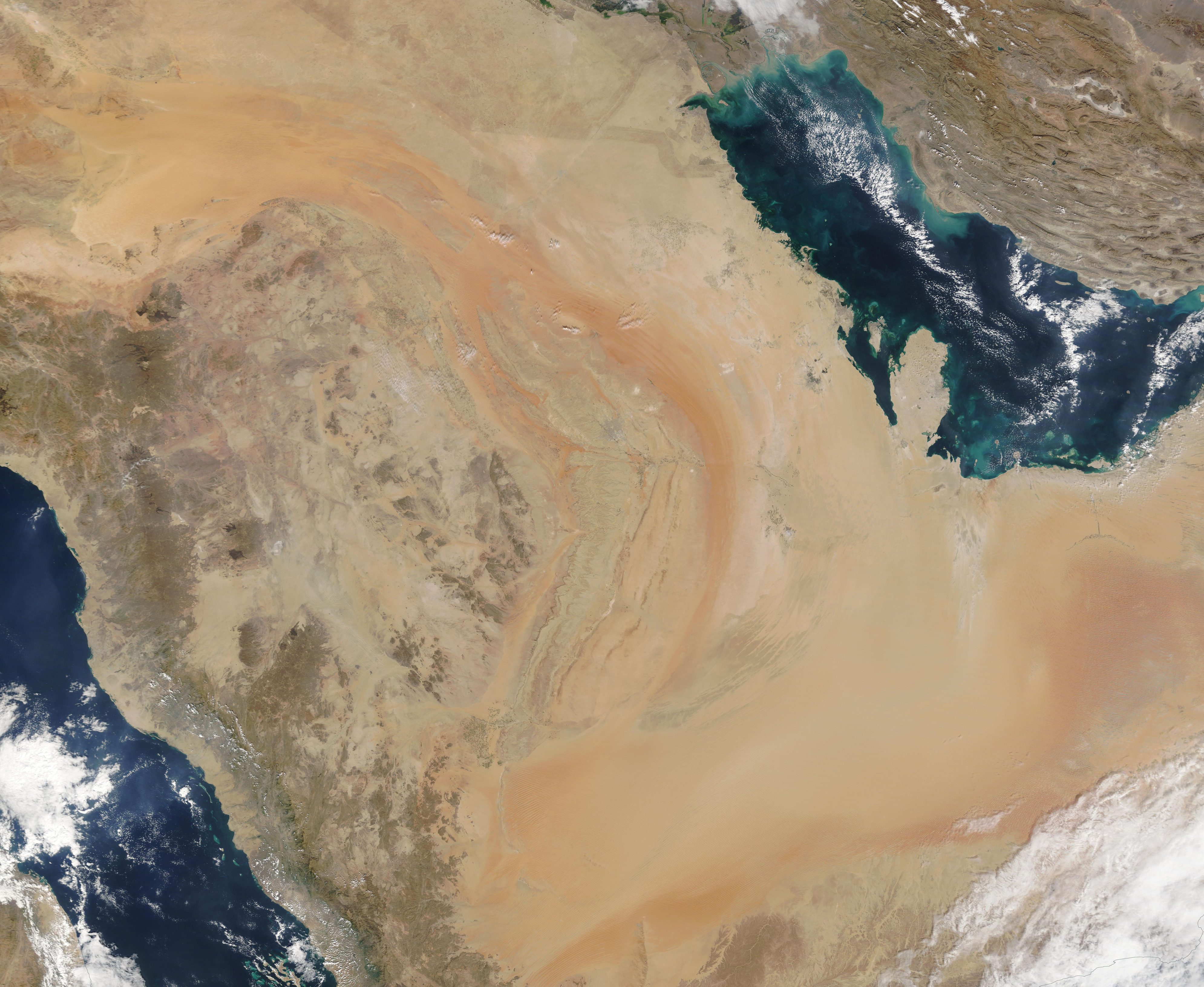
