
Images


January 8, 2020 - Gulf Coast of the United States
 Tweet
Tweet
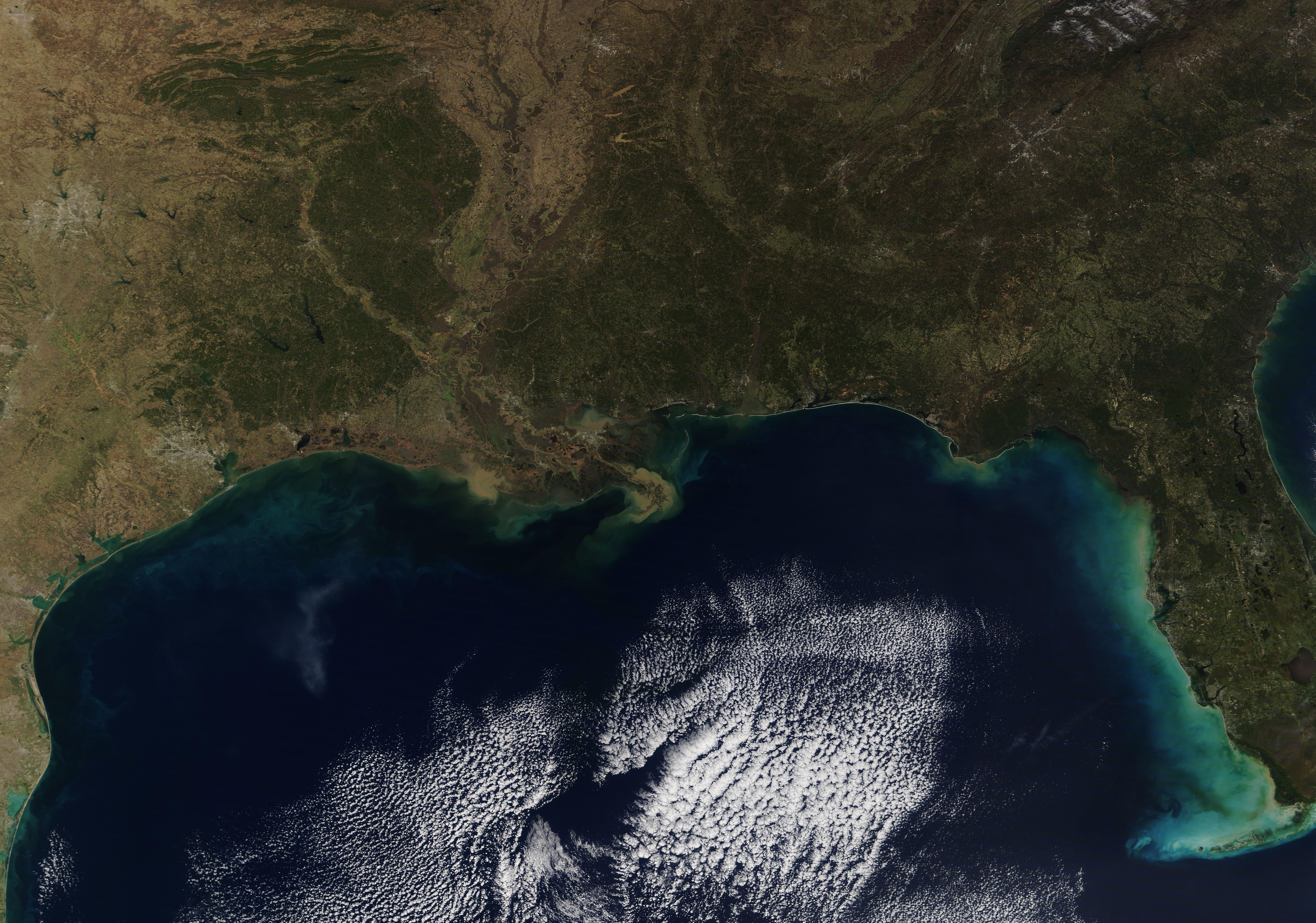
The Gulf Coast of the United States sweeps across about 1,680 miles (2,700 km) of land, spanning five states. From west to east, the amount of coastline found in each state is as follows: Texas, 367 mi (591 km); Louisiana, 397 mi (639 km); Mississippi, 44 mi (71 km); Alabama, 53 mi (82 km); Florida, 770 mi (1239 km). These numbers tell only part of the story, as the tidal shoreline winds into a complicated network of inlets, tidal rivers, bayous, and islands, creating a total length of about 17,141 miles (27,586 km). Louisiana has the largest tidal shoreline of all the states. This complicated, diverse, and rich inshore habitat, plus the subtropical warmth of the waters of the Gulf of Mexico, creates an extremely productive fishery.
The Moderate Resolution Imaging Spectroradiometer (MODIS) on board NASA’s Terra satellite acquired a true-color image of the Gulf Coast of the United States on January 5, 2020.
Image Facts
Satellite:
Terra
Date Acquired: 1/5/2020
Resolutions:
1km (2.1 MB), 500m (5.9 MB), 250m (5.1 MB)
Bands Used: 1,4,3
Image Credit:
MODIS Land Rapid Response Team, NASA GSFC
