
Images


June 28, 2020 - Volga River
 Tweet
Tweet
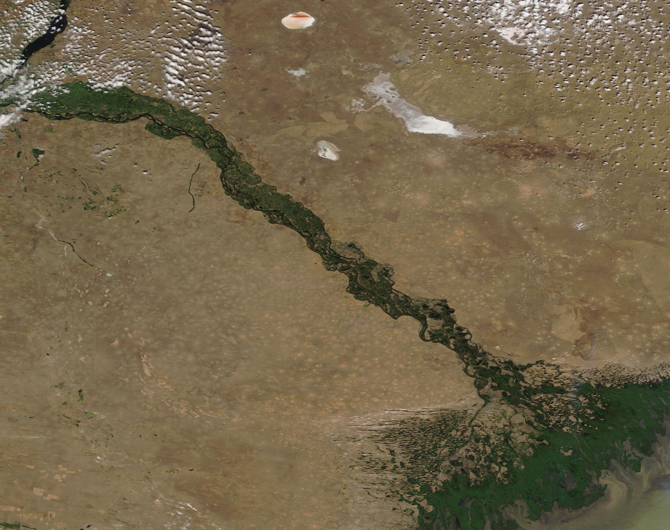
The beautiful braids of the Volga River fan into a broad delta on the northern shore of the Caspian Sea, creating a web of rich wetlands before spilling its water and sediment into the saline waters of the Sea. Rising from a small spring in the Valdai Hills about midway between St. Petersburg and Moscow, Russia, the Volga sweeps towards the southwest, creating a great arc measuring more than 1,671 mi (3690 km) before spilling into the Caspian Sea just south of the Kazakhstan border.
The longest river in Europe, the Volga has enormous economic, cultural, and environmental significance in the region. As the river approaches the Delta, water is carried in more than 500 twisting channels, creating a wetland that supports hundreds of species of birds, fish, and plants. The Volga River delta is one of the most productive regions of the world for fish, particularly caviar-producing sturgeon, 25 percent of which live in the Volga River. Four species of sturgeon live in the Volga River, the Russian sturgeon, starlet, stellate, and the one most famous for caviar – the beluga. Changes in water quality, environment, and dams have caused the population of sturgeon to drop dramatically—by about 90 percent—since 1970.
On June 26, 2020, the Moderate Resolution Spectroradiometer (MODIS) on board NASA’s Terra satellite acquired a true-color image of the Volga River as it approaches the Caspian Sea.
Image Facts
Satellite:
Terra
Date Acquired: 6/26/2020
Resolutions:
1km (95.4 KB), 500m (283.8 KB), 250m (448.6 KB)
Bands Used: 1,4,3
Image Credit:
MODIS Land Rapid Response Team, NASA GSFC
