
Images


April 8, 2021 - Tropical Cyclone Seroja
 Tweet
Tweet
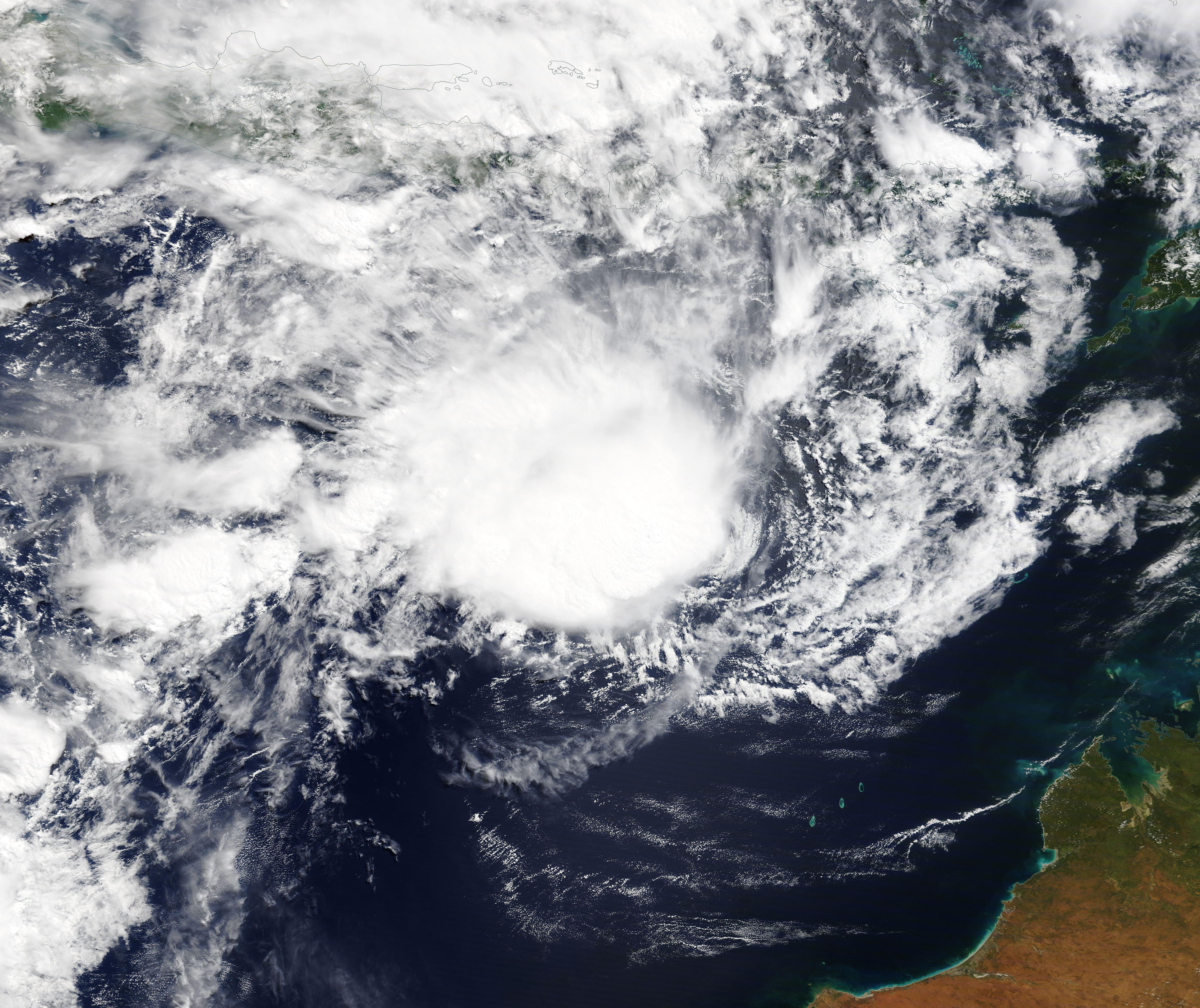
On April 4, 2021, Tropical Cyclone Seroja formed over the Savu Sea in eastern Indonesia, bringing heavy rain, wind, and storm surge to Timor-Leste and southern Indonesia. Although the storm did not carry severe winds at the time, heavy rain triggered landslides and flash flooding which has caused significant damage and death in the region. The United Nations Office for Coordination of Humanitarian Affairs (OCHA) report on ReliefWeb on April 7 that at least 113 people have died and dozens more are missing due to the storm. Twenty-seven deaths were reported in Timor-Leste, where over 10,000 people have been adversely affected by the storm. The presidential palace, in Dili, was characterized in this report as “a mud pit”. Eighty-six people were killed in Indonesia and 71 remain missing and over 2,600 are affected by flash flooding and landslides, with substantial damage to roads, bridges, and households.
At 11:00 p.m. EST on April 7 (0300 UTC April 8), the Joint Typhoon Warning Center (JTWC) stated that Tropical Cyclone Seroja was located 442 miles (711 km) north of Learmonth, Australia and was tracking west-southwestward. Maximum sustained winds registered at 63 mph (101.4 km/h) and the storm appeared to be consolidating with deepening convection noted.
The JTWC expects Tropical Cyclone Seroja to reach peak strength of 127 mph (204 km/h) on April 11. That would place it as a Category 3 storm on the Saffir-Simpson Hurricane Wind Scale. It is predicted to meet strong windshear and cooler sea surface temperatures shortly after that time, forcing a turn towards Australia. The unfavorable conditions should weaken Seroja before it makes landfall in southwestern Australia by April 12. After landfall, Seroja is expected to rapidly weaken.
The Moderate Resolution Imaging Spectroradiometer (MODIS) on board NASA’s Terra satellite acquired a true-color image of Tropical Cyclone Seroja on April 7 as it was spinning northwest of Australia. At that time the storm was beginning to consolidate and strengthen after causing severe damage in Indonesia and Timor-Leste.
Image Facts
Satellite:
Terra
Date Acquired: 4/7/2021
Resolutions:
1km (2.3 MB), 500m (6.4 MB), 250m (4.5 MB)
Bands Used: 1,4,3
Image Credit:
MODIS Land Rapid Response Team, NASA GSFC
