
Images


January 12, 2022 - Tropical Cyclone Cody
 Tweet
Tweet
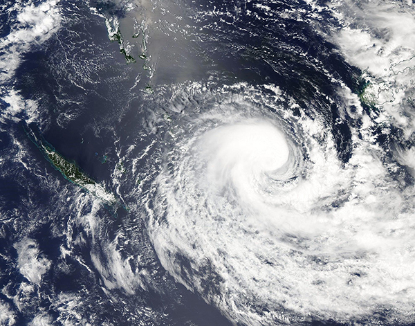
Tropical Cyclone Cody developed from a depression over the Pacific Ocean west of Fiji on January 8, 2022. On January 10, the storm passed through Fiji, causing widespread damage and leaving one person dead. Most of the damage reported was on the western side of Viti Levu, the country’s main island. Widespread flooding has forced about 2,000 people to seek shelter in 110 evacuations shelters activated across Fiji, according to local media reports. Power outages have also been reported.
At 10:00 p.m. EST on January 11, (0300 UTC January 12) the Joint Typhoon Warning Center (JTWC) advised that Tropical Cyclone Cody was located 436 mi (702 km) southwest of Suva, Fiji and was moving southwards at 12 mph (19 km/h). The storm was carrying maximum sustained winds of 58 mph (93 km/h), placing it at tropical storm strength. Cody is expected to maintain strength as it travels towards the southeast before beginning extratropical transition late on January 13. After weakening, the system may bring heavy rain to New Zealand’s North Island.
The Moderate Resolution Imaging Spectroradiometer (MODIS) on board NASA’s Aqua satellite acquired a true-color image of Tropical Cyclone Cody on January 10 as it was near peak strength. The asymmetric storm sports a tight apostrophe shape, with bands of convection winding into the center. Most of the convective bands are south of the center, likely due to wind shear along the northern side of the storm.
Image Facts
Satellite:
Aqua
Date Acquired: 1/11/2022
Resolutions:
1km (594 KB), 500m (1.9 MB), 250m (5.5 MB)
Bands Used: 1,4,3
Image Credit:
MODIS Land Rapid Response Team, NASA GSFC
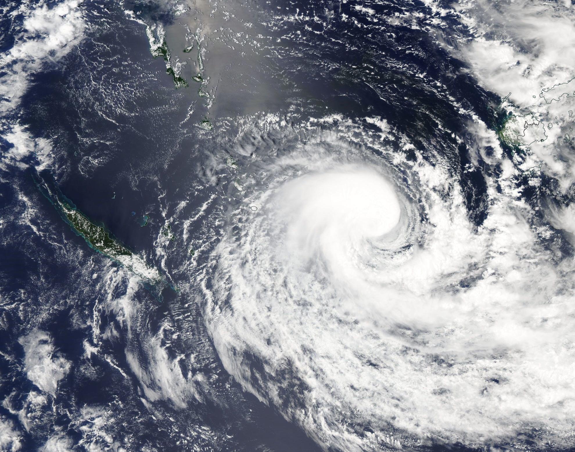
