
Images


September 12, 2022 - Smoke Shrouds the Sawtooth Range and Salmon River Mountains
 Tweet
Tweet
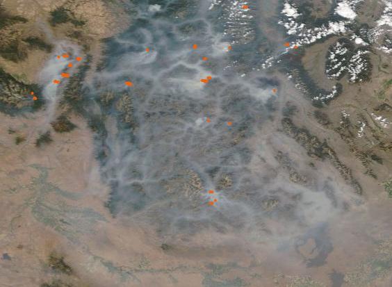
On September 9, 2022, the Moderate Resolution Imaging Spectroradiometer (MODIS) on board NASA’s Terra satellite acquired a true-color image of multiple blazes pouring smoke across Central Idaho.
In this image, each red “hot spot” marks actively burning fires. Smoke pours from several fires at the western edge of the Sawtooth Range and is blown westward by strong winds. In the rest of the Sawtooth Range and in the Salmon River Mountains, smoke seeps into the low-lying valleys, creating a shroud so thick that it obscures the valley floors from view. A thinner pall also lies over the high elevations and stretches southward over Sun Valley and the Craters of the Moon National Monument as well as southwestward over Boise.
The primary sources of the dense, choking smoke likely comes from local Idaho blazes, but many of the other conflagrations burning across the Western United States add to the thick haze. According to the National Interagency Fire Center (NIFC) on September 9, at least 96 large fires were burning on 690,000 acres (2800 square kilometers) in eight states. Many of the fires were clustered in the Northern Rockies, the Great Basin, and the Pacific Northwest, with 37 burning in Idaho, 22 in Montana, 12 apiece in Oregon and Washington, and 10 in California.
When smoke is captured by the wind, it can rise high in the atmosphere and travel long distances, sometimes without creating significant hazard at ground level. When the winds are quiet and smoke drops close to the ground, the particulate matter and gases in the smoke can create health hazards for both humans and animals, as well as dirtying cars, houses, and the landscape. Comments from residents of Idaho, posted on social media, noted the effects. On the US National Weather Service Boise Idaho Facebook Page, one person stated, “I’ve got such a headache from it…there is NO WHERE to get out of it.” Another shared, “Smoke is everywhere I’ve been…My voice is getting raspy.” The statement that seemed to sum up both the smoke and fire season best was a heartfelt lament, “Ugh, it feels like it’s never going to end”.
According to the U.S. Interagency Wildland Fire Air Quality Response Program, air quality on the evening of September 7 in the Salmon area reached an Air Quality Index (AQI) of 385, which is ranked as Hazardous, due to smoke. The highest AQI recorded at the same station on September 9 reached 295, which is ranked as Very Unhealthy. Air quality has improved since that date, but, because the inversion has failed to break and smoke not yet being able to lift, the air quality forecast in the Salmon area is anticipated to be “Unhealthy for Sensitive Groups” over the next several days. The improvement is attributed to the anticipated appearance of gusting winds that should help move smoke away from ground level.
Image Facts
Satellite:
Date Acquired: 9/9/2022
Resolutions:
1km (34.2 KB), 500m (108.7 KB), 250m (312.9 KB)
Bands Used: 1,4,3
Image Credit:
MODIS Land Rapid Response Team, NASA GSFC
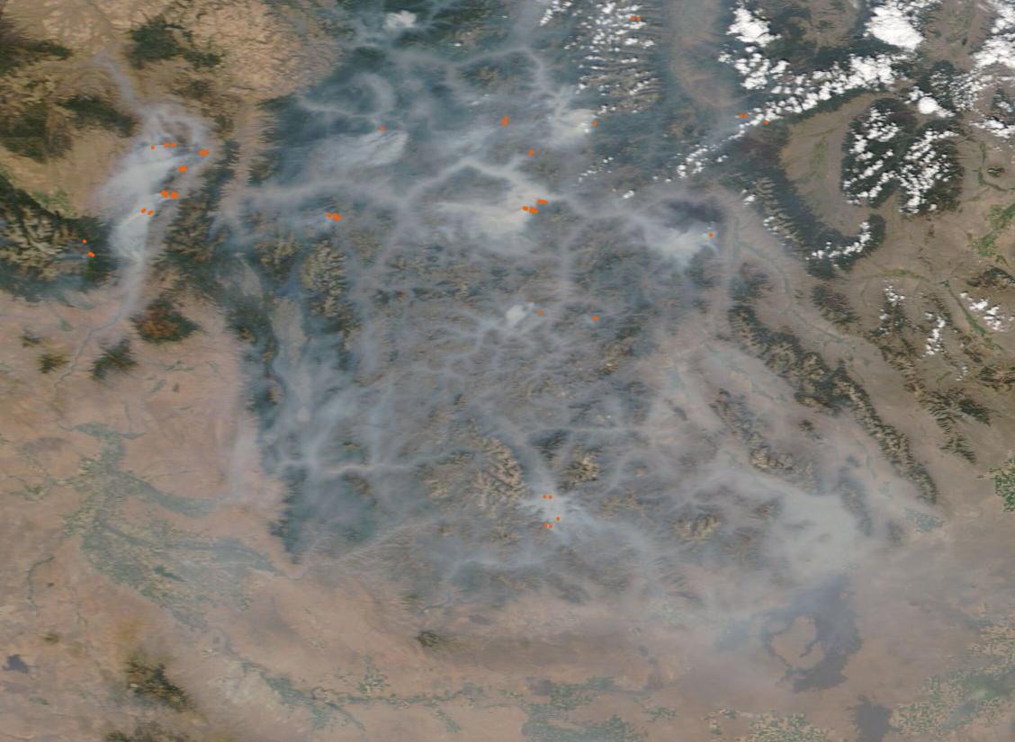
