
Images


September 26, 2022 - Snow and Burn Scars in the Sierra Nevada Mountains
 Tweet
Tweet
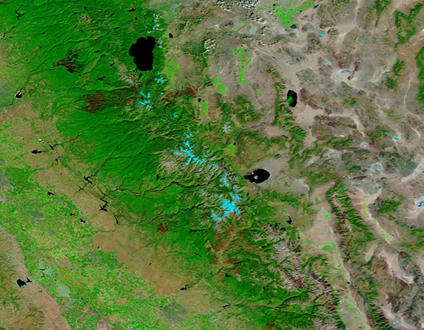
A strong storm system passing through Central California brought early snowfall to the Sierra Nevada Mountains in mid-September 2022. Clouds hung over the region between September 18 and 21, bringing precipitation in the form of rain to the valleys and dropping a light coating of snow across much of the high country.
The Moderate Resolution Imaging Spectroradiometer (MODIS) on board NASA’s Terra satellite acquired a false-color image of a section of the Sierra Nevada Mountains topped with fresh snowfall on September 22. Patches of snow covers the ridges between Lake Tahoe (north) and south of Mono Lake (south). Large burn scars (areas of damage left behind after a fire) are also visible west of Lake Tahoe and smaller burn scars are scattered throughout the mountains.
In this type of false-color image, visible and infrared light (MODIS bands 7,2,1) are combined to help highlight certain features, such as snow or burn scars. Vegetation appears bright green, water looks deep blue, snow and ice appear bright electric blue, cloud may appear white or, if they are cold and contain ice crystals, may carry a tint of bright electric blue, and open land can be colored various shades of tan. Burn scars may vary in color, ranging from brick red to tan to black, depending on completeness and heat of burn, soil conditions, and how long ago the fire occurred.
The two largest burn scars in this image were caused by the Mosquito Fire and the Caldor Fire. The Caldor Fire burned 221,835 acres in the Eldorado National Forest and other portions of the Sierra Nevada in California between August 14, 2021, and October 21, 2021. It heavily damaged the town of Grizzly Flats, in El Dorado County, including destroying about 500 structures in that location. In total, the fire destroyed more than 1,000 buildings and damaged at least 81 more. The massive rectangular burn scar sits southwest of Lake Tahoe.
The Mosquito Fire ignited September 6, 2022, and as of September 25 is still an active fire that is burning east of Foresthill, California, predominantly on the Tahoe and Eldorado National Forest in Placer and El Dorado Counties. Numerous areas and communities were under evacuation orders and warnings until September 21, when all orders were lifted. Cooler weather and precipitation between September 18 and 21 not only dropped snow in the high country, but also helped firefighting efforts, at least temporarily. As of September 25, the Mosquito Fire has burned 76,781 acres. The funnel-shaped burn scar sits in green forests northwest of Lake Tahoe.
Image Facts
Satellite:
Terra
Date Acquired: 9/22/2022
Resolutions:
1km (238.4 KB), 500m (607.9 KB), 250m (343.2 KB)
Bands Used: 7,2,1
Image Credit:
MODIS Land Rapid Response Team, NASA GSFC
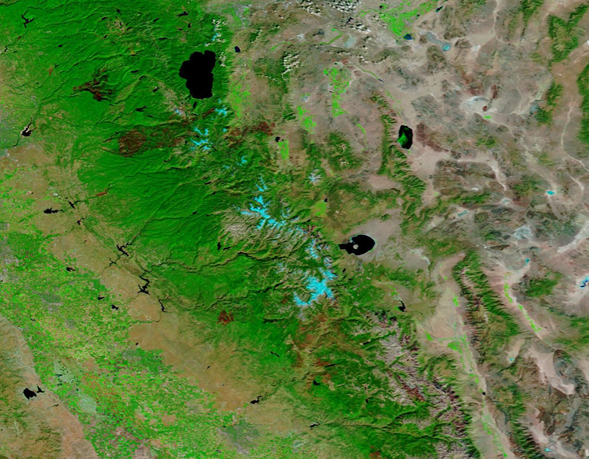
