
Images


December 30, 2016 - Strait of Gibraltar
 Tweet
Tweet
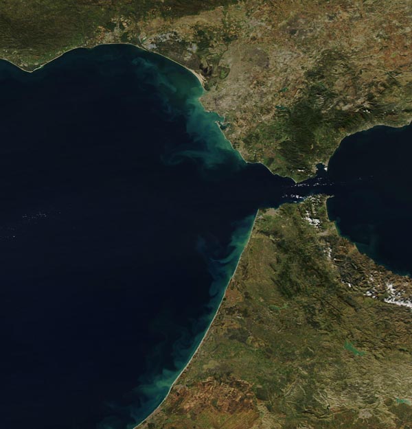
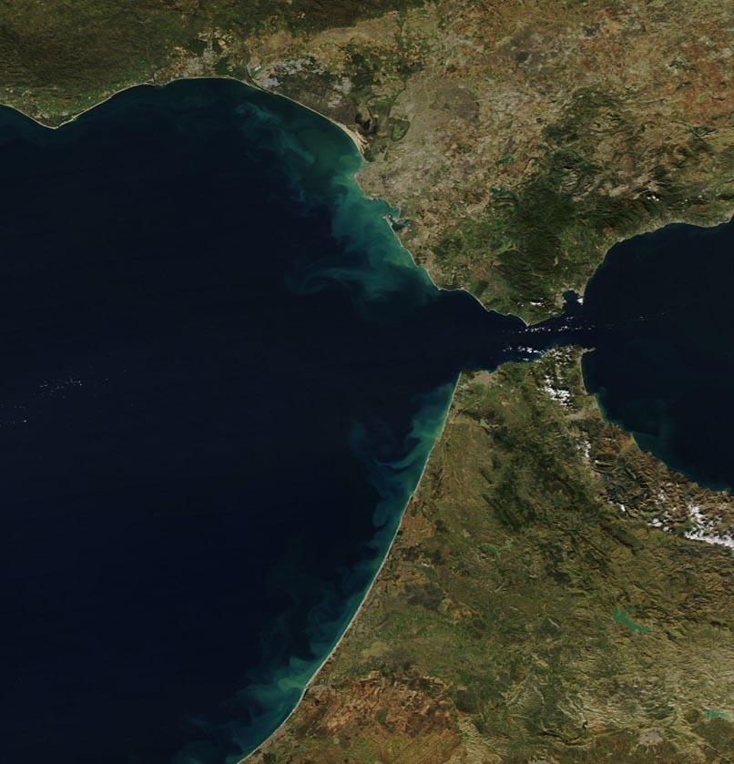
The Strait of Gibraltar is a narrow waterway which separates Spain from Morocco, Europe from Africa, and which exchanges water between the Atlantic Ocean and the Mediterranean Sea. The narrowest point is only 7.7 nautical miles (14.3 km, 8.9 mi) wide, while the waters are about 980 (2,950 feet) deep.
On December 23, 2016, the Moderate Resolution Imaging Spectroradiometer (MODIS) aboard NASA’s Aqua satellite captured this true-color image of the Strait of Gibraltar. Spain sits in the north, Morocco in the south, the Atlantic Ocean in the west and the Mediterranean Sea in the east. Sediment discolors the waters of the Atlantic off the coastlines of both continents. Gray pixels mark the locations of human habitation, most notable are Tangiers, on the western tip of the Strait in Morocco and the group of cities surrounding the Bay of Gibraltar on the east of the Spanish side of the Strait.
Image Facts
Satellite:
Aqua
Date Acquired: 12/23/2016
Resolutions:
1km (44.5 KB), 500m (118.1 KB), 250m (282.8 KB)
Bands Used: 1,4,3
Image Credit:
Jeff Schmaltz, MODIS Land Rapid Response Team, NASA GSFC
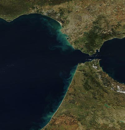
