
Images


July 27, 2018 - Palk Strait
 Tweet
Tweet
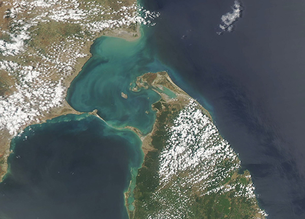
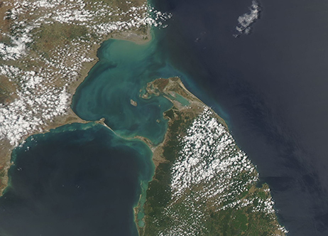
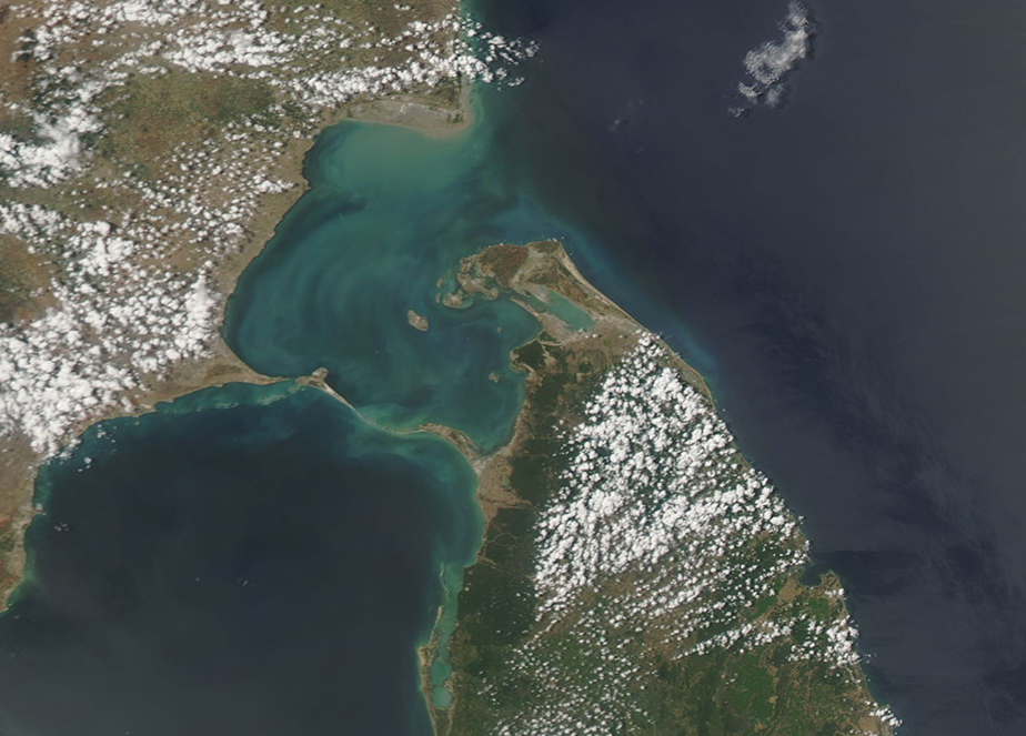
The waters of the Palk Strait separate Sri Lanka from the tip of India. At the narrowest point, the Palk Strait measures about 33 miles (53 km) wide.
A chain of islands and coral reef stretches across the southern end of the strait. Most often called Adam’s Bridge, this feature is also called “the Bridge of Rama’. Sacred to the Hindu religion, the bridge was said to be built by Lord Rama, who visited many towns in the region. The shoals are primarily limestone and the waters in this location are quite shallow – some data suggests the “bridge” may be the remnants of a true land bridge that once stretched between India and Sri Lanka.
On July 23, 2018, NASA’s Aqua satellite passed over the Palk Strait, allowing the Moderate Resolution Imaging Spectroradiometer (MODIS) flying aboard to acquire a true-color image of the region.
Swirls of greens, milky-blue, and tan float in the waters of the Palk Strait. These colors are likely created by a combination of sediment, which flows into the Strait from large rivers several rivers, and phytoplankton. Phytoplankton are microscopic plant-like organisms that frequently flourish in these waters and – in very large numbers – can be easily seen from space.
Image Facts
Satellite:
Aqua
Date Acquired: 7/23/2018
Resolutions:
1km (130.8 KB), 500m (304.8 KB), 250m (222.6 KB)
Bands Used: 1,4,3
Image Credit:
Jeff Schmaltz, MODIS Land Rapid Response Team, NASA GSFC
