
Images


September 5, 2018 - Tropical Storm Gordon
 Tweet
Tweet
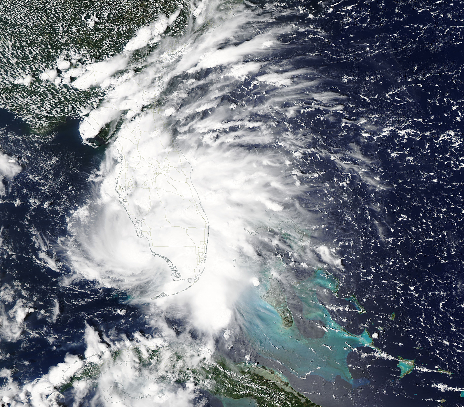
On the evening of September 2, 2018, a tropical wave off of southern Florida triggered the National Hurricane Center (NHC) to issue an advisory regarding “potential tropical cyclone Seven”.
At 8:30 a.m. EDT on September 3, the wave had organized and picked up strength, causing NHC to name it Tropical Storm Gordon. The center of the cyclone passed over Key Largo between 7:00 a.m. and 8:00 a.m. EDT on that same day, producing a west wind in Islamorada and also at an observing site in Florida Bay. The wind speed at that time was recorded at about 40 mph (64.4 km/h).
After dropping heavy rain across southern Florida, Tropical Storm Gordon travelled into the Gulf of Mexico, taking aim on the north-central Gulf Coast, including parts of Louisiana, Alabama, Mississippi and Florida. At 5:00 p.m. EDT, the NHC reported that the maximum sustained winds of Gordon had increased to an average of 69 mph (111 km/h), with some gusts measured at 92 mph (148 km/h).
The storm is expected to make landfall on or near the Mississippi coastline around 11:00 p.m. EDT, possibly as Hurricane Gordon with winds likely near or over 74 mph (119 km/h) – which is a weak Category 1 storm on the Saffir-Simpson Hurricane Wind Scale. According to the NHC, steering currents are expected to weaken, causing Gordon to slow down after landfall, increasing rainfall totals along the Gulf Coast. Gordon’s winds should weaken rapidly, and by September 7, a mid- to upper-level trough and cold front are forecast to cause a break in the subtropical ridge, allowing Gordon to turn northward and then move more rapidly northeastward by September 8, then merge with a cold front the following day.
According to the NHC, “Gordon is expected to bring life-threatening storm surge and hurricane conditions to portions of the central Gulf Coast, where a Storm Surge Warning and Hurricane Warning are in effect. The highest storm surge is expected along the coast of Mississippi and Alabama from the mouth of the Pearl River to Dauphin Island … tropical storm conditions and storm surge will also affect portions of the western Florida Panhandle.” Heavy rainfall is expected to affect the western Florida Panhandle, southwest Alabama, southern and central Mississippi, northeastern Louisiana, and southern Arkansas, where totals could reach as high as 12 inches. Such rainfall may cause flash flooding in some areas.
On September 3, 2018, the Moderate Resolution Imaging Spectroradiometer (MODIS) on board NASA’s Aqua acquired a true-color image of Tropical Storm Gordon soaking southern Florida. The center of the storm appears to be located just off the western coast of the state, but heavy cloud – which was dumping heavy rain – covered almost all of the southern half of the state.
Image Facts
Satellite:
Aqua
Date Acquired: 9/3/2018
Resolutions:
1km (2 MB), 500m (5.7 MB), 250m (4.9 MB)
Bands Used: 1,4,3
Image Credit:
MODIS Land Rapid Response Team, NASA GSFC
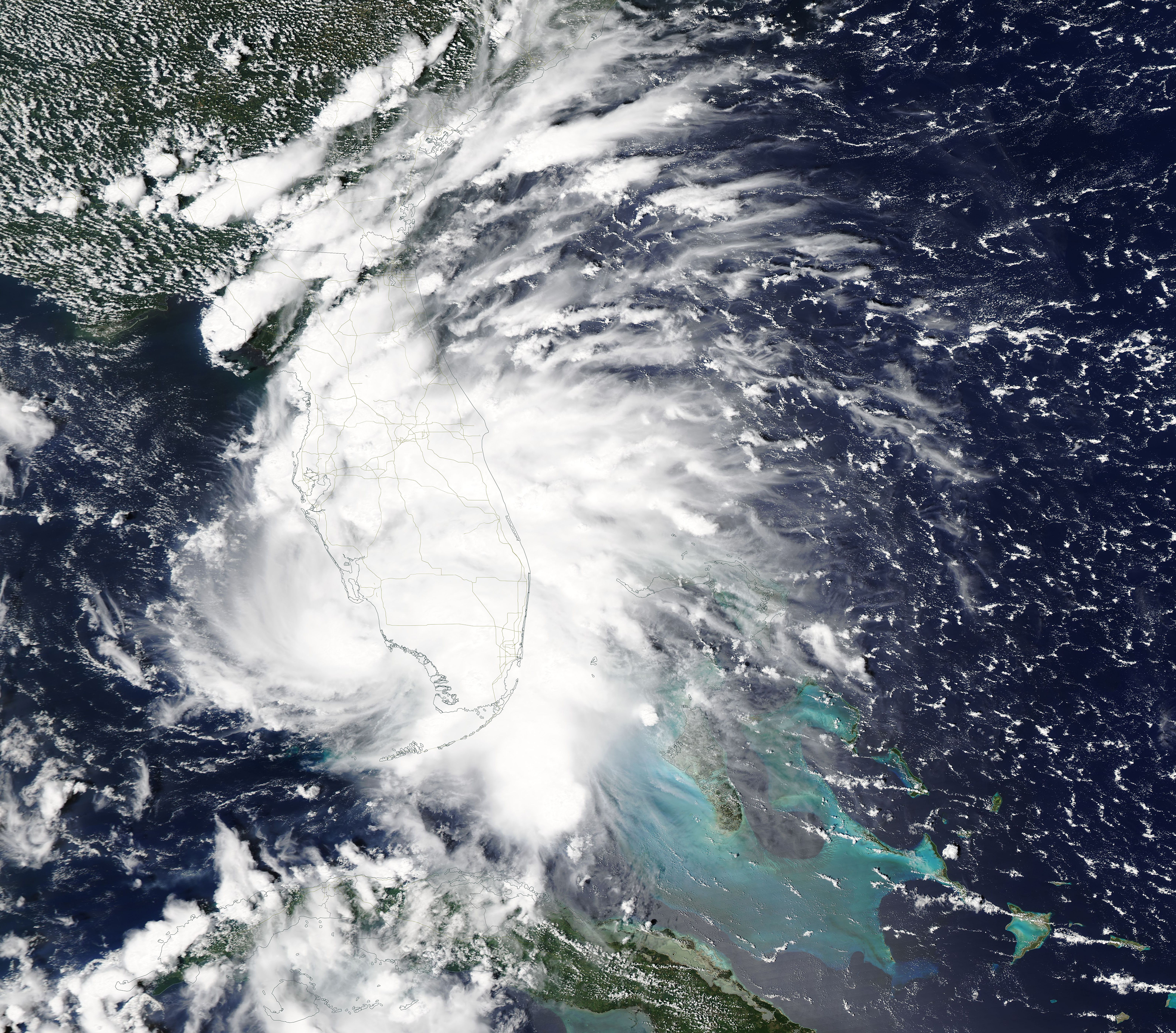
