
Images


October 26, 2019 - Rare Storm over Mediterranean Sea
 Tweet
Tweet
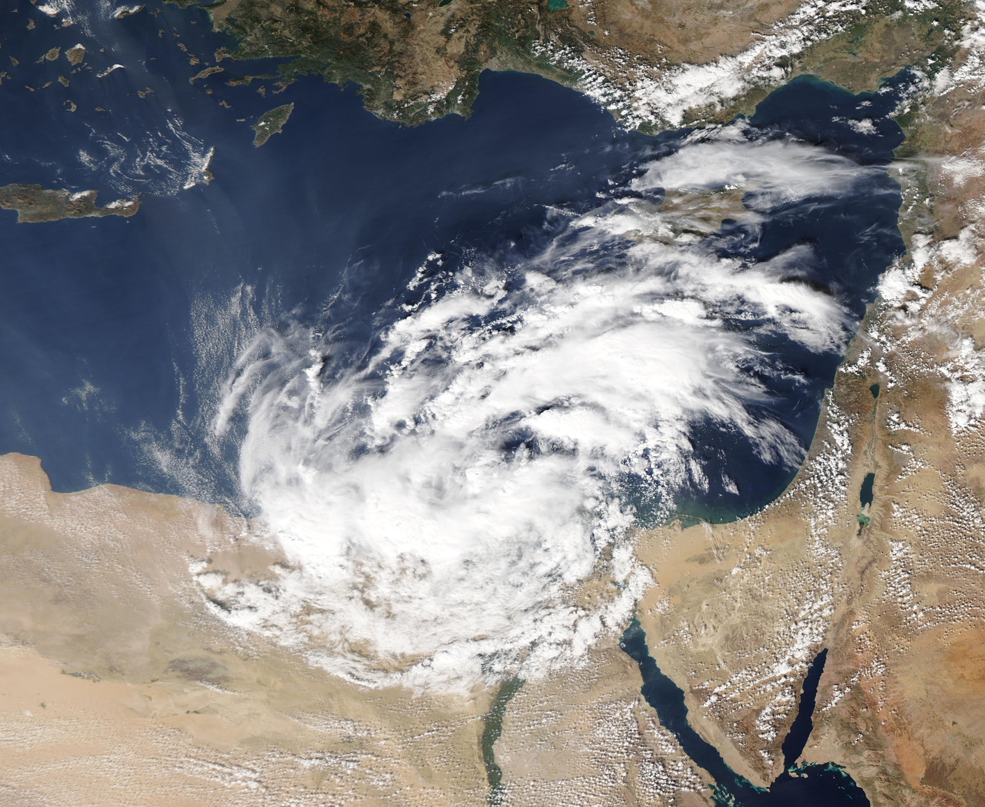
An area of low pressured developed over the Mediterranean Sea in late October, 2019, forming an unusual type of storm often called a “medicane”. The storm threatens to bring rough seas, tropical-storm strength winds, and potentially up to 200 mm (8 inches) of rain to the region. Such rainfall could measure as much as 10 times the average monthly of October across the Sinai Peninsula, Palestinian territories, and parts of Israel and Egypt, creating a risk of flooding.
Although descriptive of a Mediterranean storm with characteristics of a hurricane, the term “medicane” is not an officially-defined meteorological term. The UK Met Office says the term “is often used to describe a deep area of low pressure which forms in the Mediterranean Sea and acquires characteristics of a tropical cyclone and sometimes has the appearance of a hurricane. Tropical cyclones are distinct from low pressure areas which form at higher latitudes in that: they derive their energy from the warm ocean surface; do not have warm and cold fronts associated with them; and have their strongest winds and most intense storm activity close to their centre.”
Such storms are unusual this far east in the basin, but the driving force seems to be the exceptionally warm water temperatures at this location, which are reported to be 2-4°F warmer than normal for this time of year.
The Moderate Resolution Imaging Spectroradiometer (MODIS) on board NASA’s Aqua satellite acquired a true-color image of the storm spinning in the eastern Mediterranean Sea on October 25, 2019. The center hugs the coastline west of Port Said, Egypt. Rain bands reach south of Cairo and north over Cyprus.
Image Facts
Satellite:
Aqua
Date Acquired: 10/25/2019
Resolutions:
1km (1.3 MB), 500m (3.5 MB), 250m (6.8 MB)
Bands Used: 1,4,3
Image Credit:
MODIS Land Rapid Response Team, NASA GSFC
