
Images


July 7, 2020 - Tropical Storm Edouard
 Tweet
Tweet
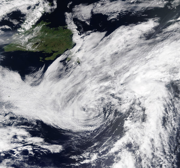
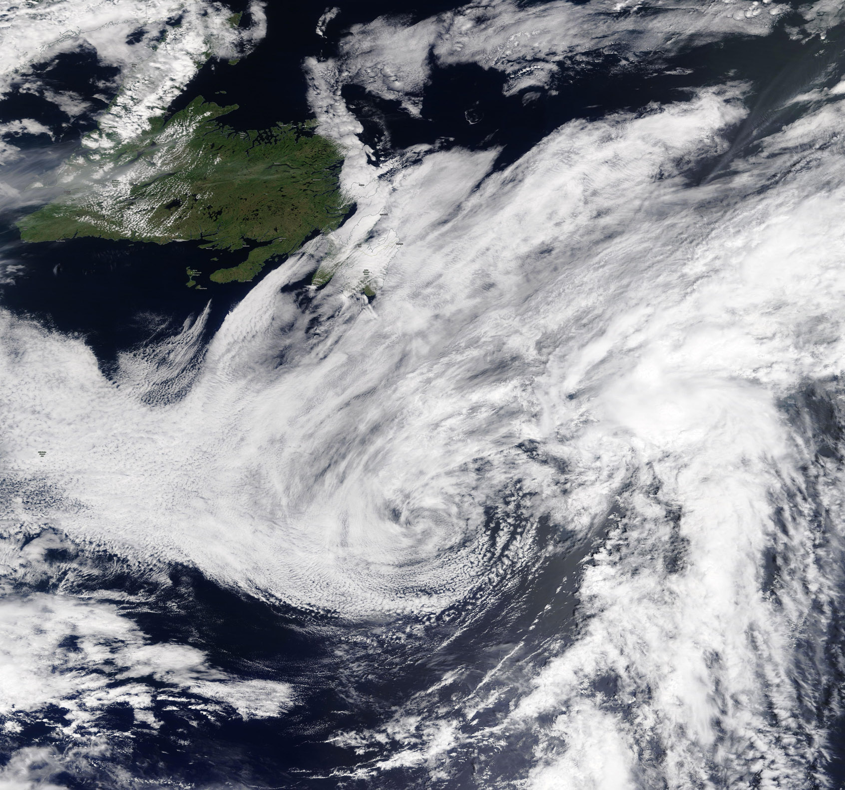
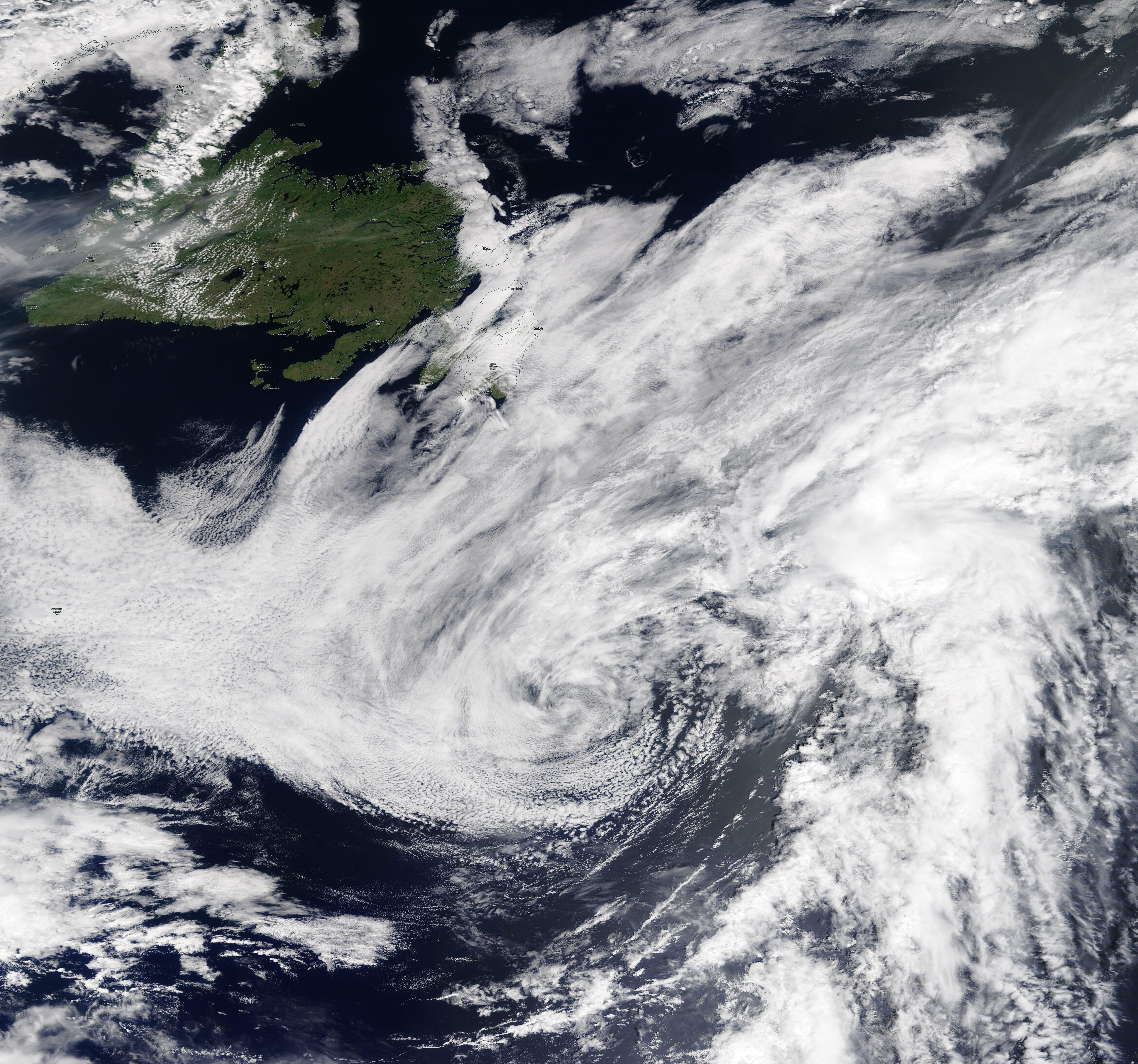
On July 5, 2020, the Moderate Resolution Imaging Spectroradiometer (MODIS) on board NASA’s Terra satellite acquired a true-color image of a short-lived record-breaking tropical storm traveling over the Atlantic Ocean on its way to the United Kingdom.
Tropical Storm Edouard formed from a depression located just off the Bahamas on July 5, carrying maximum sustained winds of 40 mph (65 km/h). This was the earliest formation of the fifth-named storm on record for the Atlantic Hurricane System. The previous record holder was Tropical Storm Emily, which formed on July 12, 2005.
At 5 a.m. EDT (0900 UTC) on July 6, the center of Tropical Storm Edouard was located near latitude 39.0 degrees north and longitude 53.6 degrees west. It was centered about 530 miles (855 km) south of Cape Race, Newfoundland, Canada. Maximum sustained winds were near 40 mph (65 km/h) with higher gusts. The estimated minimum central pressure was 1008 millibars.
Twelve hours later - and roughly 24 hours after formation - the storm had become extra-tropical, and the remnants of Edouard were 445 miles southeast of Newfoundland, Canada. Maximum sustained winds had peaked at 45 mph After forming late Sunday, the storm topped out with winds at 45 mph, the National Hurricane Center said. The storm’s remnants are forecast to continue tracking towards the United Kingdom, bringing gusty winds and rainy weather later in the week.
Image Facts
Satellite:
Terra
Date Acquired: 7/5/2020
Resolutions:
1km (691.2 KB), 500m (2.1 MB), 250m (4.3 MB)
Bands Used: 1,4,3
Image Credit:
MODIS Land Rapid Response Team, NASA GSFC
