
Images


October 15, 2022 - Sediment in the Strait of Tartary
 Tweet
Tweet
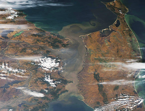
Gusty wind and scattered rain showers across Russia’s Far East contributed to a heavy sediment load in the Strait of Tartary in mid-October 2022. The Moderate Resolution Imaging Spectroradiometer (MODIS) on board NASA’s Aqua satellite acquired this true-color image of the still-windy scene on October 14.
The narrow Strait of Tartary (also known as Tartar Strait) lies between the Russian mainland (west) and Sakhalin Island (east). At its narrowest point, the Strait measures only 4.5 miles (7 km) in width, but widens as it meets both the Sea of Okhotsk, in the north, and the Sea of Japan (East Sea), in the south.
This important waterway has enough depth to allow commercial vessel traffic, dipping to nearly 210 meters (690 feet) maximum depth, but the water depth is shallow in most of the Strait. Both blowing winds and moving tides can stir up sediment from the bottom. In addition, the Earth’s tenth-longest river, the Amur River, pours into the Strait. As the Amur travels across Mongolia, China, and Russia, it collects substantial sediment, which ultimately ends up in the Strait of Tartary.
Satellite imagery shows heavy cloud covering Russia’s Far East, including the Strait of Tartary, between October 10-12. As the clouds cleared, increased loads of sediment became visible in the Strait. Heavy sediment is notably heavy on October 14, as this image reveals. At that time, strong wind was blowing gray-tinted smoke or dust into long east-to-west-oriented plumes.
Image Facts
Satellite:
Terra
Date Acquired: 10/14/2022
Resolutions:
1km (196.2 KB), 500m (475 KB), 250m (218.4 KB)
Bands Used: 1,4,3
Image Credit:
MODIS Land Rapid Response Team, NASA GSFC
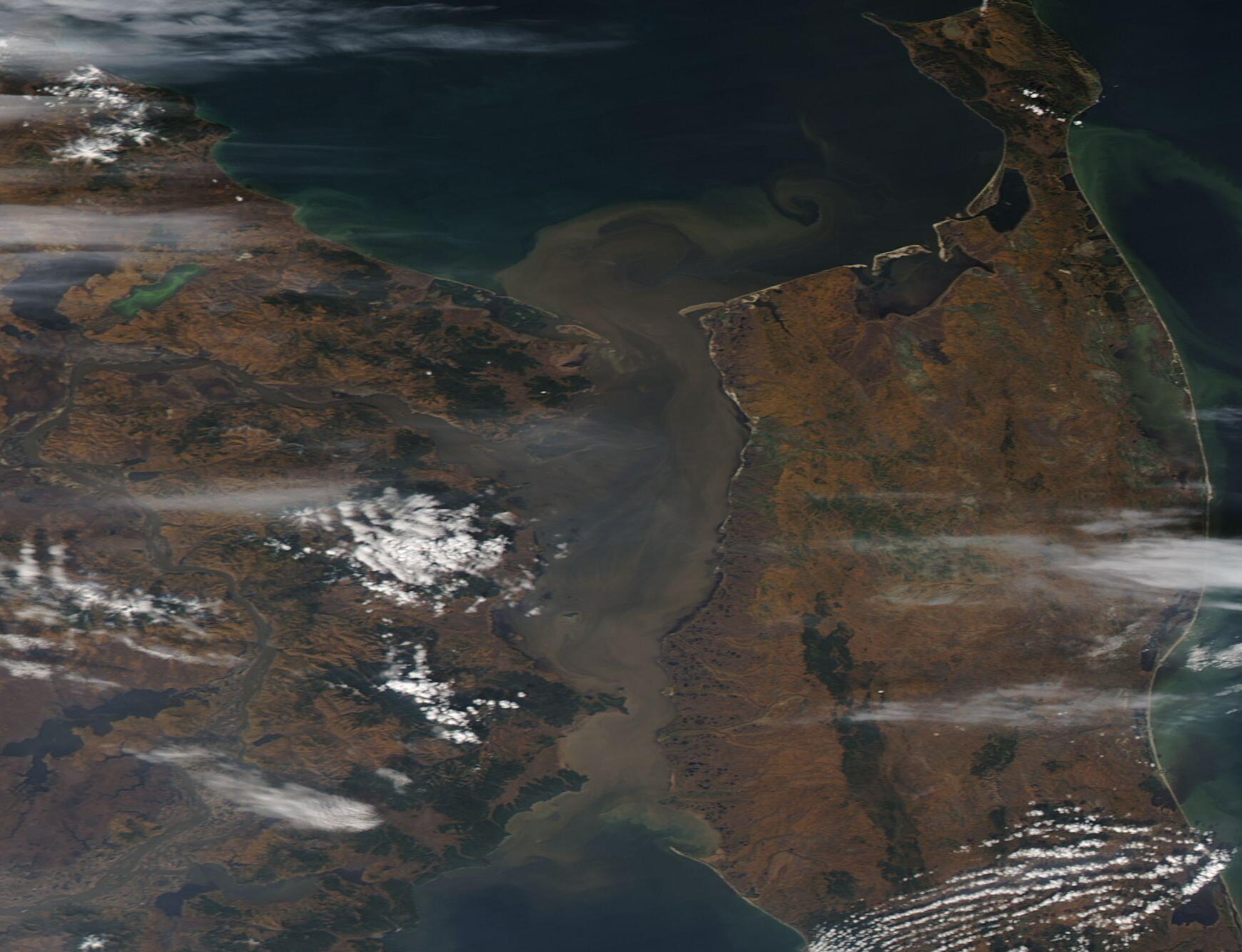
