Images
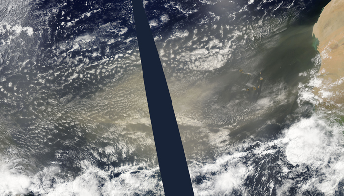
June 30, 2015 - Saharan dust over the Atlantic Ocean
Tweet
A river of dust flowed across the Atlantic Ocean towards the Americas in mid-June, 2015. The Moderate Resolution Imaging Spectroradiometer (MODIS) aboard NASA’s Aqua satellite captured this true-color image on June 16 as the dust neared the half-way point between West Africa and the United States.
The dust storm began about June 14, when a storm system off of the west coast of Africa kicked up a heavy stream of dust from Senegal, Western Sahara and Mauritania. The Weather Channel reported on June 22 that the Saharan dust had traveled more than 5,000 miles to reach southern Texas, where it contributed to moderately poor air quality.
Saharan dust has a range of impacts on ecosystems downwind. Each year, dust events like the one pictured here deliver about 40 million tons of dust from the Sahara to the Amazon River Basin. The minerals in the dust replenish nutrients in rainforest soils, which are continually depleted by drenching, tropical rains. Research focused on peat soils in the Everglades show that African dust has been arriving regularly in South Florida for thousands of years as well.
Image Facts
Satellite:
Aqua
Date Acquired: 6/16/2015
Resolutions:
1km (2.6 MB), 500m (8.8 MB), 250m ( B)
Bands Used: 1,4,3
Image Credit:
Jeff Schmaltz, MODIS Land Rapid Response Team, NASA GSFC


