Images
February 14, 2020 - Dust Storms over Lake Chad
Tweet
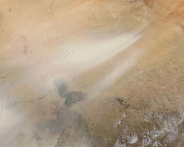
Heavy streams of pale dust blew across Lake Chad in early February 2020. The Moderate Resolution Imaging Spectroradiometer (MODIS) on board NASA’s Aqua satellite acquired a true-color image of the sandy scene on February 10.
Lake Chad, seen as the bi-lobed green-tinged area in the south, sits within the African Sahel, a semiarid strip of land dividing the Sahara Desert from the humid savannas of equatorial Africa. The Bodele depression, a source of frequent dust storms, sits to the northwest of Lake Chad. As recently as the 1960s, the Bodele depression formed part of Lake Chad on the southern edges of the vast Sahara Desert. Lack of rain and increased demand for irrigation water shrank the shorelines of the lake, leaving the Bodele depression dry. The low-lying area is now a major source of windblown dust in Europe, the Middle East, and the Western Hemisphere.
Image Facts
Satellite:
Aqua
Date Acquired: 2/10/2020
Resolutions:
1km (67.1 KB), 500m (202.8 KB), 250m (782.1 KB)
Bands Used: 1,4,3
Image Credit:
MODIS Land Rapid Response Team, NASA GSFC


